
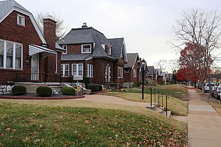
Lafayette Square is a neighborhood in St. Louis, Missouri, which is bounded on the north by Chouteau Avenue, on the south by Interstate 44, on the east by Truman Parkway, and on the west by South Jefferson Avenue. It surrounds Lafayette Park, which is the city's oldest public park — created by local ordinance in 1836.
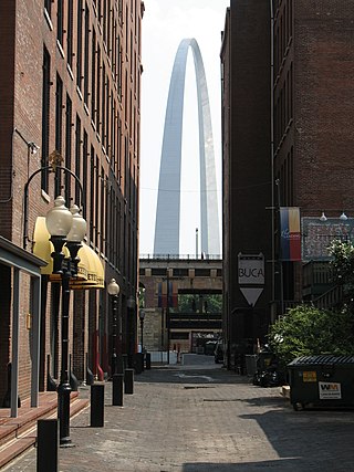
Downtown St. Louis is the central business district of St. Louis, Missouri, the hub of tourism and entertainment, and the anchor of the St. Louis metropolitan area. The downtown is bounded by Cole Street to the north, the river front to the east, Chouteau Avenue to the south, and Tucker Boulevard to the west. The downtown is the site of many corporate headquarters, including Stifel Financial Corp., HOK, Spire Inc, and a host of other companies.

Shaw is a neighborhood in St. Louis, Missouri. It is bordered on the North by Interstate 44, the east by S. Grand Blvd, the west by Tower Grove Ave and the Missouri Botanical Gardens, and the south by Tower Grove Park. The Shaw Neighborhood is a local historic district whose historic structure and character is protected by ordinance.

Boulevard Heights is a neighborhood of St. Louis, Missouri. The neighborhood is bounded by Gravois Avenue on the west, Holly Hills Boulevard and Carondelet Park on the north, South Grand Avenue and I-55 on the east, and the city limits on the south.

Carr Square is a neighborhood of St. Louis, Missouri. The neighborhood is bounded by Cass Avenue on the north, Carr Street on the south, North Tucker Boulevard and North 13th Street on the east, and North Jefferson on the west.
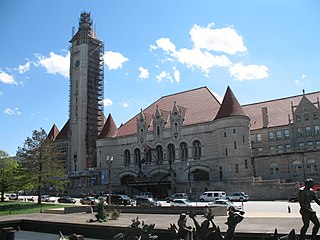
Downtown West is a neighborhood in St. Louis, Missouri. It is, as the name suggests, a section of downtown that is further inland, west from the banks of the Mississippi River. St. Louis City Hall, the Metropolitan Police Headquarters, St. Louis Union Station, Stifel Theatre, Enterprise Center, and CityPark stadium are all located in Downtown West. The Washington Avenue Historic District is a former garment district consisting of turn of the previous century high rise warehouses converted into residential lofts, restaurants, taverns, and coffee shops. It is bounded by Jefferson Avenue on the west, Tucker Boulevard on the east, Cole Street on the north, and Chouteau Avenue on the south.

Dutchtown is a neighborhood of St. Louis, Missouri. It is called "Dutch" from Deutsch, i.e., "German", as it was the southern center of German-American settlement in St. Louis in the early 19th century. It was the original site of Concordia Seminary, Concordia Publishing House, Lutheran Hospital, and other German community organizations. The German Cultural Society still has its headquarters there. St Anthony of Padua Catholic Church towers over the neighborhood and is a symbol of the neighborhood.

Forest Park Southeast (FPSE) is a neighborhood of St. Louis, Missouri. It is bordered by Interstate 64 (U.S. Route 40) to the north, Vandeventer Avenue to the east, Interstate 44 to the south, and Kingshighway Boulevard and Forest Park to the west. Adjoining neighborhoods include Kings Oak and The Hill to the west, Southwest Garden to the south, Botanical Heights to the southeast, Midtown to the east, and the Central West End to the north.
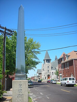
The Gate District is a neighborhood of St. Louis, Missouri. The Gate District is defined as the area between Chouteau Avenue and Interstate 44 on the north and south and between South Jefferson Avenue and South Grand Boulevard on the east and west. This area is just south of the central corridor and west of Lafayette Square. The term Gate was added to define this neighborhood due to the number of ironclad gates lining the streets. Today, the neighborhood is the subject of increased gentrification.
Gravois Park is a historic neighborhood of St. Louis, Missouri. Roughly bounded by Jefferson Avenue, Chippewa Street, Grand Boulevard, and Cherokee Street, the Gravois Park neighborhood is a diverse mix of homeowners, renters, and businesses. The area's architecture reflects its settlement at the turn of the 20th century. The namesake park dates from 1812, and was praised for its beauty in the nineteenth century already, and in 1914 was part of a walking tour of the city meant to show off the City Plan Commission's "idealized view of the shape of the city."

Holly Hills is a neighborhood in South St. Louis, Missouri, near the intersection of I-55 and Loughborough Avenue. The neighborhood is defined by Bates and Walsh on the Northeast, Holly Hills on the Southwest, Morganford Street on the Northwest, and Grand Boulevard on the Southeast. It is surrounded by Carondelet Park and the Boulevard Heights, Bevo Mill, Dutchtown and Carondelet neighborhoods.

Botanical Heights is a neighborhood of St. Louis, Missouri. Its former name was McRee Town. The Botanical Heights neighborhood is defined by Chouteau Avenue on the North, Interstate 44 on the South, 39th Street on the East and Vandeventer Avenue on the West. This near Southside neighborhood is located just north of the Shaw neighborhood.

Southwest Garden is a neighborhood of St. Louis, Missouri, located south of The Hill and Forest Park Southeast, west of the Missouri Botanical Garden and Tower Grove Park, east of Lindenwood Park and Clifton Heights, and north of North Hampton.
Princeton Heights is a neighborhood of St. Louis, Missouri. The neighborhood boundaries are defined as Hampton Boulevard on the west, Eichelberger on the north, Christy Boulevard on the east, and Gravois on the south.

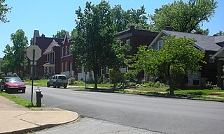
Tower Grove South is a neighborhood of south St. Louis, Missouri. Formerly known as Oak Hill, Tower Grove South is bounded by Arsenal Street on the north, Chippewa Street on the south, Kingshighway Boulevard on the west, and Grand Boulevard on the east. The majority of the neighborhood was built following the extension of streetcar lines from downtown St. Louis. Commercial development in the neighborhood is concentrated on Grand Boulevard in the east and Morganford Road in the west of the neighborhood. There are also scatterings of commercial and mixed use buildings on interior intersections.
The numbered streets of St. Louis, Missouri generally run north–south through the city, starting with 1st Street at the Mississippi River, and increasing in value the further west they are. 1st through 25th Streets are primarily centered around the Downtown and Downtown West neighborhoods, with many extending further north and south into other neighborhoods. There are a few other higher value streets that appear elsewhere in the St. Louis area, and although they are not adjacent to the 1st–25th grid in the eastern part of the city, their numberings in relation to their distances from the river are relatively consistent.
The streets of St. Louis, Missouri, United States, and the surrounding area of Greater St. Louis are under the jurisdiction of the City of St. Louis Street Department. According to the department's Streets Division, there are 1,000 miles (1,600 km) of streets and 600 miles (970 km) of alleys within the city.

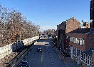
Grand Boulevard is a major, seven to five-lane wide, north-south thoroughfare that runs through the center of St. Louis, Missouri. It runs north through Carondelet Park in the south portion of the city to the Mississippi River north of the McKinley Bridge, about midway between Forest Park and the Mississippi River. Neighborhoods that it runs through include Dutchtown, Tower Grove East, Tower Grove South, Compton Heights, Tiffany, Midtown, Jef-Vander-Lou, Fairground, and College Hill.
Jefferson Avenue is a major, seven lane wide, north to south thoroughfare in the city of St. Louis, Missouri. For much of its run in south city Jefferson Avenue and Grand Boulevard take a parallel course, separated by about sixteen blocks. In the northern city, their concurrence varies some.
Forest Park Parkway is a parkway in Clayton, Missouri and St. Louis that runs from Interstate 170, becomes Forest Park Avenue at Kingshighway Boulevard, and ends at Market Street and Interstate 64. It is considered an arterial snow route. Its right-of-way has carried various railroad lines throughout much of its history.

