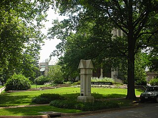
Clayton is a city in and the county seat of St. Louis County, Missouri, and borders the independent city of St. Louis. The population was 17,355 at the 2020 census. Organized in 1877, the city was named after Ralph Clayton, who donated the land for the St. Louis County courthouse.

The Central West End is a neighborhood in St. Louis, Missouri, stretching from Midtown's western edge to Union Boulevard and bordering on Forest Park with its outstanding array of free cultural institutions. It includes the Cathedral Basilica of Saint Louis on Lindell Boulevard at Newstead Avenue, which houses the largest collection of mosaics in the world. The Central West End sits entirely within the 9th Ward.

Wydown/Skinker is a neighborhood in St. Louis, Missouri. Washington University in St. Louis is located just north of this neighborhood. The neighborhood is bounded by the city limits on the west, Forsyth Boulevard on the north, Forest Park on the east and Clayton Avenue on the south. The Missouri Historical Society Library & Research Center is located in the Wydown/Skinker neighborhood.

Southampton is a neighborhood in St. Louis, Missouri. Located in the southwestern reaches of the city, its borders are Chippewa Street on the north, Hampton Avenue on the west, Eichelberger Street on the south, and South Kingshighway Boulevard on the east.

Clifton Heights is a neighborhood of St. Louis, Missouri, US, located along the southwest border of the city and highlighted by a park — Clifton Park (38.6143°N 90.2916°W) — with a playground and a lake.

DeBaliviere Place is a neighborhood of St. Louis, Missouri.

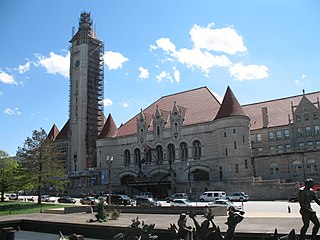
Downtown West is a neighborhood in St. Louis, Missouri. It is, as the name suggests, a section of downtown that is further inland, west from the banks of the Mississippi River. St. Louis City Hall, the Metropolitan Police Headquarters, St. Louis Union Station, Stifel Theatre, Enterprise Center, and CityPark stadium are all located in Downtown West. The Washington Avenue Historic District is a former garment district consisting of turn of the previous century high rise warehouses converted into residential lofts, restaurants, taverns, and coffee shops. It is bounded by Jefferson Avenue on the west, Tucker Boulevard on the east, Cole Street on the north, and Chouteau Avenue on the south.

Dutchtown is a neighborhood of St. Louis, Missouri. It is called "Dutch" from Deutsch, i.e., "German", as it was the southern center of German-American settlement in St. Louis in the early 19th century. It was the original site of Concordia Seminary, Concordia Publishing House, Lutheran Hospital, and other German community organizations. The German Cultural Society still has its headquarters there. St Anthony of Padua Catholic Church towers over the neighborhood and is a symbol of the neighborhood.

Forest Park Southeast (FPSE) is a neighborhood of St. Louis, Missouri. It is bordered by Interstate 64 (U.S. Route 40) to the north, Vandeventer Avenue to the east, Interstate 44 to the south, and Kingshighway Boulevard and Forest Park to the west. Adjoining neighborhoods include Kings Oak and The Hill to the west, Southwest Garden to the south, Botanical Heights to the southeast, Midtown to the east, and the Central West End to the north.

Franz Park is a neighborhood of St. Louis, Missouri.

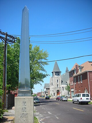
The Gate District is a neighborhood of St. Louis, Missouri. The Gate District is defined as the area between Chouteau Avenue and Interstate 44 on the north and south and between South Jefferson Avenue and South Grand Boulevard on the east and west. This area is just south of the central corridor and west of Lafayette Square. The term Gate was added to define this neighborhood due to the number of ironclad gates lining the streets. Today, the neighborhood is the subject of increased gentrification.

Hyde Park is a neighborhood of St. Louis, Missouri. A historic North St. Louis neighborhood, Hyde Park is bound by Ferry to the North, I-70 to the East, Palm Street and Natural Bridge Avenue to the South, and Glasgow to the West.

Botanical Heights is a neighborhood of St. Louis, Missouri. Its former name was McRee Town. The Botanical Heights neighborhood is defined by Chouteau Avenue on the North, Interstate 44 on the South, 39th Street on the East and Vandeventer Avenue on the West. This near Southside neighborhood is located just north of the Shaw neighborhood.

North Hampton is a neighborhood of St. Louis, Missouri. Located in Southwest City, North Hampton is bounded by Scanlan and Connecticut to the north, South Kingshighway Boulevard to the east, Chippewa Street to the south, and Hampton Avenue to the west.

O'Fallon is a neighborhood of St. Louis, Missouri. The neighborhood is located on the north side of the City of St. Louis, nestled between O'Fallon Park and Fairground Park. It is bounded by West Florissant, Harris Avenue, Algernon Street and Adelaide on the north, Pope Avenue on the northwest, Kossuth and Natural Bridge Avenues on the south via Fair Avenue, Warne on the east, and Newstead on the west. The O'Fallon neighborhood is located in the 21st Ward which is currently represented by Alderman John Collins-Muhammad.

Patch is a neighborhood of St. Louis, Missouri. The Patch neighborhood forms the southern tip of the Carondelet neighborhood. It is defined by Robert Avenue on the north, the City Limits to the south, Alabama Avenue to the west, and by the Mississippi River to the east.

Tiffany is a neighborhood of St. Louis, Missouri. It is located on the western side of Grand Boulevard along the section containing St. Louis University's Medical Complex. The neighborhood is defined by Chouteau Avenue on the North, Interstate 44 on the South, Grand Boulevard on the East, and 39th Street on the West.

The Hi-Pointe–DeMun Historic District is a historic district that was listed on the National Register of Historic Places in 2005. The district, commonly referred to as “DeMun,” is a neighborhood straddling the city limits of St. Louis, Missouri and Clayton, Missouri. The district is roughly bounded by Clayton Road to the south, Big Bend Boulevard to the west, Northwood Avenue to the north, and Skinker Boulevard to the east, and consists of two subdivisions: DeMun Park and Hi-Pointe.

Clayton–Tamm is a historic St Louis neighborhood and once an Irish-American enclave located near the western border of St. Louis, Missouri, USA, just south of Forest Park.


