Academy, St. Louis

Last updated
Academy
Cabanne in Academy (6792842477).jpg
Houses on Cabanne Avenue in Academy, January 2012
STL Neighborhood Map 51.PNG
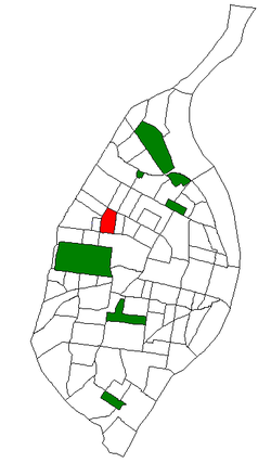
Location (red) of Academy within St. Louis
Country United States
State Missouri
City St. Louis
Wards 18, 26
Area
  Total0.44 sq mi (1.1 km2)
Population
 (2020) [1]
  Total2,355
  Density5,400/sq mi (2,100/km2)
ZIP code(s)
Parts of 63108, 63113
Area code(s) 314
Website stlouis-mo.gov

Academy/Sherman Park is a neighborhood in North St. Louis, just outside Central West End. The official boundaries of the area are Dr. Martin Luther King Drive on the north, Delmar Boulevard on the south, North Kingshighway Boulevard on the east, and Union Boulevard on the west. [2]

As of 2020, [3] there were 2,355 people residing in this neighborhood, which contained 1,276 housing units. The racial makeup of the neighborhood was 4.97% White, 87.26% Black, 1.10% Asian, 1.15% from some other race, and 5.27% from two or more races. Hispanic or Latino of any race were 2.29% of the population.

Sally Benson grew up in the Academy neighborhood. She described her childhood in her novels that inspired the film Meet Me in St. Louis . The Benson house at 5135 Kensington Avenue [4] [5] no longer exists. After being sold, it fell into disrepair, eventually became uninhabitable, and was demolished in 1994. [6]

Tennessee Williams attended Soldan High School in the neighborhood and used it as a setting for his play The Glass Menagerie . [7]

Historical population
CensusPop.
1990 5,169
2000 3,797−26.5%
2010 2,816−25.8%
2020 2,355−16.4%
Sources: [8]

Related Research Articles

<span class="mw-page-title-main">Central West End, St. Louis</span> Neighborhood of St. Louis in Missouri, United States

The Central West End is a neighborhood in St. Louis, Missouri, stretching from Midtown's western edge to Union Boulevard and bordering on Forest Park with its outstanding array of free cultural institutions. It includes the Cathedral Basilica of Saint Louis on Lindell Boulevard at Newstead Avenue, which houses the largest collection of mosaics in the world. The Central West End is represented by three aldermen as it sits partially in the 17th, 18th, and 28th Wards.

<span class="mw-page-title-main">Wydown/Skinker, St. Louis</span> Neighborhood of St. Louis in Missouri, United States

Wydown/Skinker is a neighborhood in St. Louis, Missouri. Washington University in St. Louis is located just north of this neighborhood. The neighborhood is bounded by the city limits on the west, Forsyth Boulevard on the north, Forest Park on the east and Clayton Avenue on the south. The Missouri Historical Society Library & Research Center is located in the Wydown/Skinker neighborhood.

<span class="mw-page-title-main">Carr Square, St. Louis</span> Neighborhood of St. Louis in Missouri, United States

Carr Square is a neighborhood of St. Louis, Missouri. The Downtown neighborhood is bounded by Cass Avenue on the North, Carr Street on the South, North Tucker Boulevard and North 13th Street on the East, and North Jefferson on the West.

<span class="mw-page-title-main">DeBaliviere Place, St. Louis</span> Neighborhood of St. Louis in Missouri, United States

DeBaliviere Place is a neighborhood of St. Louis, Missouri.

<span class="mw-page-title-main">Downtown West, St. Louis</span> Neighborhood of St. Louis in Missouri, United States

Downtown West is a neighborhood in St. Louis, Missouri. It is, as the name suggests, a section of downtown that is further inland, west from the banks of the Mississippi River. St. Louis City Hall, the Metropolitan Police Headquarters, St. Louis Union Station, Stifel Theatre, Enterprise Center, and the future Centene Stadium are all located in Downtown West. The Washington Avenue Historic District is a former garment district consisting of turn of the previous century high rise warehouses converted into residential lofts, restaurants, taverns, and coffee shops. It is bounded by Jefferson Avenue on the west, Tucker Boulevard on the east, Cole Street on the north, and Chouteau Avenue on the south.

<span class="mw-page-title-main">Fairground, St. Louis</span> Neighborhood of St. Louis in Missouri, United States

Fairground is a neighborhood of St. Louis, Missouri. The neighborhood's boundaries are defined as Glasgow Avenue on the east, west and North Florissant Avenues on the north, Warne on the west, and Fairground Park and Natural Bridge Avenue on the south.

<span class="mw-page-title-main">Fountain Park, St. Louis</span> Neighborhood of St. Louis in Missouri, United States

Fountain Park is a neighborhood of St. Louis, Missouri. Originally the Aubert Place subdivision, it was laid out by John Lay in 1857. The Fountain Park neighborhood is located in north St. Louis with Martin Luther King Drive on the north, Delmar Boulevard on the south, Walton Avenue on the east, and Kingshighway Boulevard on the west. It is just two blocks north of the Central West End (CWE) of the city. The Fountain Park neighborhood is named after Fountain Park, a small oval-shaped city park near its center. A Martin Luther King Jr. statue sculpted by Rudolph Edward Torrini is situated on the west side of the park.

<span class="mw-page-title-main">Gate District, St. Louis</span> Neighborhood of St. Louis in Missouri, United States

The Gate District is a neighborhood of St. Louis, Missouri. The Gate District is defined as the area between Chouteau Avenue and Interstate 44 on the north and south and between South Jefferson Avenue and South Grand Boulevard on the east and west. This area is just south of the central corridor and west of Lafayette Square. The term Gate was added to define this neighborhood due to the number of ironclad gates lining the streets. Today, the neighborhood is the subject of increased gentrification.

<span class="mw-page-title-main">JeffVanderLou, St. Louis</span> Neighborhood of St. Louis in Missouri, United States

JeffVanderLou (JVL) is a neighborhood of St. Louis, Missouri. The neighborhood is situated between North Vandeventer Avenue on the northwest, Natural Bridge Avenue on the northeast, North Jefferson Avenue on the East, Delmar Boulevard on the south, and North Compton Avenue and Martin Luther King Drive on the Southwest.

<span class="mw-page-title-main">Kingsway West, St. Louis</span> Neighborhood of St. Louis in Missouri, United States

Kingsway West is a neighborhood of St. Louis, Missouri. The Kingsway West neighborhood is defined by Union Boulevard to its north-west and Dr. Martin Luther King Drive to its south-west. Natural Bridge Avenue forms its north-east boundary and North Kingshighway is its southeast boundary.

<span class="mw-page-title-main">Botanical Heights, St. Louis</span> Neighborhood of St. Louis in Missouri, United States

Botanical Heights is a neighborhood of St. Louis, Missouri. Its former name was McRee Town. The Botanical Heights neighborhood is defined by Chouteau Avenue on the North, Interstate 44 on the South, 39th Street on the East and Vandeventer Avenue on the West. This near Southside neighborhood is located just north of the Shaw neighborhood.

<span class="mw-page-title-main">McKinley Heights, St. Louis</span> Neighborhood of St. Louis in Missouri, United States

McKinley Heights is a historic conservation neighborhood located in the near South Side of the City of St. Louis. It was rated as a Top 10 Neighborhood for young adults in the St. Louis metropolitan area. The neighborhood is bounded by I-44 to the north, Jefferson Avenue to the west, and I-55 and Gravois Boulevard to the east and south. There are restaurants and entertainment in the adjacent Soulard and Lafayette Square neighborhoods. Three bus routes provide a commute downtown or throughout the City. There are three churches and several neighborhood businesses. There is also 1 6th-12th Grade High School, McKinley Classical Leadership Academy

<span class="mw-page-title-main">North Hampton, St. Louis</span> Neighborhood of St. Louis in Missouri, United States

North Hampton is a neighborhood of St. Louis, Missouri. Located in Southwest City, North Hampton is bounded by Scanlan and Connecticut to the north, South Kingshighway Boulevard to the east, Chippewa Street to the south, and Hampton Avenue to the west.

<span class="mw-page-title-main">Near North Riverfront, St. Louis</span> Neighborhood of St. Louis in Missouri, United States

Near North Riverfront is a neighborhood of St. Louis, Missouri. Between 1990 and 2000 Near North Riverfront led the city in percentage population growth, growing 89% over the decade. Despite this large percentage growth, Near North Riverfront is largely non-residential and so the 89% percent gain represented a numerical gain of only 306 persons. The neighborhood is served by major city streets such as Tucker Boulevard, West Florissant Avenue, and Broadway Boulevard.

<span class="mw-page-title-main">Penrose, St. Louis</span> Neighborhood of St. Louis in Missouri, United States

Penrose is a neighborhood of St. Louis, Missouri. The Penrose neighborhood is split with half of it in the city's 21st Ward and the other half in the city's 1st Ward. The neighborhood is located on the north side of the city just south of Interstate 70 and west of O’Fallon Park. It is bounded by Florissant Avenue and I-70 on the north, Natural Bridge on the south, North Newstead and Pope Avenue on the east, and Kingshighway Boulevard on the west.

<span class="mw-page-title-main">Tiffany, St. Louis</span> Neighborhood of St. Louis in Missouri, United States

Tiffany is a neighborhood of St. Louis, Missouri. It is located on the western side of Grand Boulevard along the section containing St. Louis University's Medical Complex. The neighborhood is defined by Chouteau Avenue on the North, Interstate 44 on the South, Grand Boulevard on the East, and 39th Street on the West.

<span class="mw-page-title-main">Tower Grove East, St. Louis</span> Neighborhood of St. Louis in Missouri, United States

Tower Grove East is a neighborhood of St. Louis, Missouri. The Tower Grove East neighborhood is bordered by Shenandoah Avenue to the north, Nebraska Avenue to the east, Gravois Avenue to the south, and south Grand Boulevard to the west.

<span class="mw-page-title-main">Visitation Park, St. Louis</span> Neighborhood of St. Louis in Missouri, United States

Visitation Park is a neighborhood of St. Louis, Missouri. The neighborhood is defined by Maple Avenue on the North, Delmar Boulevard on the South, Union Boulevard on the East, and Belt Avenue on the West. Visitation Park is a small neighborhood nestled southeast of the West End neighborhood, just north of DeBaliviere Place.

<span class="mw-page-title-main">Walnut Park East, St. Louis</span> Neighborhood of St. Louis in Missouri, United States

Walnut Park East is a neighborhood of St. Louis, Missouri. Walnut Park East is one of several neighborhoods in northwest St. Louis. Its borders are West Florissant Avenue to the northeast, Emerson Avenue to the southeast, Interstate 70 (I-70) to the southwest and west, and Riverview Boulevard to the northwest.

<span class="mw-page-title-main">West End, St. Louis</span> Neighborhood of St. Louis in Missouri, United States

West End is a neighborhood of St. Louis, Missouri. This neighborhood is defined by Page Boulevard on the North, Delmar Boulevard on the South, Belt Avenue and Union Boulevard via Maple Avenue on the East, and City limits on the West. The neighborhood is home to the Emmanuel DeHodiamont House, one of the two oldest houses in St. Louis.

References

  1. "2020 Census Neighborhood Results".
  2. Neighborhood Data Profile for Academy. Accessed 12 April 2008. Archived July 5, 2007, at the Wayback Machine
  3. "City of St. Louis" (PDF).
  4. "Google Maps".
  5. ""Meet Me in St. Louis:" the Victorian on Kensington Avenue". 13 December 2009.
  6. "Boom Nation: Meet Me in St. Louis". ABC News .
  7. "Free Research Paper on Glass Menagerie Means 181 - 210". Cyberessays.com. Retrieved 2011-03-15.
  8. "Academy Neighborhood Statistics". St Louis, MO. Retrieved 26 January 2023.

Coordinates: 38°39′30″N90°16′02″W / 38.6584°N 90.2673°W / 38.6584; -90.2673