Cheltenham, St. Louis

Last updated
Cheltenham
Tiny Cheltenham Street (5607260669).jpg
Street in Cheltenham, April 2011
STL Neighborhood Map 41.PNG
Location (red) of Cheltenham within St. Louis
Country United States
State Missouri
City St. Louis
Wards 17, 24
Area
  Total0.33 sq mi (0.9 km2)
Population
 (2020) [1]
  Total1,260
  Density3,800/sq mi (1,500/km2)
ZIP code(s)
Part of 63110
Area code(s) 314
Website stlouis-mo.gov

Cheltenham is a neighborhood of St. Louis, Missouri. It is bound by Forest Park on the north, Macklind on the east, Manchester Avenue on the south, and Hampton Avenue on the west. Businesses located in Cheltenham include the St. Louis Community College at Forest Park, which is built on the site of the former Forest Park Highlands amusement park, as well as The Green Shag Market vintage/antique mall. It is also the former home of FOX-affiliate KTVI, as well as the St. Louis Arena. Cheltenham once covered the Clayton-Tamm neighborhood. See the 1878 Cheltenham and Additions map.

Contents

History

In October, 1856, Icarians, led by Frenchman Etienne Cabet, settled in St. Louis, Missouri. The Icarians were a 19th-century French utopian movement which had established a number of egalitarian communes in the United States. [2] [3]

The Icarians led by Cabet were dissident Icarians from Nauvoo, Illinois. These dissidents left in three different groups on October 15, 22, and 30. Cabet left Nauvoo with the final group on October 30, 1856. Cabet and his 180 loyal followers settled in "New Bremen" in the German section of St. Louis. Cabet had a stroke and died on November 8, 1856. Mercadier became the community's new president. [4] The situation in St. Louis was not ideal and the group had lost a number of dissatisfied members.

On February 15, 1858, the remaining 151 Icarians had chosen a site west of St. Louis and settled on a few hundred acres in Cheltenham. They purchased the land for $25,000 at 6% interest with a $500 down-payment. [5] Here they established workshops of tailors, joiners, wheelwrights, blacksmiths, painters, and shoemakers. The Cheltenham commune published a journal and a number of books, and it maintained in Paris, France, 'the Bureau' which printed and circulated brochures across France proclaiming the success of the commune. Schools were opened for the boys and girls, and a "salle d'asile" - a sort of kindergarten - was opened for the smallest children. [6] The revising of the community's constitution, however, proved to be problematic.

Success of the community was not to be realized. Two radical distinct parties developed, where the majority adhered faithfully to the ideas entertained by the community's deceased founder Etienne Cabet, and believed in investing very large if not absolutely dictatorial authority in some chosen leader called a "Gérance" or "Gérant unique", who would direct the moral and material affairs of the community. The minority, however, who were led by a man named Vogel, a cap maker from Comar, France, were unalterably opposed to such an undemocratic system of government. Vogel and the dissidents would not accept compromise, and the General Assembly sessions of 1858 and 1859 were stormy. Vogel was accused by Mercadier of insulting Cabet's memory by insisting on a "parliamentary government." On February 17, 1859, the majority of the General Assembly, backing Mercadier, voted to reenact what they referred to as the "Engagement of October 13, 1856" which were the strict pledges that Cabet had demanded of his followers before leaving Navoo, Illinois. This pledge included a ban on smoking and drinking. For Vogel and the dissidents, this ban was deemed intolerable. [7] Differences of opinion degenerated into party strife; and the vanquished minority, numbering forty-two persons, left the community. The loss of Vogel and the dissidents caused a serious problem. Of those who left, many were the most skillful craftsmen, and the loss was irreparable. Furthermore, Vogel and his supporters took with them $188 in cash, $588 in IOUs, and $1,800 in clothing and tools. The depleted society struggled heroically for five years longer in spite of a series of events which otherwise would have brought them down. By January 1864 with Arsene Sauva as president, there were 8 "citoyens," 7 "citoyennes," and some children left in Cheltenham. With this internal strife, the loss of most of its members, young men leaving to fight on the Union side in the American Civil War, and growing debt, the remaining members of the colony eventually agreed at their last General Assembly to disband the community. The keys to the property were handed over to its original owner, Thomas Allen, in 1864. The Louis Gillet and Arsene Sauva families later joined the Icarian Community in Adams County, Iowa. [8]

Demographics

Historical population
YearPop.±%
1990 491    
2000 480−2.2%
2010 620+29.2%
2020 1,260+103.2%

In 2020 Cheltenham's population was 65.2% White, 8.4% Black, 0.2% Native American, 17.9% Asian, 7.1% Two or More Races, and 1.3% Some Other Race. 5.4% of the population was of Hispanic or Latino origin. [9]

Racial composition1990 [10] 2000 [11] 2010 [12] 2020
White 93.7%80.0%67.3%65.2%
Black or African American 4.9%14.0%15.0%8.4%
Hispanic or Latino (of any race)1.5%3.7%5.4%
Asian 2.1%10.6%17.9%
Two or More Races1.7%5.6%7.1%

Other Cheltenhams

Cheltenham on the Twinning Fingerpost in Cheltenham Township, Pennsylvania. Cheltenhamtwp 06.JPG
Cheltenham on the Twinning Fingerpost in Cheltenham Township, Pennsylvania.

Six other places in the World are named "Cheltenham."

See also

Related Research Articles

Utopian and dystopian fiction are subgenres of science fiction that explore social and political structures. Utopian fiction portrays a setting that agrees with the author's ethos, having various attributes of another reality intended to appeal to readers. Dystopian fiction offers the opposite: the portrayal of a setting that completely disagrees with the author's ethos. Some novels combine both genres, often as a metaphor for the different directions humanity can take depending on its choices, ending up with one of two possible futures. Both utopias and dystopias are commonly found in science fiction and other types of speculative fiction.

<span class="mw-page-title-main">Nauvoo, Alabama</span> Town in Alabama, United States

Nauvoo is a town on the northwestern edge of Walker County, Alabama, United States, that extends slightly north into southwestern Winston. As of the 2010 census, the population of the town is 221, down from 284 in 2000. Camp McDowell, the official camp and conference center of the Episcopal Diocese of Alabama, is located here.

<span class="mw-page-title-main">Nauvoo, Illinois</span> City in Illinois, United States

Nauvoo is a small city in Hancock County, Illinois, United States, on the Mississippi River near Fort Madison, Iowa. The population of Nauvoo was 950 at the 2020 census. Nauvoo attracts visitors for its historic importance and its religious significance to members of several groups: The Church of Jesus Christ of Latter-day Saints; the Community of Christ, formerly the Reorganized Church of Jesus Christ of Latter Day Saints (RLDS); other groups stemming from the Latter Day Saint movement; and the Icarians. The city and its immediate surrounding area are listed on the National Register of Historic Places as the Nauvoo Historic District.

<span class="mw-page-title-main">Corning, Iowa</span> City in Iowa, United States

Corning is a city in Quincy Township, Adams County, Iowa, United States. The population was 1,564 at the 2020 census. It is the county seat of Adams County. Corning is located just north of the intersection of U.S. Route 34 and Iowa Highway 148. Corning is perhaps best known as the birthplace of Johnny Carson. Daniel Webster Turner, who was governor of Iowa from 1931 to 1933, was born in Corning on March 17, 1877.
<span class="mw-page-title-main">Joseph Smith III</span> Son of Joseph Smith Jr and leader of RLDS Church (1832–1914)

Joseph Smith III was the eldest surviving son of Joseph Smith and Emma Hale Smith. Joseph Smith III was the Prophet-President of what became the Reorganized Church of Jesus Christ of Latter Day Saints, renamed Community of Christ in 2001, which considers itself a continuation of the church established by Smith's father in 1830. For fifty-four years until his own death, Smith presided over the church. Smith's moderate ideas and nature set much of the tone for the church's development, earning him the sobriquet of "the pragmatic prophet".

<span class="mw-page-title-main">Icarians</span> Historic site in Sonoma County

The Icarians were a French-based utopian socialist movement, established by the followers of politician, journalist, and author Étienne Cabet. In an attempt to put his economic and social theories into practice, Cabet led his followers to the United States of America in 1848, where the Icarians established a series of egalitarian communes in the states of Texas, Illinois, Iowa, Missouri, and California. The movement split several times due to factional disagreements.

Dogtown or Dog Town may refer to:

<span class="mw-page-title-main">Étienne Cabet</span> French philosopher (1788–1856)

Étienne Cabet was a French philosopher and utopian socialist who founded the Icarian movement. Cabet became the most popular socialist advocate of his day, with a special appeal to artisans who were being undercut by factories. Cabet published Voyage en Icarie in French in 1839, in which he proposed replacing capitalist production with workers' cooperatives. Recurrent problems with French officials, led him to emigrate to the United States in 1848. Cabet founded utopian communities in Texas and Illinois, but was again undercut, this time by recurring feuds with his followers.
<span class="mw-page-title-main">Nauvoo Temple</span> Second temple constructed by The Church of Jesus Christ of Latter-day Saints

The Nauvoo Temple was the second temple constructed by the Church of Jesus Christ of Latter Day Saints. The church's first temple was completed in Kirtland, Ohio, United States, in 1836. When the main body of the church was forced out of Nauvoo, Illinois, in the winter of 1846, the church attempted to sell the building, finally succeeding in 1848. The building was damaged by fire and a tornado before being demolished.

Tom Bauer is an American lawyer and politician from St. Louis, Missouri, who served in the Missouri House of Representatives and on the St. Louis Board of Aldermen. In 2005 he was recalled from his position as alderman after supporting a controversial redevelopment proposal, using eminent domain to acquire homes to build a gas station. In March 2011, Bauer defeated incumbent 24th Ward alderman Bill Waterhouse in the Democratic primary, but lost to independent candidate Scott Ogilvie in the April general election.
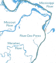
<span class="mw-page-title-main">Geography of St. Louis</span> Geography in and surrounding St. Louis, Missouri

St. Louis is located at 38°38′53″N90°12′44″W.

<span class="mw-page-title-main">Southampton, St. Louis</span> Neighborhood of St. Louis in Missouri, United States

Southampton is a neighborhood in St. Louis, Missouri. Located in the southwestern reaches of the city, its borders are Chippewa Street on the north, Hampton Avenue on the west, Eichelberger Street on the south, and South Kingshighway Boulevard on the east.

The history of Nauvoo, Illinois, starts with the Sauk and Meskwaki tribes who frequented the area, on a bend of the Mississippi River in Hancock County, some 53 miles (85 km) north of today's Quincy. They called the area "Quashquema", in honor of the Native American chief who headed a Sauk and Fox settlement numbering nearly 500 lodges. Permanent settlement by non-natives was reportedly begun in 1824 by Captain James White. By 1830, the community was called "Venus", and it was the site of the first post office in the county. In 1834 the name Venus was changed to "Commerce" in anticipation that the town would prosper under the United States' westward expansion.

<span class="mw-page-title-main">Ellendale, St. Louis</span> Neighborhood of St. Louis in Missouri, United States

Ellendale is a neighborhood of St. Louis, Missouri. Its eastern portion is considered a part of Dogtown, which also includes four other neighborhoods north of Manchester.

<span class="mw-page-title-main">St. Louis Hills, St. Louis</span> Neighborhood of St. Louis in Missouri, United States

St. Louis Hills is a neighborhood in St. Louis, Missouri. The neighborhood, which is home to the Chippewa location of Ted Drewes Frozen Custard, is situated in the southwest part of St. Louis. It is bounded by Chippewa Street to the northwest and north, Hampton Avenue to the east, Gravois Avenue to the southeast, and the St. Louis county border to the southwest.
<span class="mw-page-title-main">Frederick George Holweck</span> German-American Roman Catholic parish priest and scholar (1856–1927)

Frederick George Holweck was a German-American Catholic parish priest and scholar, hagiographer and church historian. Monsignor Holweck contributed some articles to the Catholic Encyclopedia.

<span class="mw-page-title-main">Dogtown, St. Louis</span>

John George Alleman was a missionary Catholic priest who served in the states of Ohio, Iowa and Illinois. He served as a priest in the Dominican Order from 1834 to 1840, after which time he was expelled from the order. He then served as a secular priest in the Diocese of Dubuque from 1840 to 1851, and in the Diocese of Chicago from 1851 to 1863. During his hospitalization in St. Louis, Missouri, (1863–1865) he was accepted back into the Dominican Order.

<span class="mw-page-title-main">Clayton–Tamm, St. Louis</span> Neighborhood of St. Louis in Missouri, United States

Clayton–Tamm is a historic St Louis neighborhood and once an Irish-American enclave located near the western border of St. Louis, Missouri, USA, just south of Forest Park.

Fields Foods is a grocery store chain operating in the St. Louis, Missouri area.

References

  1. "2020 Census Neighborhood Results".
  2. James Matthew Morris, Andrea L. Kross (2004). Historical Dictionary of Utopianism. Scarecrow Press. ISBN   9780810849129.
  3. JR. C. S. Trahair (1999). Utopias and Utopians: An Historical Dictionary . Greenwood Publishing Group. p.  70. ISBN   9780313294655. icarians cheltenham.
  4. THE CHELTENHAM ICARIANS: FROM SHAW'S ICARIA http://www2.webster.edu/~corbetre/dogtown/icarian/schweers-overview.html
  5. Robert P. Sutton (1994). Les Icariens: The Utopian Dream in Europe and America . University of Illinois Press. p.  173. ISBN   9780252020674. cheltenham.
  6. THE STORY OF ICARIA http://www2.webster.edu/~corbetre/dogtown/icarian/shaw.html
  7. Robert P. Sutton (1994). Les Icariens: The Utopian Dream in Europe and America . University of Illinois Press. p.  173. ISBN   9780252020674. cheltenham.
  8. Etienne Cabet (2003). Travels in Icaria. Syracuse University Press. ISBN   9780815630098.
  9. https://www.stlouis-mo.gov/government/departments/planning/research/documents/upload/Total-Population-by-Neighborhood-Census-2020-Redistricting-Release-2.pdf [ bare URL PDF ]
  10. "Cheltnenham Neighborhood Statistics". City of St. Louis.
  11. "The City of St. Louis Missouri". City of St. Louis.
  12. "The City of St. Louis Missouri". City of St. Louis.
  13. Cheltenham Twinning Association
  14. Cheltenham Town Council: Other Cheltenhams
  15. Other Cheltenhams Archived 2013-01-11 at archive.today
  16. Cheltenham Township Twinning

38°37′36″N90°16′54″W / 38.6267°N 90.2817°W / 38.6267; -90.2817