St. Louis Hills, St. Louis

Last updated
St. Louis Hills
Blue Drewes (8156292433).jpg
Chippewa location of Ted Drewes Frozen Custard
STL Neighborhood Map 08.PNG
Location (red) of St. Louis Hills within St. Louis
Country United States
State Missouri
City St. Louis
Wards 12, 16
Area
  Total1.63 sq mi (4.2 km2)
Population
 (2020) [1]
  Total7,516
  Density4,600/sq mi (1,800/km2)
ZIP code(s)
Parts of 63110, 63139, 63109
Area code(s) 314
Website stlouis-mo.gov

St. Louis Hills is a neighborhood in St. Louis, Missouri. The neighborhood, which is home to the Chippewa location of Ted Drewes Frozen Custard, is situated in the southwest part of St. Louis. It is bounded by Chippewa Street to the northwest and north, Hampton Avenue to the east, Gravois Avenue to the southeast, and the St. Louis county border to the southwest. [2]

Contents

Overview

St. Louis Hills is rich in its architecture, strategic location, and its history. "Country living in the City" was the phrase used to market St. Louis Hills in the 1930s since St. Louis Hills was so far west of any other residential or commercial buildings located within the City limits. [3]

St. Louis Hills History

The history of St. Louis Hills, developed from 1930-50s, is relatively recent compared to the city's beginnings in 1763. The land which became St. Louis Hills dates back to deeds granted to pioneer French colonists Madame Ann Camp and Anton Reihle in 1768 by one founder of the Village of St. Louis, Pierre Laclède. At the time, the land included 2,471 acres. Camp and Reihl's heirs sold the land to George C. Clarke, who gave it to two sons. When the Village was chartered as the City of St. Louis in 1836, St. Louis Hills was still remote, open, and forested land, and essentially remained so until the early 1930s. In 1876, when the county and city of St. Louis separated, the western boundary of St. Louis City was set just west of the River des Peres (River of the Fathers). Even then, what is now St. Louis Hills was still open land.

David Rowland Francis, Governor of the state from 1889-1893, became the owner of part of the property in 1884 on which he established his vast farm. At the turn of the century, David R. Francis was President of the Louisiana Purchase Exposition from 1889 until its opening in 1904. Francis originally considered the use of his farmland as a site for the World's Fair, but logistics of transportation and construction to Francis' land persuaded the use of Forest Park as the now-famous 1904 World's Fair site. Francis was appointed U.S. Ambassador to Russia in 1916. The next year, Francis made a gift of the land to the city, and so it was named Francis Park. David Rowland Francis died on January 15, 1927.

Cyrus Crane Willmore, for whom the neighborhood's second park is named, became the visionary developer of the St. Louis Hills 700 acre neighborhood. He came to St. Louis in 1912 after graduation from the University of Illinois law school and worked for a realty firm until 1922 when he formed his own company. Willmore's intentions for the area were clear from the beginning: tree-lined residential streets for families and single persons, churches and schools throughout, bordered on three sides by developing businesses, and open green spaces in parks. (See Architecture and Parks for more information.)

Names of streets within the neighborhood, as well as early development architecture, reflect Willmore's English heritage—Nottingham Avenue, Devonshire Avenue, Tamm Avenue to name a few. Eichelberger Street, a main east-west roadway through the center of St. Louis Hills, was originally named Clarke Road for George C. Clarke. Mature trees lining streets throughout the area are predominantly oak, maple, poplar, with birch trees along Francis Park.

St. Louis Cardinals Hall-of-Famer Stan Musial lived in St. Louis Hills for much of his baseball career, on Childress Avenue from 1948 to 1955 and Westway Road from 1955 to 1965. [4]

Demographics

Historical population
CensusPop.Note
1990 6,786
2000 7,50610.6%
2010 7,373−1.8%
2020 7,5161.9%
Sources: [5] [6]

In 2020 St. Louis Hills' racial makeup was 88.8% White, 3.7% Black, 0.2% Native American, 1.5% Asian, 5.0% Two or More Races, and 0.9% Some Other Race. 2.6% of the population was of Hispanic or Latino origin. [7]

Related Research Articles

<span class="mw-page-title-main">Ted Drewes</span> Family-owned frozen custard business in St. Louis, Missouri

Ted Drewes is a family-owned frozen custard company in St. Louis, Missouri, United States. The business was founded by Ted Drewes, Sr. in 1929. The shop on Chippewa Street is open much of the year, while the South Grand Boulevard location is open from mid-May through late August.

The Syracuse Far Westside is one of 26 neighborhoods recognized by the City of Syracuse, New York. Until this area joined the city in 1886 it was known as the Village of Geddes.

<span class="mw-page-title-main">Lafayette Square, St. Louis</span> Neighborhood of St. Louis in Missouri, United States

Lafayette Square is a neighborhood in St. Louis, Missouri, which is bounded on the north by Chouteau Avenue, on the south by Interstate 44, on the east by Truman Parkway, and on the west by South Jefferson Avenue. It surrounds Lafayette Park, which is the city's oldest public park — created by local ordinance in 1836.

<span class="mw-page-title-main">LaSalle Park</span> Neighborhood of St. Louis in Missouri, United States

LaSalle Park is an integral part of the three-neighborhood "Old Frenchtown" area—LaSalle Park, Lafayette Square and Soulard—bordering the southern edge of downtown St. Louis. It was formed as a "new" neighborhood, legally distinct from the larger Soulard district, through the efforts of the city of St. Louis, Missouri and Ralston Purina, which has its world headquarters in LaSalle Park.

<span class="mw-page-title-main">Southampton, St. Louis</span> Neighborhood of St. Louis in Missouri, United States

Southampton is a neighborhood in St. Louis, Missouri. Located in the southwestern reaches of the city, its borders are Chippewa Street on the north, Hampton Avenue on the west, Eichelberger Street on the south, and South Kingshighway Boulevard on the east.

<span class="mw-page-title-main">Clifton Heights, St. Louis</span> Neighborhood of St. Louis in Missouri, United States

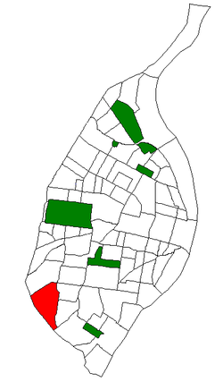
Clifton Heights is a neighborhood of St. Louis, Missouri, US, located along the southwest border of the city and highlighted by a park — Clifton Park (38.6143°N 90.2916°W) — with a playground and a lake.

<span class="mw-page-title-main">DeBaliviere Place, St. Louis</span> Neighborhood of St. Louis in Missouri, United States

DeBaliviere Place is a neighborhood of St. Louis, Missouri.

<span class="mw-page-title-main">Fox Park, St. Louis</span> Neighborhood of St. Louis in Missouri, United States

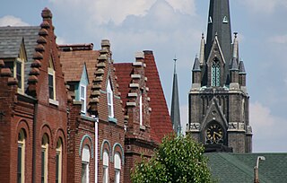
Fox Park is a neighborhood of St. Louis, Missouri. The neighborhood borders are Jefferson Avenue to the east, Interstate 44 to the north, Gravois Avenue to the south and Nebraska Avenue to the west. Surrounding neighborhoods include the Gate District, Compton Heights, Tower Grove East, Benton Park West and McKinley Heights.

<span class="mw-page-title-main">Gravois Park, St. Louis</span> Neighborhood of St. Louis in Missouri, United States

Gravois Park is a historic neighborhood of St. Louis, Missouri. Roughly bounded by Jefferson Avenue, Chippewa Street, Grand Boulevard, and Cherokee Street, the Gravois Park neighborhood is a diverse mix of homeowners, renters, and businesses. The area's architecture reflects its settlement at the turn of the 20th century. The namesake park dates from 1812, and was praised for its beauty in the nineteenth century already, and in 1914 was part of a walking tour of the city meant to show off the City Plan Commission's "idealized view of the shape of the city."

<span class="mw-page-title-main">Lindenwood Park, St. Louis</span> Neighborhood of St. Louis in Missouri, United States

Lindenwood Park is a neighborhood of St. Louis, Missouri. The Lindenwood Neighborhood is defined by Arsenal Street and I-44 to the north, Watson and Chippewa Street to the south, Hampton Avenue on the east and the city limits to the west.

<span class="mw-page-title-main">Marine Villa, St. Louis</span> Neighborhood of St. Louis in Missouri, United States

Marine Villa is a neighborhood of St. Louis, Missouri. The neighborhood is located just south of the large and historic Anheuser-Busch Brewery complex along the bluffs of the Mississippi River. It is further defined by Cherokee Street's Antique Row on the north, Gasconade Street on the south, South Broadway and Jefferson Avenue on the west, and the Mississippi River on the east.

<span class="mw-page-title-main">North Hampton, St. Louis</span> Neighborhood of St. Louis in Missouri, United States

North Hampton is a neighborhood of St. Louis, Missouri. Located in Southwest City, North Hampton is bounded by Scanlan and Connecticut to the north, South Kingshighway Boulevard to the east, Chippewa Street to the south, and Hampton Avenue to the west.

<span class="mw-page-title-main">Southwest Garden, St. Louis</span> Neighborhood of St. Louis in Missouri, United States

Southwest Garden is a neighborhood of St. Louis, Missouri, located south of The Hill and Forest Park Southeast, west of the Missouri Botanical Garden and Tower Grove Park, east of Lindenwood Park and Clifton Heights, and north of North Hampton.

<span class="mw-page-title-main">Princeton Heights, St. Louis</span> Neighborhood of St. Louis in Missouri, United States

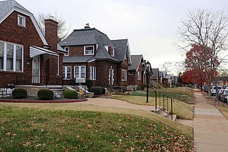
Princeton Heights is a neighborhood of St. Louis, Missouri. The neighborhood boundaries are defined as Hampton Boulevard on the west, Eichelberger on the north, Christy Boulevard on the east, and Gravois on the south.

<span class="mw-page-title-main">Tiffany, St. Louis</span> Neighborhood of St. Louis in Missouri, United States

Tiffany is a neighborhood of St. Louis, Missouri. It is located on the western side of Grand Boulevard along the section containing St. Louis University's Medical Complex. The neighborhood is defined by Chouteau Avenue on the North, Interstate 44 on the South, Grand Boulevard on the East, and 39th Street on the West.

<span class="mw-page-title-main">Tower Grove East, St. Louis</span> Neighborhood of St. Louis in Missouri, United States

Tower Grove East is a neighborhood of St. Louis, Missouri. The Tower Grove East neighborhood is bordered by Shenandoah Avenue to the north, Nebraska Avenue to the east, Gravois Avenue to the south, and south Grand Boulevard to the west.

<span class="mw-page-title-main">Tower Grove South, St. Louis</span> Neighborhood of St. Louis in Missouri, United States

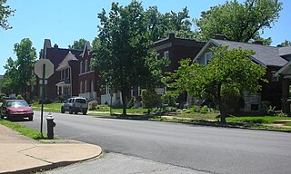
Tower Grove South is a neighborhood of south St. Louis, Missouri. Formerly known as Oak Hill, Tower Grove South is bounded by Arsenal Street on the north, Chippewa Street on the south, Kingshighway Boulevard on the west, and Grand Boulevard on the east. The majority of the neighborhood was built following the extension of streetcar lines from downtown St. Louis. Commercial development in the neighborhood is concentrated on Grand Boulevard in the east and Morganford Road in the west of the neighborhood. There are also scatterings of commercial and mixed use buildings on interior intersections.

The streets of St. Louis, Missouri, United States, and the surrounding area of Greater St. Louis are under the jurisdiction of the City of St. Louis Street Department. According to the Streets Division, there are 1,000-mile (1,600 km) of streets and 600-mile (970 km) of alleys within the city.

<span class="mw-page-title-main">Clayton–Tamm, St. Louis</span> Neighborhood of St. Louis in Missouri, United States

Clayton–Tamm is a historic St Louis neighborhood and once an Irish-American enclave located near the western border of St. Louis, Missouri, USA, just south of Forest Park.

<span class="mw-page-title-main">Francis Park</span>

Francis Park is an urban park located in the St. Louis Hills neighborhood of St. Louis, Missouri, United States. Francis Park is located between Eichelberger Street, Nottingham Avenue, Donovan Avenue and Tamm Avenue.

References

  1. 2020 Census Neighborhood Results
  2. Neighborhood Data Profile for St. Louis Hills
  3. "St. Louis Hills Neighborhood Association History".
  4. "The Stan Musial Tour of St. Louis". The Riverfront Times.
  5. "St. Louis Hills Neighborhood Statistics". St Louis, MO. Retrieved 8 August 2023.
  6. "Neighborhood Census Data". City of St. Louis. Retrieved 8 August 2023.
  7. Whiteley, Jason (2020). "City of St. Louis - Neighborhood Population & Demographics Census 2020". Mayor Tishaura Jones.

38°34′47″N90°18′06″W / 38.5796°N 90.3018°W / 38.5796; -90.3018