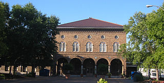
Central West End, St. Louis

Last updated
Central West End
Central West End Collage.jpg
Top: The Central West End's most prominent buildings as seen from Barnes-Jewish Hospital.
Bottom: The Central West End seen from the Parc Frontenac apartment building.
STL Neighborhood Map 38.PNG
Location (red) of the Central West End within St. Louis
Country United States
State Missouri
City St. Louis
Wards 17, 18, 28
Area
  Total1.89 sq mi (4.9 km2)
Population
 (2020) [1]
  Total16,670
  Density8,800/sq mi (3,400/km2)
ZIP code(s)
Parts of 63108 63110
Area code(s) 314
Public transit BSicon TRAM.svg   Red    Blue  
At Central West End, Cortex
Website stlouis-mo.gov

The Central West End is a neighborhood in St. Louis, Missouri, stretching from Midtown's western edge to Union Boulevard and bordering on Forest Park with its array of free cultural institutions. It includes the Cathedral Basilica of Saint Louis (the New Cathedral) on Lindell Boulevard at Newstead Avenue, which houses the second-largest collection of mosaics in the world. The Central West End sits entirely within the 9th Ward. [2]

Contents

Notable people

Playwright Tennessee Williams grew up in the neighborhood, and the house of the renowned poet T. S. Eliot is located in the Central West End. Beat writer William S. Burroughs's childhood home sits on Pershing Avenue (formerly Berlin Avenue) in the neighborhood. It is often mistaken as the location of Sally Benson's home, 5135 Kensington Avenue, which is the setting of her stories which were adapted into the movie Meet Me in St. Louis. 5135 Kensington Avenue was actually located in the Academy neighborhood just across Delmar Boulevard. It is no longer standing, having been torn down in 1994 after years of neglect. [3]

George Julian Zolnay (Gyula Zsolnay) (July 4, 1863 – May 1, 1949) the Hungarian and American sculptor known as the "Sculptor of the Confederacy" lived in the Central West End in the early 1900s at 4384 Maryland Avenue. [4]

Geography

Lindell Boulevard in the neighborhood of King's Highway, Lake Avenue and the main entrance to Forest Park, as sketched by Marguerite Martyn for the St. Louis Post-Dispatch, October 22, 1905 Premiere Page du Saint-Louis Post-Dispatch Montrant Des Gens Discutant.jpg
Lindell Boulevard in the neighborhood of King's Highway, Lake Avenue and the main entrance to Forest Park, as sketched by Marguerite Martyn for the St. Louis Post-Dispatch, October 22, 1905

The neighborhood's boundaries are Union Boulevard and the eastern portion of Forest Park on the west, I-64/US 40 on the south, Delmar Boulevard on the north, and Vandeventer Ave [5] on the east.

The Central West End's main commercial district runs along Euclid Avenue and stretches from Forest Park Parkway on the south to Delmar Boulevard on the north. The neighborhood grew in popularity during the 1904 World's Fair, held in the adjacent Forest Park.

Some residential areas of the Central West End are included in the National Register of Historic Places. One example is Fullerton's Westminster Place, whose large, architect-designed homes, most of which were built in 1890–1910. Another is the private place called Washington Terrace, laid out in 1892. Modern residential buildings in Central West End include Park East Tower and One Hundred. [6]

Public facilities and commercial buildings

Neighborhood organizations

CWE Business Community Improvement District (CWEScene.com)

Demographics

Historical population
YearPop.±%
1990 16,565    
2000 14,144−14.6%
2010 14,471+2.3%
2020 16,670+15.2%
[9]

In 2020 the neighborhood's population was 56.9% White, 21.0% Black, 0.1% Native American, 13.7% Asian, 6.4% Two or More Races, and 1.9% Some Other Race. 4.7% of the population was of Hispanic or Latino origin. [10]

Racial composition1990 [11] 2000 [12] 2010 [12] 2020 [12]
White 59.1%55.5%58.0%56.9%
Black or African American 37.9%36.4%28.0%21.0%
Hispanic or Latino (of any race)N/A2.0%2.7%4.7%
Asian N/A5.4%11.1%13.7%
Two or More RacesN/A1.8%2.2%6.4%

See also

Related Research Articles

<span class="mw-page-title-main">Transportation in St. Louis</span>

Transportation in Greater St. Louis, Missouri includes road, rail, ship, and air transportation modes connecting the bi-state St. Louis metropolitan area with surrounding communities throughout the Midwest, national transportation networks, and international locations. The Greater St. Louis region also supports a multi-modal transportation network that includes bus, paratransit, and light rail service in addition to shared-use paths, bike lanes and greenways.

<span class="mw-page-title-main">Wydown/Skinker, St. Louis</span> Neighborhood of St. Louis in Missouri, United States

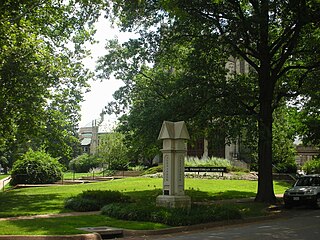
Wydown/Skinker is a neighborhood in St. Louis, Missouri. Washington University in St. Louis is located just north of this neighborhood. The neighborhood is bounded by the city limits on the west, Forsyth Boulevard on the north, Forest Park on the east and Clayton Avenue on the south. The Missouri Historical Society Library & Research Center is located in the Wydown/Skinker neighborhood.

<span class="mw-page-title-main">Academy, St. Louis</span> Neighborhood of St. Louis in Missouri, United States

Academy/Sherman Park is a neighborhood in North St. Louis, just outside Central West End. The official boundaries of the area are Dr. Martin Luther King Drive on the north, Delmar Boulevard on the south, North Kingshighway Boulevard on the east, and Union Boulevard on the west.

<span class="mw-page-title-main">Boulevard Heights, St. Louis</span> Neighborhood of St. Louis in Missouri, United States

Boulevard Heights is a neighborhood of St. Louis, Missouri. The neighborhood is bounded by Gravois Avenue on the west, Holly Hills Boulevard and Carondelet Park on the north, South Grand Avenue and I-55 on the east, and the city limits on the south.

<span class="mw-page-title-main">DeBaliviere Place, St. Louis</span> Neighborhood of St. Louis in Missouri, United States

DeBaliviere Place is a neighborhood of St. Louis, Missouri.

<span class="mw-page-title-main">Dutchtown, St. Louis</span> Neighborhood of St. Louis in Missouri, United States

Dutchtown is a neighborhood of St. Louis, Missouri. It is called "Dutch" from Deutsch, i.e., "German", as it was the southern center of German-American settlement in St. Louis in the early 19th century. It was the original site of Concordia Seminary, Concordia Publishing House, Lutheran Hospital, and other German community organizations. The German Cultural Society still has its headquarters there. St Anthony of Padua Catholic Church towers over the neighborhood and is a symbol of the neighborhood.

<span class="mw-page-title-main">Fountain Park, St. Louis</span> Neighborhood in Missouri, United States

Fountain Park is a neighborhood of St. Louis, Missouri, United States. Originally the Aubert Place subdivision, it was laid out by John Lay in 1857. The Fountain Park neighborhood is located in north St. Louis with Martin Luther King Drive on the north, Delmar Boulevard on the south, Walton Avenue on the east, and Kingshighway Boulevard on the west. It is just two blocks north of the Central West End (CWE) of the city. The Fountain Park neighborhood is named after Fountain Park, a small oval-shaped city park near its center. A Martin Luther King Jr. statue sculpted by Rudolph Edward Torrini is situated on the west side of the park.

<span class="mw-page-title-main">Skinker DeBaliviere, St. Louis</span> Neighborhood of St. Louis in Missouri, United States

Skinker DeBaliviere is a neighborhood of St. Louis, Missouri, located directly north of Forest Park. In addition to the park, its boundaries are Delmar Boulevard to the north, DeBaliviere Avenue to the east, and the western city limits near Skinker Boulevard. It is home to The Pageant, Pin-up Bowl, and all the other establishments of the Delmar Loop east of University City. It also includes the west end of the Forest Park – DeBaliviere and the entire Skinker MetroLink stations. The Delmar Loop station is just outside of its north boundary. In 1978, the neighborhood was designated a Local Historic District by the City of St. Louis, and the private subdivision of Parkview is listed in the National Register of Historic Places.

<span class="mw-page-title-main">Botanical Heights, St. Louis</span> Neighborhood of St. Louis in Missouri, United States

Botanical Heights is a neighborhood of St. Louis, Missouri. Its former name was McRee Town. The Botanical Heights neighborhood is defined by Chouteau Avenue on the North, Interstate 44 on the South, 39th Street on the East and Vandeventer Avenue on the West. This near Southside neighborhood is located just north of the Shaw neighborhood.

<span class="mw-page-title-main">Southwest Garden, St. Louis</span> Neighborhood of St. Louis in Missouri, United States

Southwest Garden is a neighborhood of St. Louis, Missouri, located south of The Hill and Forest Park Southeast, west of the Missouri Botanical Garden and Tower Grove Park, east of Lindenwood Park and Clifton Heights, and north of North Hampton.

<span class="mw-page-title-main">Penrose, St. Louis</span> Neighborhood of St. Louis in Missouri, United States

Penrose is a primarily residential neighborhood of St. Louis, Missouri. The neighborhood is located on the north side of the city just south of Interstate 70 and west of O’Fallon Park. It is bounded by Florissant Avenue and I-70 on the north, Natural Bridge Avenue on the south, North Newstead and Pope Avenues on the east, and Kingshighway Boulevard on the west.

<span class="mw-page-title-main">Tiffany, St. Louis</span> Neighborhood of St. Louis in Missouri, United States

Tiffany is a neighborhood of St. Louis, Missouri. It is located on the western side of Grand Boulevard along the section containing St. Louis University's Medical Complex. The neighborhood is defined by Chouteau Avenue on the North, Interstate 44 on the South, Grand Boulevard on the East, and 39th Street on the West.

<span class="mw-page-title-main">Tower Grove East, St. Louis</span> Neighborhood of St. Louis in Missouri, United States

Tower Grove East is a neighborhood of St. Louis, Missouri. The Tower Grove East neighborhood is bordered by Shenandoah Avenue to the north, Nebraska Avenue to the east, Gravois Avenue to the south, and south Grand Boulevard to the west.

<span class="mw-page-title-main">Tower Grove South, St. Louis</span> Neighborhood of St. Louis in Missouri, United States

Tower Grove South is a neighborhood of south St. Louis, Missouri. Formerly known as Oak Hill, Tower Grove South is bounded by Arsenal Street on the north, Chippewa Street on the south, Kingshighway Boulevard on the west, and Grand Boulevard on the east. The majority of the neighborhood was built following the extension of streetcar lines from downtown St. Louis. Commercial development in the neighborhood is concentrated on Grand Boulevard in the east and Morganford Road in the west of the neighborhood. There are also scatterings of commercial and mixed use buildings on interior intersections.

<span class="mw-page-title-main">Visitation Park, St. Louis</span> Neighborhood of St. Louis in Missouri, United States

Visitation Park is a neighborhood in St. Louis, Missouri. The neighborhood is defined by Maple Avenue on the North, Delmar Boulevard on the South, Union Boulevard on the East, and Belt Avenue on the West. Visitation Park is a small neighborhood nestled southeast of the West End neighborhood, just north of DeBaliviere Place.

<span class="mw-page-title-main">West End, St. Louis</span> Neighborhood of St. Louis in Missouri, United States

West End is a neighborhood of St. Louis, Missouri. This neighborhood is defined by Page Boulevard on the North, Delmar Boulevard on the South, Belt Avenue and Union Boulevard via Maple Avenue on the East, and City limits on the West. The neighborhood is home to the Emmanuel DeHodiamont House, one of the two oldest houses in St. Louis.

The streets of St. Louis, Missouri, United States, and the surrounding area of Greater St. Louis are under the jurisdiction of the City of St. Louis Street Department. According to the department's Streets Division, there are 1,000 miles (1,600 km) of streets and 600 miles (970 km) of alleys within the city.

<span class="mw-page-title-main">Grand Boulevard (St. Louis)</span>

Grand Boulevard is a major, seven to five-lane wide, north-south thoroughfare that runs through the center of St. Louis, Missouri. It runs north through Carondelet Park in the south portion of the city to the Mississippi River north of the McKinley Bridge, about midway between Forest Park and the Mississippi River. Neighborhoods that it runs through include Dutchtown, Tower Grove East, Tower Grove South, Compton Heights, Tiffany, Midtown, Jef-Vander-Lou, Fairground, and College Hill.

<span class="mw-page-title-main">Delmar Boulevard</span> Street in St. Louis, Missouri, U.S.

Delmar Boulevard is a major east-west street in St. Louis, Missouri, United States.

<span class="mw-page-title-main">Forest Park Parkway (St. Louis)</span>

Forest Park Parkway is a parkway in Clayton, Missouri and St. Louis that runs from Interstate 170, becomes Forest Park Avenue at Kingshighway Boulevard, and ends at Market Street and Interstate 64. It is considered an arterial snow route. Its right-of-way has carried various railroad lines throughout much of its history.

References

  1. 2020 Census Neighborhood Results
  2. "Ward 09". stlouis-mo.gov. Retrieved 2023-09-05.
  3. "Can You Find These Famous Houses in St. Louis?". bhhsselectstl.com. 2022-05-17. Retrieved 2024-02-01.
  4. "Central West End address of George Julian Zolnay" (PDF). Retrieved Apr 24, 2021.
  5. https://stlouis-mo.gov/government/departments/planning/documents/upload/38-CentralWestEnd_9-30-2011.pdf [ bare URL PDF ]
  6. "One Hundred Above the Park". Emporis. Archived from the original on January 24, 2021.
  7. "National Register of Historic Places Inventory/Nomination: Bel Air Motel" (PDF). National Park Service. Archived from the original (PDF) on 2023-11-02. Retrieved November 1, 2023. With accompanying pictures
  8. "Boom Town," St. Louis Post-Dispatch, July 1, 1995, image 22
  9. "Census". dynamic.stlouis-mo.gov. Retrieved Apr 24, 2021.
  10. https://www.stlouis-mo.gov/government/departments/planning/research/documents/upload/Total-Population-by-Neighborhood-Census-2020-Redistricting-Release-2.pdf . Retrieved 2021-09-14.{{cite web}}: Missing or empty |title= (help)
  11. "Central West End Neighborhood Statistics". City of St. Louis.
  12. 1 2 3 "The City of St. Louis Missouri". City of St. Louis.

38°38′25″N90°15′17″W / 38.6403°N 90.2548°W / 38.6403; -90.2548