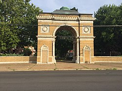
The Central West End is a neighborhood in St. Louis, Missouri, stretching from Midtown's western edge to Union Boulevard and bordering on Forest Park with its outstanding array of free cultural institutions. It includes the Cathedral Basilica of Saint Louis on Lindell Boulevard at Newstead Avenue, which houses the largest collection of mosaics in the world. The Central West End is represented by three aldermen as it sits partially in the 17th, 18th, and 28th Wards.
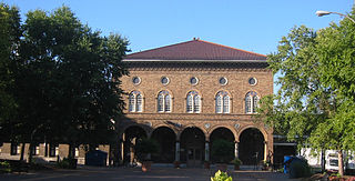
Soulard is a historic neighborhood in St. Louis, Missouri. It is the home of Soulard Farmers Market, the oldest farmers' market west of the Mississippi River. Soulard is one of ten certified local historic districts in the city of St. Louis.
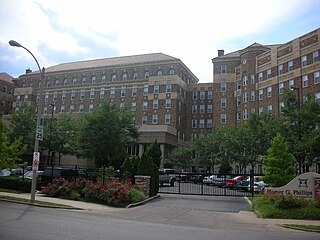
The Ville is a historic African-American neighborhood located in North St. Louis, Missouri. It has had a long history of African-American businesses and residents.

Old North St. Louis is a neighborhood just north and slightly west of the downtown area of St. Louis, Missouri. It is known for Crown Candy Kitchen, historic 19th-century brick homes, and its community gardens.
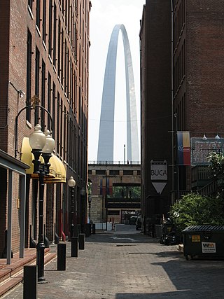
Downtown St. Louis is the central business district of St. Louis, Missouri, the hub of tourism and entertainment, and the anchor of the St. Louis metropolitan area. The downtown is bounded by Cole Street to the north, the river front to the east, Chouteau Avenue to the south, and Tucker Boulevard to the west. The downtown is the site of many corporate headquarters, including Stifel Financial Corp., HOK, Spire Inc, and a host of other companies.

LaSalle Park is an integral part of the three-neighborhood "Old Frenchtown" area—LaSalle Park, Lafayette Square and Soulard—bordering the southern edge of downtown St. Louis. It was formed as a "new" neighborhood, legally distinct from the larger Soulard district, through the efforts of the city of St. Louis, Missouri and Ralston Purina, which has its world headquarters in LaSalle Park.

Shaw is a neighborhood in St. Louis, Missouri. It is bordered on the North by Interstate 44, the east by S. Grand Blvd, the west by Tower Grove Ave and the Missouri Botanical Gardens, and the south by Tower Grove Park. The Shaw Neighborhood is a local historic district whose historic structure and character is protected by ordinance.

Benton Park West is a neighborhood located in South St. Louis City, Missouri, United States. The neighborhood is bounded by Jefferson Ave. on the east, Gravois Ave. on the north and west, and an irregular boundary consisting of Cherokee Street, S. Compton Ave., and Potomac St. to the south. The neighborhood is the conglomeration of two different neighborhoods in the 1970s, Compton Hill and Marquette-Cherokee. Parts of these two 1970s neighborhoods make up the current day Benton Park West. Marquette-Cherokee was bounded by Arsenal Street on the north, Bates Street on the south and Grand Boulevard on the west. Its eastern edge was the bank of the Mississippi River. Benton Park West has the highest percentage of Latino residents among St. Louis neighborhoods.

Midtown is a neighborhood in St. Louis, Missouri. It is located 3 miles (4.8 km) west of the city riverfront at the intersection of Grand and Lindell Boulevards. It is home to the campus of Saint Louis University and the Grand Center Arts District.

Benton Park is a neighborhood in southside St. Louis, Missouri, just west of the Soulard neighborhood. The official boundaries of the area are Gravois Avenue on the north, Cherokee Street on the south, I-55 on the east, and Jefferson Avenue on the west. Benton Park is unrelated to Benton Place, a private street located in Lafayette Square, St. Louis.

College Hill is a neighborhood of the City of St. Louis, Missouri. The name College Hill was given to this area because it was the location of the Saint Louis University College Farm. This area, bounded generally by Warne Ave., O'Fallon Park, I-70, Grand Boulevard, and W. Florissant Ave., was acquired by the University for garden and recreation purposes in 1836. It was subdivided in the early 1870s.

Columbus Square is a neighborhood of St. Louis, Missouri. It is bounded by Cass Avenue to the north, I-70 to the east, Tucker & North 13th Streets to the west, and Cole Street to the south.

DeBaliviere Place is a neighborhood of St. Louis, Missouri.

Forest Park Southeast (FPSE) is a neighborhood of St. Louis, Missouri. It is bordered by Interstate 64 to the north, Vandeventer Avenue to the east, Interstate 44 to the south, and Kingshighway Boulevard and Forest Park to the west. Adjoining neighborhoods include Kings Oak and The Hill to the west, Southwest Garden to the south, Botanical Heights to the southeast, Midtown to the east, and the Central West End to the north.

Hamilton Heights is a neighborhood of St. Louis, Missouri. The neighborhood is bounded by Dr. Martin Luther King Drive on the Northeast, the city limits on the Northwest, Page Avenue on the South, and Union Boulevard on the East.

Hyde Park is a neighborhood of St. Louis, Missouri. A historic North St. Louis neighborhood, Hyde Park is bound by Ferry to the North, I-70 to the East, Palm Street and Natural Bridge Avenue to the South, and Glasgow to the West.

Skinker DeBaliviere is a neighborhood of St. Louis, Missouri, located directly north of Forest Park. In addition to the park, its boundaries are Delmar Boulevard to the north, DeBaliviere Avenue to the east, and the western city limits near Skinker Boulevard. It is home to The Pageant, Pin-up Bowl, and all the other establishments of the Delmar Loop east of University City. It also includes the west end of the Forest Park – DeBaliviere and the entire Skinker MetroLink stations. The Delmar Loop station is just outside of its north boundary. In 1978, the neighborhood was designated a Local Historic District by the City of St. Louis, and the private subdivision of Parkview is listed in the National Register of Historic Places.
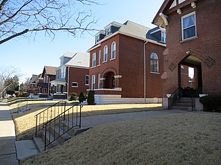
Kingsway East is a neighborhood of St. Louis, Missouri. The neighborhood is generally defined by Natural Bridge on the North, Martin Luther King on the South, Marcus Avenue on the East, and Kingshighway on the West.
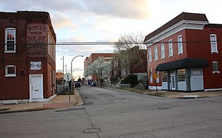
Marine Villa is a neighborhood of St. Louis, Missouri. The neighborhood is located just south of the large and historic Anheuser-Busch Brewery complex along the bluffs of the Mississippi River. It is further defined by Cherokee Street's Antique Row on the north, Gasconade Street on the south, South Broadway and Jefferson Avenue on the west, and the Mississippi River on the east.
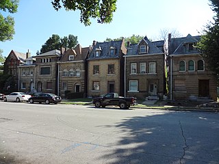
Vandeventer is a neighborhood of St. Louis, Missouri. The area is bounded by Dr. Martin Luther King Drive on the North, Delmar Boulevard on the South, Vandeventer Avenue on the East, and Newstead Avenue on the West.
