Freeburg, Missouri | |
---|---|
Village of Freeburg | |
Coordinates: 38°18′58″N91°55′20″W / 38.31611°N 91.92222°W Coordinates: 38°18′58″N91°55′20″W / 38.31611°N 91.92222°W | |
Country | United States |
State | Missouri |
County | Osage |
Named for | Freiburg, Germany |
Area | |
• Total | 0.83 sq mi (2.16 km2) |
• Land | 0.83 sq mi (2.16 km2) |
• Water | 0.00 sq mi (0.00 km2) |
Elevation | 883 ft (269 m) |
Population (2020) | |
• Total | 409 |
• Density | 490.41/sq mi (189.26/km2) |
Time zone | UTC-6 (Central (CST)) |
• Summer (DST) | UTC-5 (CDT) |
ZIP code | 65035 |
Area code | 573 |
FIPS code | 29-25822 [3] |
GNIS feature ID | 2398924 [2] |
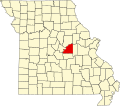
Freeburg is a village in Osage County, Missouri, United States. The population was 409 at the 2020 census. [4] It is part of the Jefferson City, Missouri Metropolitan Statistical Area.
Settled by Germans in the 1850s, Freeburg was platted in 1903 and named after the German city of Freiburg, soon after the railroad was extended to that point. [5]
According to the United States Census Bureau, the village has a total area of 0.83 square miles (2.15 km2), all land. [6]
Census | Pop. | Note | %± |
---|---|---|---|
1910 | 331 | — | |
1920 | 292 | −11.8% | |
1930 | 436 | 49.3% | |
1940 | 395 | −9.4% | |
1950 | 370 | −6.3% | |
1960 | 399 | 7.8% | |
1970 | 577 | 44.6% | |
1980 | 554 | −4.0% | |
1990 | 446 | −19.5% | |
2000 | 423 | −5.2% | |
2010 | 437 | 3.3% | |
2020 | 409 | −6.4% | |
U.S. Decennial Census [7] |
As of the census [8] of 2010, there were 437 people, 199 households, and 123 families residing in the village. The population density was 526.5 inhabitants per square mile (203.3/km2). There were 227 housing units at an average density of 273.5 per square mile (105.6/km2). The racial makeup of the village was 98.9% White, 0.2% Asian, 0.5% Pacific Islander, and 0.5% from two or more races. Hispanic or Latino of any race were 0.7% of the population.
There were 199 households, of which 25.1% had children under the age of 18 living with them, 47.7% were married couples living together, 10.1% had a female householder with no husband present, 4.0% had a male householder with no wife present, and 38.2% were non-families. 33.7% of all households were made up of individuals, and 13.1% had someone living alone who was 65 years of age or older. The average household size was 2.20 and the average family size was 2.80.
The median age in the village was 40.6 years. 21.3% of residents were under the age of 18; 8.6% were between the ages of 18 and 24; 24.9% were from 25 to 44; 25.9% were from 45 to 64; and 19.2% were 65 years of age or older. The gender makeup of the village was 50.8% male and 49.2% female.
As of the census [3] of 2000, there were 423 people, 181 households, and 114 families residing in the village. The population density was 513.1 inhabitants per square mile (198.1/km2). There were 205 housing units at an average density of 248.7 per square mile (96.0/km2). The racial makeup of the village was 100.00% White. Hispanic or Latino of any race were 0.71% of the population.
There were 181 households, out of which 30.9% had children under the age of 18 living with them, 45.9% were married couples living together, 11.6% had a female householder with no husband present, and 37.0% were non-families. 33.7% of all households were made up of individuals, and 16.0% had someone living alone who was 65 years of age or older. The average household size was 2.34 and the average family size was 2.96.
In the city the population was spread out, with 23.2% under the age of 18, 13.5% from 18 to 24, 26.2% from 25 to 44, 21.0% from 45 to 64, and 16.1% who were 65 years of age or older. The median age was 34 years. For every 100 females, there were 98.6 males. For every 100 females age 18 and over, there were 101.9 males.
The median income for a household in the village was $31,429, and the median income for a family was $40,156. Males had a median income of $22,000 versus $19,792 for females. The per capita income for the village was $20,071. About 4.8% of families and 9.2% of the population were below the poverty line, including 11.9% of those under age 18 and 12.1% of those age 65 or over.
The climate in this area is characterized by hot, humid summers and generally cool winters. According to the Köppen Climate Classification system, Freeburg has a humid subtropical climate, abbreviated "Cfa" on climate maps.
Climate data for Freeburg, MO | |||||||||||||
---|---|---|---|---|---|---|---|---|---|---|---|---|---|
Month | Jan | Feb | Mar | Apr | May | Jun | Jul | Aug | Sep | Oct | Nov | Dec | Year |
Average high °F (°C) | 41.3 (5.2) | 46.6 (8.1) | 57.1 (13.9) | 67.8 (19.9) | 76.1 (24.5) | 84.2 (29.0) | 89.0 (31.7) | 88.8 (31.6) | 80.5 (26.9) | 69.4 (20.8) | 56.8 (13.8) | 43.9 (6.6) | 66.8 (19.3) |
Average low °F (°C) | 21.3 (−5.9) | 25.0 (−3.9) | 33.6 (0.9) | 43.7 (6.5) | 53.4 (11.9) | 62.6 (17.0) | 67.1 (19.5) | 65.2 (18.4) | 56.1 (13.4) | 44.5 (6.9) | 35.1 (1.7) | 24.3 (−4.3) | 44.3 (6.8) |
Average precipitation inches (mm) | 2.2 (56) | 2.2 (56) | 3.2 (81) | 4.0 (100) | 5.2 (130) | 4.5 (110) | 4.2 (110) | 4.0 (100) | 4.2 (110) | 3.6 (91) | 3.9 (99) | 2.9 (74) | 44.1 (1,117) |
Average snowfall inches (cm) | 3.5 (8.9) | 3.0 (7.6) | 1.5 (3.8) | 0 (0) | 0 (0) | 0 (0) | 0 (0) | 0 (0) | 0 (0) | 0 (0) | 0.5 (1.3) | 3.0 (7.6) | 11.5 (29.2) |
Average precipitation days | 7 | 7 | 9 | 10 | 11 | 9 | 8 | 7 | 7 | 8 | 8 | 8 | 99 |
Average snowy days | 2 | 2 | 0.5 | 0 | 0 | 0 | 0 | 0 | 0 | 0 | 0.3 | 2 | 6.8 |
Source: NOAA [9] |
Freeburg is a village in St. Clair County, Illinois, United States. Located within Greater St. Louis, it is a southeastern exurb with many residents commuting to Downtown St. Louis or the Belleville area for employment. As of 2010, Freeburg had a population of 4,354.
Winston is a village in southwestern Daviess County, Missouri, United States. The population was 229 at the 2020 census.
Leslie is a village in west central Franklin County, Missouri, United States. The population was 171 at the 2010 census.
Corning is a village in Holt County, Missouri, United States. The population was 3 at the 2020 census.
River Bend is a village in Jackson County, Missouri, United States. The population was 3 at the 2020 census. It is the only part of Jackson County that lies north of the Missouri River. In 1951, the Missouri River was relocated to a new channel, creating River Bend,. The county line still follows the original riverbed. It is part of the Kansas City metropolitan area. The mayor is Alex Dockler.
Freistatt is a village in Lawrence County, Missouri, United States. The population was 163 at the 2010 census.
Laurie is a city in southern Morgan and northern Camden counties, Missouri, United States. The population was 945 at the 2010 census.
Stover is a city in Morgan County, Missouri, United States. The population was 1,094 at the 2010 census.
Pascola is a village in Pemiscot County, Missouri, United States. The population was 108 at the 2010 census.
Velda Village Hills is a village in northeastern St. Louis County, Missouri, United States. The population was 1,055 at the 2010 census.
Bull Creek is a village in northwest Taney County, Missouri, United States. The population was 426 at the 2020 census. It is part of the Branson, Missouri Micropolitan Statistical Area.
Moundville is a village in southwest Vernon County, Missouri, United States. The population was 124 at the 2010 census.
Richards is a village in northwest Vernon County, Missouri, United States. The population was 96 at the 2010 census.
Merriman is a village in Cherry County, Nebraska. The population was 128 at the time of the 2010 census.
Anselmo is a village in Custer County, Nebraska, United States. The population was 145 at the 2010 census.
Dodge is a village in Dodge County, Nebraska, United States. The population was 612 at the 2010 census.
Champ is a village in St. Louis County, Missouri, United States. The population was 10 at the 2020 census.
Freeburg is a borough in Snyder County, Pennsylvania, United States. The population was 557 at the 2020 census.
Beech Bottom is a village in Brooke County, West Virginia, United States, situated along the Ohio River. The population was 523 at the 2010 census. It is part of the Weirton–Steubenville metropolitan area.
Ionia is a village in northern Benton and southern Pettis counties in the U.S. state of Missouri. The population was 88 at the 2010 census.