The Chaplin Historic District in Chaplin, Connecticut is a historic district that was listed on the National Register of Historic Places (NRHP) in 1978. The district encompasses the historic village center of Chaplin, which extends for 0.8 miles (1.3 km) along Chaplin Street, and was most heavily developed in the early 19th century. The focal center of the district is the 1812-15 Congregational Church, which stands on a knoll overlooking the street. Most of the district's buildings are wood-frame houses, although the Witter House is a notable brick structure. Stylistically most of the houses are either Federal or Greek Revival in style. In addition to the church, other public buildings include the 1840 former town hall, the 1911 Colonial Revival Ross Memorial Library building, and Eaton's Store, built in 1850.

The Conway Center Historic District encompasses the historic village center of Conway, Massachusetts. The district is focused on Main Street, a section of Massachusetts Route 116 that connects two major road intersections on either side of the South River. It includes properties on Main Street, Elm Street, and Academy Hill Road, and is generally representative of the growth of the community between about 1830 and 1930. The district was listed on the National Register of Historic Places in 1999.
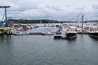
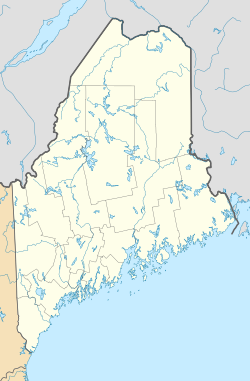
The Harraseeket River is a 3.2-mile-long (5.1 km) tidal river in the town of Freeport within the U.S. state of Maine. It forms a northern arm of Casco Bay.

The Main Street Historic District encompasses the historic commercial center of Damariscotta, Maine. Although the community was settled in the 18th century, most of its downtown area dates to the second half of the 19th century due to an 1845 fire. Lining Main Street east of the Damariscotta River, the downtown has a well-preserved collection of commercial, residential, and civic structures from the period. The district was added to the National Register of Historic Places in 1979, and enlarged in 2001.

The Captain Greenfield Pote House is an historic house located on Wolfe's Neck Road in Freeport, Maine, United States. Built c. 1750 and supposedly moved to this location in 1765, it is Freeport's oldest surviving building. It was listed on the National Register of Historic Places in 1970, and is part of the Harraseeket Historic District. The property is owned by the Wolfe's Neck Center for Agriculture and the Environment.

Freeport is a town in Cumberland County, Maine, United States. Freeport is included in the Lewiston-Auburn, Maine metropolitan New England City and town area. The population was 8,737 at the 2020 census. Once home to a prominent shipbuilding industry, timber operations, and farming, it is now known for its numerous outlet stores; Freeport is home to L.L. Bean, Wolfe's Neck Woods State Park, and the Desert of Maine.
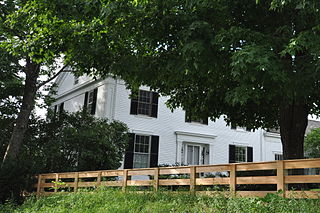
The Harraseeket Historic District encompasses some of the oldest maritime village areas of the town of Freeport, Maine. It includes properties along both banks of the tidal Harraseeket River, from the Mast Landing area in the north to Wolf Neck and the villages of Porter's Landing and South Freeport on the west bank of the river. The district was listed on the National Register of Historic Places in 1974.
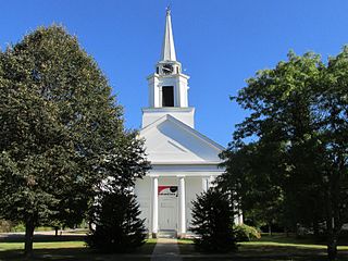
The Main Street Historic District of Fryeburg, Maine, encompasses the growth of the town's principal village between about 1800 and 1935. It extends along Main Street, from Woodland Street in the north to Portland Street (SR 5 and Maine State Route 113) in the south, and includes forty primary buildings on 55 acres (22 ha). The district was listed on the National Register of Historic Places in 1991.

The Norway Historic District encompasses most of the historic village center of Norway, Maine, and is reflective of the town's growth over 150 years. Although significant early-to-mid 19th century buildings survive in the village, it was significantly damaged by a major fire in 1894, resulting in the construction of a number of new brick and wood-frame buildings. The district, which is 44 acres (18 ha) in size, includes 64 historically significant residential, civic, social, and commercial buildings, and was listed on the National Register of Historic Places in 1988.

The Market Square Historic District of Houlton, Maine encompasses that town's historic late-19th century central business district. Centered on the junction of Market Square, Court Street, Water Street, and Main Street, it includes a relatively cohesive assortment of brick and masonry commercial buildings, designed by architects and built between 1885 and 1910, following the arrival of the Bangor and Aroostook Railroad. The district was listed on the National Register of Historic Places in 1980.
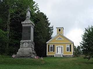
The Dennysville Historic District encompasses the historic town center of Dennysville, Maine. Located near the southern end of the large rural community, its architecture covers more than 100 years of community history, from the early 19th to early 20th centuries. The district extends along Main Street between Maine State Route 86 and Bunker Hill Road, on the west bank of the Dennys River. It was listed on the National Register of Historic Places in 1982.

The Salmon Falls (East) Historic District encompasses a node of rural development in western Buxton, Maine. It includes thirteen historic properties, mainly Greek Revival in character, extending north along Maine State Route 117, north of its junction with Simpson Road, and two on the latter street, that were all built between about 1800 and 1850. The district was listed on the National Register of Historic Places in 1987.
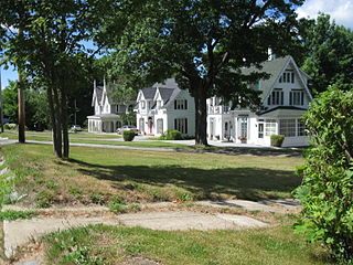
The Hinckley Hill Historic District encompasses a well-preserved collection of stylish mid-19th century residences in Calais, Maine. Built mostly between 1820 and 1860, it includes a trio of high-quality Gothic Revival houses from the 1850s near the eastern edge of the town. The district was listed on the National Register of Historic Places in 1994.

The Bellows Falls Neighborhood Historic District encompasses a residential area of the village of Bellows Falls, Vermont. Located south of downtown Bellows Falls, the area has one of the largest concentrations of well-preserved 19th century residences in southern Vermont. It was listed on the National Register of Historic Places in 2002, and enlarged in 2007.

The Pettengill House and Farm is a historic conservation property in Freeport, Maine, United States. Now owned by the Freeport Historical Society, this farm was in active use from at least 1831 until 1960. More than 140 acres (57 ha) of its original 180 acres (73 ha) have been preserved, as has the c. 1800 saltbox farmhouse. The property was listed on the National Register of Historic Places in 1970, and is part of the 1974 Harraseeket Historic District. The farm is located at the southern end of Pettengill Road in Freeport's Mast Landing area. The house faces south, looking down the Harraseeket River. The property's trails are open to the public daily from dawn to dusk.

The Days Ferry Historic District encompasses a rural village that grew around a ferry crossing on the Kennebec River in what is now Woolwich, Maine. The village and ferry were on the main stage route between Bath and Wiscasset until the 1870s, and retains a concentration of well-preserved 18th and early 19th-century houses. The district was listed on the National Register of Historic Places in 1975.

The Crosby Street Historic District encompasses a collection of well-preserved high-quality early 19th-century houses on Crosby Street and Crosby Lane in Augusta, Maine. Located on a rise overlooking the city's downtown, these houses were built by leading businessmen of the period, and are either Federal or Greek Revival in their style. The district was listed on the National Register of Historic Places in 1986.

The Randolph Center Historic District encompasses the historic early town center of Randolph, Vermont. Established in 1783, it was later eclipsed by Randolph Village, which developed around the town's main railroad depot. The village now has a distinguished array of late 18th and early 19th-century architecture and is home to an academic campus now housing Vermont State University. It was listed on the National Register of Historic Places in 1974.

The Pearl Street Historic District of Burlington, Vermont encompasses part of the city's first major east-west transportation arteries, which developed from a fashionable residential area in the early 19th century to its present mixed use. It contains one of the city's highest concentrations of early Federal period architecture, as well as a number of fine Queen Anne and Colonial Revival houses. It was listed on the National Register of Historic Places in 1984.

The Southbury Historic District No. 1 encompasses a well-preserved 19th-century village landscape along Main Street North in Southbury, Connecticut. This area includes the historic town center of Southbury, and is part of a larger streetscape extending into neighboring Woodbury, where it continues in the Woodbury Historic District No. 2. The district was listed on the National Register of Historic Places in 1971.