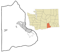
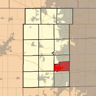
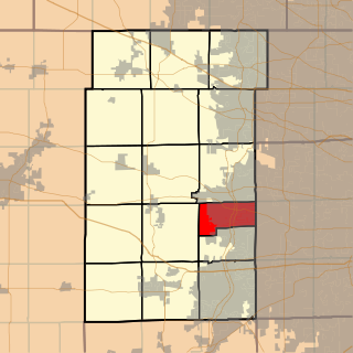
"},"website":{"wt":""},"footnotes":{"wt":""}},"i":0}}]}" id="mwAg">Unincorporated community in Washington, United States Geneva Junction is an unincorporated community in Benton County, Washington, United States, located approximately eight miles north of Richland on the Hanford Nuclear Reservation. Geneva Township is one of the twenty-seven townships of Ashtabula County, Ohio, United States. The 2010 census found 11,098 people in the township. Batavia Township is in Kane County, Illinois. It is divided by the Fox River. As of the 2010 census, its population was 35,221 and it contained 12,892 housing units. The western part of the United States Department of Energy's Fermilab is at the township's eastern edge, although most of the facility is in neighboring Winfield Township in DuPage County. Geneva Township is in Kane County, Illinois. As of the 2010 census, its population was 26,552 and it contained 10,210 housing units. Geneva is an unincorporated community in Noble Township, Shelby County, in the U.S. state of Indiana. Milford Junction is an unincorporated community in Van Buren Township, Kosciusko County, in the U.S. state of Indiana. Thomaston is an unincorporated community in Hanna Township, LaPorte County, Indiana. Geneva is an unincorporated community in Bear Lake County, Idaho, United States. Its elevation is 6,178 feet (1,883 m). Although Geneva is unincorporated, it has a post office, with the ZIP code of 83238; the ZCTA for ZIP Code 83238 had a population of 141 at the 2000 census. Laona Junction is an unincorporated community in the town of Caswell in Forest County, Wisconsin, United States. U.S. Route 8 travels north-south near the community. Seville is an unincorporated community in Fulton County, Illinois, United States. Seville is located on Illinois Route 95, west of Smithfield. It is served by Keokuk Junction Railway. Alta is an unincorporated community in Greenbrier County, West Virginia, United States. Alta is located at the junction of Interstate 64, U.S. Route 60, and West Virginia Route 12 northwest of Lewisburg. Schodack Center is a hamlet in the town of Schodack, Rensselaer County, New York, United States. Schodack Center is located at the junction of Interstate 90, U.S. Route 20, and U.S. Route 9. Charmco is an unincorporated community and coal town in Greenbrier County, West Virginia, United States. Charmco is located at the junction of U.S. Route 60 and West Virginia Route 20 northeast of Rainelle. Charmco has a post office with ZIP code 25958. The community was named for the Charleston Milling Company. Glover is an unincorporated community in Champaign County, Illinois, United States. Glover is located on U.S. Route 150 near the eastern border of St. Joseph.There are no buildings in Glover. There used to be a tower at the Junction of the Chicago and Eastern Illinois, Peoria and Eastern, and the Illinois Terminal railroads. The Peoria and Eastern and the Illinois Terminal have been removed. Houses nearby belong to St Joseph, Illinois. Gordon is an unincorporated community in Crawford County, Illinois, United States. Gordon is located at the junction of Illinois Route 1 and Illinois Route 33, 3 miles (4.8 km) east of Robinson. North Hartland is a census-designated place (CDP) in the town of Hartland, Windsor County, Vermont, United States. As of the 2010 census, the population of the CDP was 302. Donald is a census-designated place and unincorporated community in Yakima County, Washington, United States. The population was 91 at the 2010 census. Sawyer is an unincorporated community in Yakima County, Washington, United States. May Junction is an unincorporated community in Benton County, Washington, United States, located approximately 23 miles southwest of Othello on the Hanford Nuclear Reservation. Richland Junction is a neighborhood of Richland in Benton County, Washington, United States. It is located within the east city limits of Richland. Percy Junction is an unincorporated community in Grant Township, Newton County, in the U.S. state of Indiana.Geneva Junction, Washington Unincorporated community Coordinates: 46°27′56″N119°19′32″W / 46.4656916°N 119.3255748°W Coordinates: 46°27′56″N119°19′32″W / 46.4656916°N 119.3255748°W [1] Country United States State Washington County Benton Elevation [2] 420 ft (128 m) Time zone Pacific (PST) (UTC-8) • Summer (DST) PDT (UTC-7) ZIP code 98944 Area code(s) 509 GNIS feature ID 1510986 [2] Related Research Articles
References
This Benton County, Washington state location article is a stub. You can help Wikipedia by expanding it.