Yavatmal district, [jəʋət̪maːɭ] formerly known as Yeotmal, is a district of the Indian state of Maharashtra. It is located in the region of Vidarbha, in the east-central part of the state. It is Vidarbha's third-largest district by population, after Nagpur and Amravati. Yavatmal city is the administrative headquarters of the district.
Shegaon is a city and municipal council in the Buldhana district in the Indian state of Maharashtra. Shegaon has become a pilgrimage centre due to the influence of Shri Sant Gajanan Maharaj, who is considered a saint by Hindus.
Wardha is a city and a municipal council in Wardha district in the Indian state of Maharashtra. The administrative headquarter of Wardha district is situated here. Wardha gets its name from Wardha River which flows on the northern, western and southern boundaries of the district. Founded in 1866, the town is now an important centre for cotton trade. Wardha was an important part of the Gandhian era.

Amravati district is a district of Maharashtra state in central India. It is the administrative headquarter of Amravati division, which is one of the two divisions in Vidarbha, out of total 6 regions in state of Maharashtra.

Yavatmal ( is a city and municipal council in the Indian state of Maharashtra. It is the administrative headquarters of Yavatmal District. Yavatmal is around 90 km away from divisional headquarters Amravati while it is 670 km away from the state capital Mumbai. Yavatmal District is on 2nd position in India after Kolkata and known for its unique Navratri festival celebration, and nearly total 2,766+ durga mata is installed in the whole district. Yavatmal is known for organizing huge celebration events for Navratri.
Murtijapur is a Municipal council and one of the taluka of district of Akola of the Amravati division of the Vidarbha region of Maharashtra.
Khamgaon is a city in Buldhana District, Maharashtra, India. It is the largest city in Buldhana district. It is well connected to all other big cities of Maharashtra and India through National Highway 6 and other state highways.
Sillod is a city and a taluka in the Aurangabad district of the Indian state of Maharashtra. Sillod is represented in the Maharashtra Vidhan Sabha through the Sillod Vidhan Sabha constituency.
Anjangaon is a city and a municipal council in Amravati district in the state of Maharashtra, India. Anjangaon City got the status of Municipal Council in 1930. It is the first municipal council established in Amravati district and the second biggest council as well. Anjangaon Surji Tehsil was established in 1981. It is technically made up of two main zones, Anjangaon and Surji, on either side of Shahanur River, and is called Anjangaon-Surji in combination. It is called a "Banana Hub of Vidarbha" as it is a large producer of bananas and a hub of medicinal plants - Piper longum and Safed musali.

Chopda is a city and municipal council in the Jalgaon district in the state of Maharashtra, India.
Darwha is a town and a municipal council in Yavatmal district in the state of Maharashtra, India.

Gangakhed is a city located on banks of Godavari River and a municipal council in Parbhani district in the state of Maharashtra, India. It is also known as Dakshin Kashi. It is also the second largest city In Parbhani District.
Pandharkawda is a City and a Municipal council in Yavatmal district in the Indian state of Maharashtra. The Pandharkawada municipality won "Best Municipality at Amravati Division" in 2006 and a quality of education award in 2011. It is near the Saikheda Dam, an earthfill dam on the Khuni River..

Rahimatpur is a city and a municipal council in Satara district in the Indian state of Maharashtra.

Wani is a 3rd largest city in Yavatmal district in the Indian state of Maharashtra.
Mahagaon is located in Pusad subdivision of Yavatmal district in the state of Maharashtra, India.
Ner is a census town and tehsil in Darwha subdivision of Yavatmal district in the state of Maharashtra, India. As per 2011 census population of Ner was around 90,000. The famous Shri Fakirji Maharaj yatra (fair) is held in Ner tehsil. Famous landmarks in Ner include a Ganesha temple named 'Shree Ganpati Math', a Someshwar temple, a Jama Masjid, an Agricultural produce market committee and a cotton market.
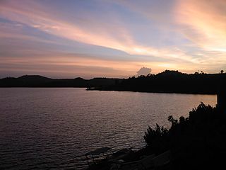
Arni is a town with & tehsil in Yavatmal district of Maharashtra State in India. It is situated on the banks of the Arunavati River. It Connected with National Highway-361. Nearest Railway Station is a Dhamangaon which is located 90 km approx & Nearest Airport is a Dr.Babasaheb Ambedkar International Airport, Nagpur is around 187 km from Arni.
Mahagaon is a town in Gadhinglaj Taluka, Kolhapur district, situated in the southwest corner of the state of Maharashtra, India, on the banks of the Hiranyakeshi river. It is about 10 kilometres (6.2 mi) south of Gadhinglaj and 14 kilometres (8.7 mi) from the city of Kadgaon. It is managed by a town council. In 2011, it had a population of about 20,108.
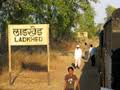
Ladkhed is a village in Darwha Taluka in Yavatmal District of Maharashtra state, India. It is a part of the Vidarbha region and is in Amravati Division. It is located 27 kilometres (17 mi) west of its district headquarters at Yavatmal and is 18 kilometres (11 mi) from Darwha. Its PIN code is 445201. and postal head office is Ladkhed.


