
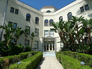
Mission Hills is a suburban neighborhood in the City of Los Angeles, California, located in the San Fernando Valley.

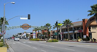
Canoga Park is a neighborhood in the San Fernando Valley region of the City of Los Angeles, California. Before the Mexican–American War, the district was part of a rancho, and after the American victory it was converted into wheat farms and then subdivided, with part of it named Owensmouth as a town founded in 1912. It joined Los Angeles in 1917 and was renamed Canoga Park on March 1, 1931, after Canoga, New York.

Wilmington is a neighborhood in the Harbor region of Los Angeles, California, covering 9.14 square miles (23.7 km2).

Studio City is a neighborhood in the city of Los Angeles, California, in the southeast San Fernando Valley, just west of the Cahuenga Pass. It is named after the studio lot that was established in the area by film producer Mack Sennett in 1927, now known as Radford Studio Center.
Eagle Rock is a neighborhood of Northeast Los Angeles, abutting the San Rafael Hills in Los Angeles County, California. Eagle Rock is named after Eagle Rock, a large boulder whose shadow resembles an eagle. Eagle Rock was once part of the Rancho San Rafael under Spanish and Mexican governorship. In 1911, Eagle Rock was incorporated as a city, and in 1923 it combined with the City of Los Angeles.
Encino is a neighborhood in the San Fernando Valley region of Los Angeles, California.

Sun Valley is a neighborhood in Los Angeles, California in the San Fernando Valley region. The neighborhood is known for its overall youthful population and moderate racial diversity. There are three recreation centers in Sun Valley, one of which is a historic site. The neighborhood has thirteen public schools—including John H. Francis Polytechnic High School and Sun Valley High School—and four private schools.

Wrigley Field was a ballpark in Los Angeles, California. It hosted minor league baseball teams in the region for more than 30 years. It was the home park for the minor league Los Angeles Angels during their run in the Pacific Coast League, as well as for the inaugural season of the major league team of the same name in 1961. The park was designed by Zachary Taylor Davis, who had previously designed both Chicago ballparks: Comiskey Park and Wrigley Field. The ballpark was also used as the backdrop for several Hollywood films about baseball, as well as the 1960 TV series Home Run Derby.

West Hills is an affluent suburban / residential community in the western San Fernando Valley region of the City of Los Angeles, California. The percentage of residents aged 35 and older is among the highest in Los Angeles County.

Travel Town Museum is a railway museum dedicated on December 14, 1952, and located in the northwest corner of Los Angeles, California's Griffith Park. The history of railroad transportation in the western United States from 1880 to the 1930s is the primary focus of the museum's collection, with an emphasis on railroading in Southern California and the Los Angeles area.
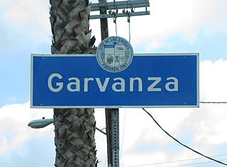
Garvanza is a neighborhood in northeast Los Angeles. Fourteen Los Angeles Historic-Cultural Monuments are located in the neighborhood.
Reseda Boulevard, named Reseda Avenue until May 1929, is a major north–south arterial road that runs through the western San Fernando Valley region of Los Angeles, California.
Peck Park is a public park located in the San Pedro district of Los Angeles, California. The park's address is 560 Western Avenue, near the intersection with Summerland Avenue. Peck Park is managed by the City of Los Angeles Department of Recreation and Parks. Facilities at the park include a swimming pool, a baseball diamond, indoor and outdoor basketball courts, extensive hiking trails, and a child care center. In 1997 the Peck Park gymnasium was designed by Koning Eizenberg Architecture, Inc. The park is the largest of four in San Pedro named for notable land owner and developer George H. Peck and his family; Peck began to donate the land to the city for the park starting in 1929. The other three parks are named after his three children.
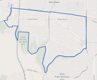
Baldwin Hills/Crenshaw is a neighborhood in the south region of the city of Los Angeles. It is divided between the upscale, principally home-owning Baldwin Hills residential district to the south and a more concentrated apartment area to the north, just south of Jefferson Boulevard. A commercial corridor along Crenshaw Boulevard includes Baldwin Hills Crenshaw Plaza, Marlton Square and Crenshaw Boulevard.

Castle Heights is a neighborhood on the Westside of the city of Los Angeles, California.
Vermont Square Park is an urban park located in Los Angeles City Council District 9, Los Angeles, California. It features barbecue pits, basketball courts, and a children's playground.
Veterans Barrington Park is an urban park located in Los Angeles City Council District 11, Los Angeles, California. It features a baseball field, a leash-less dog park, and a grassy play area.

Brand Park is a recreation facility in Mission Hills, Los Angeles, California. It is located directly south of the Mission San Fernando Rey de España. Its western section contains the historic Brand Park Memory Garden along with the Brand Park Community Center which is used as a multi-purpose area for events. In its eastern section there are grass fields, two baseball diamonds, and a parking lot.


