Glen Canyon Group

Last updated

Glen Canyon Group
Stratigraphic range: Rhaetian–Toarcian
Glen Canyon Group.jpg
Glen Canyon Group in southeast Utah. At top are massive beds of Navajo Sandstone separated by thinner beds of the Kayenta Formation from massive beds at bottom of the Wingate Sandstone.
Type Group
Sub-units(oldest to youngest) Wingate Sandstone, Moenave Formation, Kayenta Formation, Navajo Sandstone
Underlies San Rafael Group
Overlies Chinle Formation
Location
Coordinates 36°56′17″N111°28′59″W / 36.938°N 111.483°W / 36.938; -111.483
Region Four Corners
Country United States
Type section
Named for Glen Canyon
Named byGregory and Moore
Usa edcp relief location map.png
Cyan pog.svg
Glen Canyon Group (the United States)
USA Arizona relief location map.svg
Cyan pog.svg
Glen Canyon Group (Arizona)

The Glen Canyon Group is a geologic group of formations that is spread across the U.S. states of Nevada, Utah, northern Arizona, north west New Mexico and western Colorado. It is called the Glen Canyon Sandstone in the Green River Basin of Colorado and Utah. [1]

Contents

There are four formations within the group. From oldest to youngest, these are the Wingate Sandstone, Moenave Formation, Kayenta Formation, and Navajo Sandstone. [2] Part of the Colorado Plateau and the Basin and Range, this group of formations was laid down during the Late Triassic and Early Jurassic, with the Triassic-Jurassic boundary within the Wingate Sandstone. [3] [4] The top of the Glen Canyon Group is thought to date to the Toarcian stage of the Early Jurassic. [5]

Asterisks (*) below indicate usage by the U.S. Geological Survey.

Description

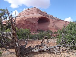
The Glen Canyon Group consists of extensive eolian deposits of latest Triassic to Early Jurassic age on the Colorado Plateau. These form the spectacular orange canyon walls of Canyonlands National Park and Paria Canyon as well as the unflooded portions of Glen Canyon. Deposition of the Glen Canyon Group ceased in the Middle Jurassic with the transgression of the Sundance Sea, which separated deposition of the Glen Canyon Group from deposition of the overlying San Rafael Group. [6] The Glen Canyon Group is separated from the underlying Chinle Formation by the regional J-0 unconformity, which represents a time of widespread erosion across western North America. The group is likewise separated from the overlying San Rafael Group by the regional J-2 conformity, representing a renewal of widespread erosion. [7]

The Glen Canyon Group was deposited in a foreland basin created by the uplift of the Sevier Mountains in what is now Nevada and eastern Utah. As a result, the formations of the group thicken to the west. [8]

The Kayenta Formation pinches out and disappears to the north, in the Uintah Basin, and the Wingate Sandstone and Navajo Sandstone become indistinguishable. These remaining eolian beds have sometimes been mapped as simply Glen Canyon Formation, but they correlate with the Nugget Sandstone further north, and it has been recommended that they be assigned to the Nugget Sandstone. [9]

Subunits

The Permian through Jurassic stratigraphy of the Colorado Plateau area of southeastern Utah that makes up much of the famous prominent rock formations in protected areas such as Capitol Reef National Park and Canyonlands National Park. From top to bottom: Rounded tan domes of the Navajo Sandstone, layered red Kayenta Formation, cliff-forming, vertically-jointed, red Wingate Sandstone, slope-forming, purplish Chinle Formation, layered, lighter-red Moenkopi Formation, and white, layered Cutler Formation sandstone. Picture from Glen Canyon National Recreation Area, Utah. SEUtahStrat.JPG
The Permian through Jurassic stratigraphy of the Colorado Plateau area of southeastern Utah that makes up much of the famous prominent rock formations in protected areas such as Capitol Reef National Park and Canyonlands National Park. From top to bottom: Rounded tan domes of the Navajo Sandstone, layered red Kayenta Formation, cliff-forming, vertically-jointed, red Wingate Sandstone, slope-forming, purplish Chinle Formation, layered, lighter-red Moenkopi Formation, and white, layered Cutler Formation sandstone. Picture from Glen Canyon National Recreation Area, Utah.

Group rank (stratigraphic order): [2]

History of investigation

There is no designated type locality for this group. It was named by Gregory and Moore prior to 1928 for exposures in walls that form the Glen Canyon of the Colorado River in Coconino County, Arizona and San Juan County, Utah, though their report was not published until 1931. [18] The name had by then been published by Gilluly and Reeside, who gave an overview of the group. [19]

In 1936, A.A. Baker reexamined the group and named the Kayenta Formation. [20] The work was revised again in 1955 by Averitt and others. They assigned the Shurtz Sandstone Tongue (new) and Lamb Point Tongue (new) to the Navajo Sandstone, and Cedar City Tongue (new) and Tenney Canyon Tongue (new) to the Kayenta Formation. [17] In 1957 Harshbarger and others created an overview and revision that assigned the Moenave Formation and divided the Wingate Sandstone into the newly named Rock Point and Lukachukai members. [2] In 1963, the upper contact was revised by Phoenix, who moved the uppermost silstone beds of the Navajo Sandstone into the Judd Hollow Tongue of the Carmel Formation. [21] Poole and Stewart mapped the group into the Green River Basin in 1964, treating it here as a single formation. [22] Areal extent limits were revised by Wilson and Stewart in 1967 [23] and again by Green in 1974, who added the Iyanbito Member. [24] Peterson and Pipiringos revised the upper contact and created an overview in 1979. [13] In 1989 the age of the group was reexamined by Padian [10] and separately by Dubiel (who also revised the lower contact). [25]

Places found

Alcove in the Navajo Sandstone near Moab, Utah. MoabAlcove.JPG
Alcove in the Navajo Sandstone near Moab, Utah.

Geologic Province:

Paleontology

Prehistoric animals from the various formations of the Glen Canyon Group include several types of dinosaurs, known from both skeletal remains and tracks. Dinosaur finds in the Wingate and Moenave formations are presently almost entirely tracks. The Kayenta Formation has a diverse skeletal fauna including the theropods "Syntarsus" kayentakatae and Dilophosaurus , the prosauropod Sarahsaurus , an unnamed heterodontosaurid, and the armored dinosaurs Scelidosaurus and Scutellosaurus . The Navajo Sandstone has body fossils of the theropod Segisaurus and an Ammosaurus -like prosauropod, and tracks. [5]

The following summarizes vertebrate fossils and tracks reported in the Glen Canyon Group:

Navajo Sandstone:

Body fossils
Tritylodontidae indet. [26]
Protosuchidae indet. [26]
Segisaurus halliiCamp [26]
Ammosaurus [26]
Trace fossils
Actinopterygii [27]
Anchisauripus [28]
Anomoepus? [28]
Brasilichnium [26] [28]
Eubrontes [26] [28]
Grallator [28]
Tetrasauropus [26]
Otozoum [26]
Anomoepus [26]

Kayenta Formation:

Body fossils
Hybodontidae incert. [26]
Osteichthyes incert. [26]
Prosalirus bitisShubin and Jenkins [26]
Eocaecilia micropodiaJenkins and Wash [26]
Kayentachelys aprixGaffney et al. [26]
’’Sarahsaurus’’
’’Dilophosaurus’’
’’Kayentavenator’’
’’Scelidosaurus’’
’’Scutellosaurus’’
Unnamed Heterodontosaur
Trace fossils
Brasilichnium? [28]
Eubrontes [28]
Grallator [28]
Otozoum [29]

Moenave Formation:

Body fossils
Semionotidae incert. [26]
Reptilia indet. [26]
Protosuchus [26]
Lepidosauria indet. [26]
Megapnosaurus [26]
Trace fossils
Brasilichnium [26]
Grallator [28]
Tetrasauropus [26]
Eubrontes [28]

Wingate Sandstone:

Trace fossils:
Brasilichnium [26]
Tetrasauropus [26]
Grallator [26]

See also

Related Research Articles

<span class="mw-page-title-main">Geology of the Zion and Kolob canyons area</span> Geology of Zion National Park in Utah

The geology of the Zion and Kolob canyons area includes nine known exposed formations, all visible in Zion National Park in the U.S. state of Utah. Together, these formations represent about 150 million years of mostly Mesozoic-aged sedimentation in that part of North America. Part of a super-sequence of rock units called the Grand Staircase, the formations exposed in the Zion and Kolob area were deposited in several different environments that range from the warm shallow seas of the Kaibab and Moenkopi formations, streams and lakes of the Chinle, Moenave, and Kayenta formations to the large deserts of the Navajo and Temple Cap formations and dry near shore environments of the Carmel Formation.

<span class="mw-page-title-main">Geology of the Capitol Reef area</span>

The exposed geology of the Capitol Reef area presents a record of mostly Mesozoic-aged sedimentation in an area of North America in and around Capitol Reef National Park, on the Colorado Plateau in southeastern Utah.

<span class="mw-page-title-main">Morrison Formation</span> Rock formation in the western United States

The Morrison Formation is a distinctive sequence of Upper Jurassic sedimentary rock found in the western United States which has been the most fertile source of dinosaur fossils in North America. It is composed of mudstone, sandstone, siltstone, and limestone and is light gray, greenish gray, or red. Most of the fossils occur in the green siltstone beds and lower sandstones, relics of the rivers and floodplains of the Jurassic period.

Oligokyphus is an extinct genus of herbivorous tritylodontid cynodont known from the Late Triassic to Early Jurassic of Europe, Asia and North America.

<span class="mw-page-title-main">Navajo Sandstone</span> Geologic formation in the southwestern United States

The Navajo Sandstone is a geological formation in the Glen Canyon Group that is spread across the U.S. states of southern Nevada, northern Arizona, northwest Colorado, and Utah as part of the Colorado Plateau province of the United States.

<span class="mw-page-title-main">Cutler Formation</span> Geologic formation in the Four Corners, US

The Cutler Formation or Cutler Group is a rock unit that is exposed across the U.S. states of Arizona, northwest New Mexico, southeast Utah and southwest Colorado. It was laid down in the Early Permian during the Wolfcampian epoch.

<span class="mw-page-title-main">Moenkopi Formation</span> Geologic formation in the southwestern United States

The Moenkopi Formation is a geological formation that is spread across the U.S. states of New Mexico, northern Arizona, Nevada, southeastern California, eastern Utah and western Colorado. This unit is considered to be a group in Arizona. Part of the Colorado Plateau and Basin and Range, this red sandstone was laid down in the Lower Triassic and possibly part of the Middle Triassic, around 240 million years ago.

<span class="mw-page-title-main">Chinle Formation</span> Geological formation in the western US

The Chinle Formation is an Upper Triassic continental geological formation of fluvial, lacustrine, and palustrine to eolian deposits spread across the U.S. states of Nevada, Utah, northern Arizona, western New Mexico, and western Colorado. In New Mexico, it is often raised to the status of a geological group, the Chinle Group. Some authors have controversially considered the Chinle to be synonymous to the Dockum Group of eastern Colorado and New Mexico, western Texas, the Oklahoma panhandle, and southwestern Kansas. The Chinle Formation is part of the Colorado Plateau, Basin and Range, and the southern section of the Interior Plains. A probable separate depositional basin within the Chinle is found in northwestern Colorado and northeastern Utah. The southern portion of the Chinle reaches a maximum thickness of a little over 520 meters (1,710 ft). Typically, the Chinle rests unconformably on the Moenkopi Formation.

The San Rafael Group is a geologic group or collection of related rock formations that is spread across the U.S. states of New Mexico, Arizona, Utah and Colorado. As part of the Colorado Plateau, this group of formations was laid down in the Middle Jurassic during the Bajocian, Bathonian and Callovian Stages.

<span class="mw-page-title-main">Carmel Formation</span> Geological formation in Utah, USA

The Carmel Formation is a geologic formation in the San Rafael Group that is spread across the U.S. states of Wyoming, Utah, Colorado, north east Arizona and New Mexico. Part of the Colorado Plateau, this formation was laid down in the Middle Jurassic during the late Bajocian, through the Bathonian and into the early Callovian stages.

<span class="mw-page-title-main">Wingate Sandstone</span> Geologic formation across the Colorado Plateau, USA

The Wingate Sandstone is a geologic formation in the Glen Canyon Group of the Colorado Plateau province of the United States which crops out in northern Arizona, northwest Colorado, Nevada, and Utah.

<span class="mw-page-title-main">Kayenta Formation</span> Jurassic sandstone formation of the southwestern United States

The Kayenta Formation is a geological formation in the Glen Canyon Group that is spread across the Colorado Plateau province of the United States, including northern Arizona, northwest Colorado, Nevada, and Utah. Traditionally has been suggested as Sinemurian-Pliensbachian, but more recent dating of detrital zircons has yielded a depositional age of 183.7 ± 2.7 Ma, thus a Pliensbachian-Toarcian age is more likely. A previous depth work recovered a solid "Carixian" age from measurements done in the Tenney Canyon. More recent works have provided varied datations for the layers, with samples from Colorado and Arizona suggesting 197.0±1.5-195.2±5.5 Ma, while the topmost section is likely Toarcian or close in age, maybe even recovering terrestrial deposits coeval with the Toarcian Oceanic Anoxic Event. This last age asignation also correlated the Toarcian Vulcanism on the west Cordilleran Magmatic Arc, as the number of grains from this event correlate with the silt content in the sandstones of the upper layers.

<span class="mw-page-title-main">Group (stratigraphy)</span> A group of geologic formations

In geology, a group is a lithostratigraphic unit consisting of a series of related formations that have been classified together to form a group. Formations are the fundamental unit of stratigraphy. Groups may sometimes be combined into supergroups.

<span class="mw-page-title-main">Comb Ridge</span> Landform in Utah and Arizona, US

Comb Ridge is a linear north to south-trending monocline nearly 80 miles long in Southeastern Utah and Northeastern Arizona. Its northern end merges with the Abajo Mountains some eleven miles west of Blanding. It extends essentially due south for 45 km (28 mi) to the San Juan River. South of the San Juan the ridge turns to the southwest and is more subdued in expression as it extends for an additional 67 km (42 mi) to Laguna Creek 9 km (5.6 mi) east of Kayenta, Arizona.

<span class="mw-page-title-main">Moenave Formation</span> Geologic formation in Utah and Arizona

The Moenave Formation is a Mesozoic geologic formation, in the Glen Canyon Group. It is found in Utah and Arizona.

Kayentavenator is a genus of small carnivorous tetanuran dinosaur that lived during the Early Jurassic Period; fossils were recovered from the Kayenta Formation of northeastern Arizona and were described in 2010.

<i>Sarahsaurus</i> Extinct genus of dinosaurs

Sarahsaurus is a genus of basal sauropodomorph dinosaur which lived during the Early Jurassic period in what is now northeastern Arizona, United States.

<i>Coelophysis</i>? <i>kayentakatae</i> Extinct species of dinosaur

Coelophysis? kayentakatae is an extinct species of neotheropod dinosaur that lived approximately 200–196 million years ago during the early part of the Jurassic Period in what is now the southwestern United States. It was originally named Syntarsus kayentakatae, but the genus Syntarus was found to be preoccupied by a Colydiine beetle, so it was moved to the genus Megapnosaurus, and then to Coelophysis. A recent reassessment suggests that this species may require a new genus name.

<span class="mw-page-title-main">Rock Point Formation</span> Geologic formation in the United States

The Rock Point Formation is a geologic formation in New Mexico, Arizona, and Utah. It preserves fossils dating back to the late Triassic.

<span class="mw-page-title-main">Geology of Utah</span>

The geology of Utah, in the western United States, includes rocks formed at the edge of the proto-North American continent during the Precambrian. A shallow marine sedimentary environment covered the region for much of the Paleozoic and Mesozoic, followed by dryland conditions, volcanism, and the formation of the basin and range terrain in the Cenozoic.

References

Notes

  1. Rowley, P.D.; Hansen, W.R. (1979). "Geologic map of the Plug Hat quadrangle, Moffat County, Colorado". U.S. Geological Survey Geologic Quadrangle Map. GQ-1514. Retrieved 28 October 2021.
  2. 1 2 3 4 5 6 7 Harshbarger, J.W.; Repenning, C.A.; Irwin, J.H. (1957). "Stratigraphy of the uppermost Triassic and the Jurassic rocks of the Navajo country". United States Geological Survey Professional Paper. Professional Paper. 291. doi: 10.3133/pp291 .
  3. Lucas, S. G.; Heckert, A.B.; Estep, J.W.; Anderson, O.J. (1997). "Stratigraphy, biostratigraphy, and sequence stratigraphy of the Upper Triassic Chinle Group, Four Corners region" (PDF). New Mexico Geological Society Field Conference Series. 48: 81–107. Retrieved 28 October 2021.
  4. Lucas, S.G.; Heckert, A.B.; Tanner, L.H. (2005). "Arizona's Jurassic fossil vertebrates and the age of the Glen Canyon Group". New Mexico Museum of Natural History and Science Bulletin. 29: 95–104. Retrieved 28 October 2021.
  5. 1 2 Weishampel, David B.; Barrett, Paul M.; Coria, Rodolfo A.; Le Loueff, Jean; Xu, Xing Zhao Xijin; Sahni, Ashok; Gomani, Elizabeth M.P.; Noto, Christopher N. (2004). "Dinosaur distribution". In Weishampel, David B.; Dodson, Peter; Osmólska, Halszka (eds.). The Dinosauria (2nd ed.). Berkeley: University of California Press. pp. 517–606. ISBN   0-520-24209-2.
  6. Fillmore, Robert (2010). Geological evolution of the Colorado Plateau of eastern Utah and western Colorado, including the San Juan River, Natural Bridges, Canyonlands, Arches, and the Book Cliffs. Salt Lake City: University of Utah Press. p. 177. ISBN   978-1-60781-004-9.
  7. Pipiringos, G.N.; O'Sullivan, R.B. (1978). "Principle unconformities in Triassic and Jurassic rocks, western interior United States - a preliminary survey". U.S.G.S. Professional Paper. Professional Paper. 1035-A: A1–A29. doi: 10.3133/pp1035A .
  8. Fillmore 2010, pp. 170–180.
  9. Sprinkel, D.A.; Kowallis, B.J.; Jensen, P.H. (2011). "Correlation and age of the Nugget Sandstone and Glen Canyon Group, Utah" (PDF). Utah Geological Association Publication. 40: 131–149. Retrieved 29 October 2021.
  10. 1 2 3 4 5 Padian, Kevin (1 May 1989). "Presence of the dinosaur Scelidosaurus indicates Jurassic age for the Kayenta Formation (Glen Canyon Group, northern Arizona)". Geology. 17 (5): 438–441. Bibcode:1989Geo....17..438P. doi:10.1130/0091-7613(1989)017<0438:POTDSI>2.3.CO;2.
  11. Cater, F.W.; Craig, L.C. (1970). "Geology of the Salt Anticline region in southwestern Colorado, with a section on stratigraphy". U.S. Geological Survey Professional Paper. Professional Paper. 637. doi: 10.3133/pp637 .
  12. Cooper, Jack C. (1952). "Rattlesnake Oil and Gas Field San Juan County, New Mexico". Geological Symposium of the Four Corners Region. pp. 75–82. Retrieved 28 October 2021.
  13. 1 2 3 4 5 Peterson, F.; Pipiringos, G.N. (1979). "Stratigraphic relations of the Navajo Sandstone to Middle Jurassic formations, southern Utah and northern Arizona". United States Geological Survey Professional Paper. Professional Paper. 1035-B. doi: 10.3133/pp1035B .
  14. Stephens, Mark (May 1994). "Architectural element analysis within the Kayenta Formation (Lower Jurassic) using ground-probing radar and sedimentological profiling, southwestern Colorado". Sedimentary Geology. 90 (3–4): 179–211. Bibcode:1994SedG...90..179S. doi:10.1016/0037-0738(94)90038-8.
  15. Anderson, R.E.; Hintze, L.F. (1993). "Geologic map of the Dodge Spring quadrangle, Washington County, Utah and Lincoln County, Nevada". U.S. Geological Survey Geologic Quadrangle Map. GQ-1721. Retrieved 28 October 2021.
  16. Jamison, W.R.; Stearns, D.W. (1982). "Tectonic Deformation of Wingate Sandstone, Colorado National Monument". AAPG Bulletin. 66. doi:10.1306/03B5AC7D-16D1-11D7-8645000102C1865D.
  17. 1 2 Averitt, P.; Detterman, J.S.; Harshbarger, J.W.; Repenning, C.A.; Wilson, R.F. (1955). "Revisions in Correlation and Nomenclature of Triassic and Jurassic Formations in Southwestern Utah and Northern Arizona: GEOLOGICAL NOTES". AAPG Bulletin. 39. doi:10.1306/5CEAE2E9-16BB-11D7-8645000102C1865D.
  18. Gregory, H.E.; Moore, R.C. (1931). "The Kaiparowits Region: A Geographic and Geologic Reconnaissance of Parts of Utah and Arizona". U.S. Geological Survey Professional Paper. Professional Paper. 164. doi: 10.3133/pp164 . hdl:2027/uc1.32106006462755.
  19. Gilluly, J.; Reeside, J.B. Jr. (1928). "Sedimentary rocks of the San Rafael Swell and some adjacent areas in eastern Utah". U.S. Geological Survey Professional Paper. Professional Paper. 150-D. doi: 10.3133/pp150D .
  20. Baker, A.A. (1936). "Geology of the Monument Valley-Navajo Mountain region, San Juan County, Utah". U.S. Geological Survey Bulletin. 865. doi: 10.3133/b865 . hdl: 2346/66951 .
  21. Phoenix, D.A. (1963). "Geology of the Lees Ferry area, Coconino County, Arizona". U.S. Geological Survey Bulletin. 1137. doi: 10.3133/b1137 .
  22. 1 2 3 4 Poole, F.G.; Stewart, J.H. (1964). "Chinle Formation and Glen Canyon Sandstone in northeastern Utah and northwestern Colorado". U.S. Geological Survey Professional Paper. 501-D: D30–D39. doi: 10.3133/pp501D .
  23. Wilson, R.F.; Stewart, J.H. (1967). "Correlation of Upper Triassic and Triassic(?) formations between southwestern Utah and southern Nevada". U.S. Geological Survey Bulletin. 1244-D: D1–D20. doi: 10.3133/b1244D .
  24. Green, M.W. (1974). "The Iyanbito Member (a new stratigraphic unit) of the Jurassic Entrada Sandstone, Gallup-Grants area, New Mexico". U.S. Geological Survey Bulletin. 1395-D: D1–D12. doi: 10.3133/b1395D .
  25. 1 2 Dubiel, R.F. (1989). "Depositional and climatic setting of the Upper Triassic Chinle Formation, Colorado Plateau". In Lucas, S.G.; Hunt, A.P. (eds.). Dawn of the Age of Dinosaurs in the American Southwest. New Mexico Museum of Natural History. pp. 171–187. Retrieved 28 October 2021.
  26. 1 2 3 4 5 6 7 8 9 10 11 12 13 14 15 16 17 18 19 20 21 22 23 24 Lucas, S.G.; Heckert, A.B.; Tanner, L.H. (2005). "Arizona's Jurassic fossil vertebrates and the age of the Glen Canyon Group. New Mexico Museum of Natural History and Science Bulletin". 29: 94–103. Retrieved 30 October 2021.{{cite journal}}: Cite journal requires |journal= (help)
  27. Frederickson, Joseph A.; Davis, Brian M. (May 2017). "First reported actinopterygian from the Navajo Sandstone (Lower Jurassic, Glen Canyon Group) of southern Utah, USA". Journal of Paleontology. 91 (3): 548–553. doi: 10.1017/jpa.2017.14 . S2CID   134433653.
  28. 1 2 3 4 5 6 7 8 9 10 Smith, J.A.; Santucci, V.L.; Reynolds, R.E. (April 2001). "Vertebrate ichnostratigraphy of the Glen Canyon Group (Jurassic) in Zion National Park, Utah". In Reynolds, R.E. (ed.). The changing face of the east Mojave Desert. 2001 Desert Symposium (PDF). Fullerton: California State University Desert Studies Consortium. pp. 15–19. Archived from the original (PDF) on 2 November 2023. Retrieved 30 October 2021.
  29. Lockley, M.G.; Gierlinkski, G.D. (2014). "A new Otozoum-dominated tracksite in the Glen Canyon Group (Jurassic) of eastern Utah". New Mexico Museum of Natural History and Science Bulletin. 62: 211–214. Retrieved 30 October 2021.