Eclectic is a town in Elmore County, Alabama, United States. It incorporated in 1907. At the 2020 census, the population was 1,193. It is part of the Montgomery Metropolitan Statistical Area.
Odon is a town in Madison Township, Daviess County, Indiana, United States. The population was 1,354 at the 2010 census.
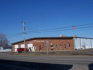
Plainville is a town in Steele Township, Daviess County, Indiana, United States. The population was 476 at the 2010 census. The former high school mascot was the Plainville Midgets.

Perham is a town in Aroostook County, Maine, United States. The population was 371 at the 2020 census. The town was named after Maine's 33rd governor, Sidney Perham.
Alna is a town in Lincoln County, Maine, United States. The population was 710 at the 2020 census. Alna is home to the Wiscasset, Waterville and Farmington Railway Museum and is noted for its historic architecture, including the early mill village of Head Tide.
Sweden is a town in Oxford County, Maine, United States. The population was 406 at the 2020 census. Set among hills, forests and ponds, Sweden includes the village of East Sweden.
Chester is a town in Penobscot County, Maine, United States. The population was 549 at the 2020 census.

Sharptown is a town in Wicomico County, Maryland, United States. The population was 651 at the 2010 census. It is included in the Salisbury, Maryland-Delaware Metropolitan Statistical Area.

Springport is a village in Jackson County of the U.S. state of Michigan. The population was 800 at the 2010 census. The village is located within Springport Township on M-99 about 20 miles (32.2 km) northwest of Jackson. Springport High School is located in the village.

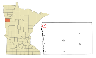
Nashwauk is a town in Itasca County, Minnesota, United States. The population was 970 at the 2020 census.
Shelly is a city in Norman County, Minnesota, United States. The population was 179 at the 2020 census.

Bloomfield is a city in Knox County, Nebraska, United States. The population was 1,028 at the 2010 census.
Fordville is a city in Walsh County, North Dakota, United States. The population was 207 at the 2020 census. Fordville was founded in 1905.

Rockford is a town in Spokane County, Washington, United States. The population was 522 at the 2020 census.

Mabscott is a town in Raleigh County, West Virginia, United States. The population was 1,333 at the 2020 census. The town's name is a contraction of the name Mabel Scott, wife of local coal operator Cyrus H. Scott.
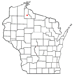
Morse is a town in Ashland County in the U.S. state of Wisconsin. The population was 493 at the 2010 census. The unincorporated communities of Ballou, Cayuga, Foster Junction, and Penokee are located in the town.

York is a town in Clark County in the U.S. state of Wisconsin. The population was 853 at the 2000 census.
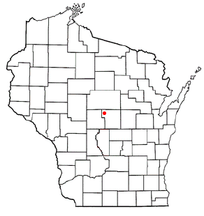
Eau Pleine is a town in Portage County, Wisconsin, United States. The population was 931 at the 2000 census.
Dane is a village in Dane County, Wisconsin, United States. The population was 1,117 at the 2020 census. Located in the Town of Dane, the village is part of the Madison Metropolitan Statistical Area.
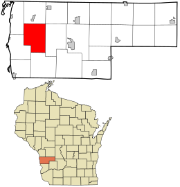
Hammond is a town in St. Croix County, Wisconsin, United States. The population was 947 at the 2000 census. The Village of Hammond is located within the town.