
Enfield is a town in Hartford County, Connecticut, United States, first settled by John and Robert Pease of Salem, Massachusetts Bay Colony. The town is part of the Capitol Planning Region. The population was 42,141 at the 2020 census. It is bordered by Longmeadow, Massachusetts, and East Longmeadow, Massachusetts, to the north, Somers to the east, East Windsor and Ellington to the south, and the Connecticut River to the west.

Hazardville is a section of the town of Enfield, Connecticut, in Hartford County. It is a census-designated place (CDP) that had a total population of 4,599 as of the 2010 census.

The Main Street Historic District encompasses the historic commercial center of Middletown, Connecticut, United States. Middletown was one of the most important ports on the Connecticut River during the colonial period, and Main Street "has been the center of community life since the earliest period of settlement". Today Main Street is home to a number of 19th century buildings, maintaining the bulk of its historic character. It was listed on the National Register of Historic Places in 1983.

The Broad Street Historic District encompasses a well-preserved 19th-century residential area in Middletown, Connecticut, USA. Centered on Broad and Pearl Streets west of Main Street, the area was developed residential in response to local economic development intended to revitalize the city, whose port was in decline. The district includes the city's largest concentration of Greek Revival houses, and was listed on the National Register of Historic Places in 1988.
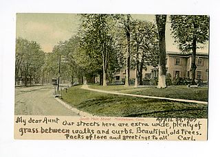
Located in Middletown, Connecticut, the Middletown South Green Historic District was created to preserved the historic character of the city's South Green and the historic buildings that surround it. It is a 90-acre (36 ha) historic district that includes a concentration of predominantly residential high-quality architecture from the late 19th century. It was listed on the National Register of Historic Places in 1975.

The Danielson Main Street Historic District encompasses the historic late 19th-century commercial business district of the borough of Danielson in the town of Killingly, Connecticut. It extends along Main Street, between the Five Mile River and Spring Street, including a few buildings on adjacent side streets, representing the area's growth as a commercial and civic center in the late 19th and early 20th centuries. It was listed on the National Register of Historic Places in 1992.

The Noank Historic District is a historic district encompassing the historic main part of the village of Noank in the town of Groton, Connecticut. The district contains a distinctive assortment of mid-to-late 19th-century residential architecture that is notable for its often picturesque woodwork. At the time of their construction, the village was primarily a worker village for nearby shipyards. The district was listed on the National Register of Historic Places in 1979.
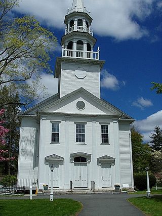
The South Britain Historic District encompasses the core of the unincorporated village of South Britain in Southbury, Connecticut, United States. The village arose in the 18th century as an industrial center serving the surrounding agricultural community, powered by the Pomperaug River, and rivalled the town center of Southbury in importance. The district was listed on the National Register of Historic Places in 1987.

The Tariffville Historic District is a 93 acres (38 ha) historic district in the town of Simsbury, Connecticut. It was listed on the National Register of Historic Places in 1993. It is part of the Tariffville section of Simsbury. The district includes 165 contributing buildings and two contributing sites. It also includes 26 non-contributing buildings and 4 non-contributing sites. There are several houses in the district of Gothic Revival style, probably following designs from pattern books of architect Andrew Jackson Downing. The Trinity Episcopal Church is the only building in the district designed by an architect of national standing, namely Henry C. Dudley. Many of the homes in the area were built by the Tariff Manufacturing Company, which opened a carpet mill along the Farmington River, and needed housing for workers.

The Bean Hill Historic District is a historic district in Norwich, Connecticut that was listed on the National Register of Historic Places in 1982. It consists of a well-preserved collection of buildings focused on the Bean Hill Green, which capture the 19th-century period when Bean Hill was a local center for manufacturing and commercial activity. The district is located in the vicinity of West Town Street between I-395 and Connecticut Avenue, and also extends northeast along Huntington Avenue to include properties further beyond Bean Hill Plain. The district is about 22 acres (8.9 ha) in size, with 23 contributing buildings.

Ohio Street Methodist Episcopal Church Complex, also known as Third Avenue Methodist Church and St. Ann Maronite Catholic Church, is a historic Methodist Episcopal church at 1921 Third Avenue in Watervliet, Albany County, New York. It was originally built about 1850 and modified about 1895. The parish house was built about 1880. Both are brick buildings with wood floor and roof framing and stone foundations.
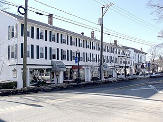
The Greenwood Avenue Historic District encompasses the historic commercial village center of Bethel, Connecticut. Extending along Greenwood Avenue from P.T. Barnum Square to Depot Place, the district includes a variety of commercial and residential architecture from the mid-19th to early 20th centuries. The district was listed on the National Register of Historic Places in 1999.
Augustus George Hazard, known as Colonel Augustus Hazard, was an American gunpowder manufacturer and Hazardville, Connecticut's namesake.
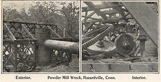
The Hazard Powder Company is a former American manufacturer of gunpowder and explosives. It was located in Hazardville within the town of Enfield, Connecticut.
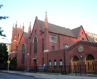
Clinton Hill Historic District is a national historic district in Clinton Hill, Brooklyn, in New York City. It consists of 1,063 largely residential contributing buildings built between the 1840s and 1930 in popular contemporary and revival styles. Buildings include freestanding mansions, row houses, and apartment buildings. The district includes the mansions of Clinton Avenue, built in the 1870s and 1880s. The most prominent of these are linked to Charles Pratt, who built a mansion for himself at 232 Clinton Avenue in 1874, the year his Charles Pratt & Company was acquired by Standard Oil, and one each as wedding presents for three of his four sons. These four mansions can be seen on Clinton Avenue between DeKalb and Willoughby. The rest of the historic district is noted for its prominent Italianate and Beaux-Arts rowhouses. The Clinton Hill South Historic District was listed in 1986.

The Summerfield District is a 56.2-acre (22.7 ha) historic district in Summerfield, Dallas County, Alabama. It is bounded by the Selma-Summerfield and Marion roads, and Centenary and College streets. Federal and Greek Revival are the primary architectural styles in the district. It contains 10 contributing properties and 6 noncontributing properties. The contributing properties are the Summerfield Methodist Church (1845), Summerfield Bank Building, school, Moore-Pinson-Tate-Hudson House (1840s), Sturdivant-Moore-Caine-Hodo House, Johnson-Chisolm-Reed House, unnamed residence, Bishop Andrew-Brady House, Swift-Moore-Cottingham House, and Childers-Tate-Crow House. The Summerfield District was added to the National Register of Historic Places on March 1, 1982.

Rushville Commercial Historic District is a national historic district located at Rushville, Rush County, Indiana. The district encompasses 54 contributing buildings in the central business district of Rushville. The district developed between about 1847 and 1940 and includes notable examples of Greek Revival, Italianate, Romanesque Revival, Classical Revival, Collegiate Gothic, Commercial style, and Art Deco style architecture. Located in the district are the separately listed Durbin Hotel, Melodeon Hall, and Rush County Courthouse. Other notable buildings include the former Methodist Episcopal Church (1847-1850), Church of Christ / Boys' and Girls' Club (1850-1853), Beher-King Block (1883), Presbyterian Church (1892-1893), Rushville National Bank (1911), Phoenix Lodge (1913–1915), Rushville Public Library, and former Castle Theatre (1939).

The River Ledge Historic District is a primarily residential historic district located along Jefferson, Scott, and Lincoln Streets between Franklin and Maple Streets in Grand Ledge, Michigan. It was listed on the National Register of Historic Places in 1987.

The Asbury Historic District is a 288 acres (117 ha) historic district encompassing the community of Asbury in Franklin Township of Warren County, New Jersey. It is bounded by County Route 632, County Route 643, Maple Avenue, Kitchen Road, and School Street and extends along the Musconetcong River into Bethlehem Township of Hunterdon County. It was listed on the National Register of Historic Places on March 19, 1993 for its significance in architecture, industry, religion, community development, politics/government, and commerce. The district includes 141 contributing buildings, a contributing structure, two contributing sites, and four contributing objects.
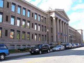
The Golden Hill Historic District encompasses a well-preserved formerly residential area on the northwest fringe of downtown Bridgeport, Connecticut. Located mainly on Lyon Terrace, Gold Hill Street, and Congress Street, the district includes 11 formerly residential buildings now mainly in commercial use, which were built between about 1890 and 1930. It also includes Bridgeport City Hall, and the Golden Hill United Methodist Church. The district was listed on the National Register of Historic Places in 1987.


