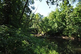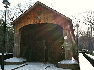
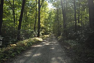
Salmon River State Forest is a Connecticut state forest located in the towns of Hebron, Marlborough, Colchester, East Haddam, and East Hampton. It includes 1,300 acres (530 ha) leased from the United States government. The forest features Comstock's Bridge, the only remaining covered bridge in eastern Connecticut, which spans the Salmon River near Route 16 in East Hampton.

Black Rock State Park is a seasonal public recreation area adjoining Mattatuck State Forest in the town of Watertown, Connecticut. The state park covers 444 acres (180 ha) and is known for its large rock face, Black Rock, that offers views of Thomaston, Watertown, and portions of Waterbury. The park is managed by the Connecticut Department of Energy and Environmental Protection.

Bigelow Hollow State Park is public recreation area in the town of Union, Connecticut, in the Quinebaug Highlands. The state park's 516 acres (209 ha) border Nipmuck State Forest on the east and west and Mashapaug Lake on the north. The park and forest are located in a large hollow or depression approximately 700' below the surrounding ridgelines. They are managed by the Connecticut Department of Energy and Environmental Protection.
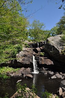
Devil's Hopyard State Park is a public recreation area located at the Eightmile River's Chapman Falls in the town of East Haddam, Connecticut. The 1,000-acre (400 ha) state park includes facilities for hiking, fishing, bicycling, picnicking, and camping. It is managed by the Connecticut Department of Energy and Environmental Protection.

Nipmuck State Forest is a Connecticut state forest. Its 9,000 acres (3,600 ha) surround Bigelow Hollow State Park in the town of Union and include parcels in Stafford, Ashford, and other towns. The forest is part of a larger network of forest lands making up some 40,000 acres (16,000 ha) in all.
Mashamoquet Brook State Park is a public recreation area in the town of Pomfret, Connecticut. Notable features of the state park include the Wolf Den national historic site, the Brayton Grist Mill, and the Table Rock and Indian Chair natural stone formations. The state park offers facilities for camping, swimming, fishing, and picnicking. It is managed by the Connecticut Department of Energy and Environmental Protection.
Bolton Notch State Park is a public recreation area located in the town of Bolton, Connecticut, on the boundary between the Thames River and Connecticut River watersheds. The state park's 95 acres (38 ha) offer opportunities for hiking, climbing, and cave exploration.

Beaver Brook State Park is an undeveloped public recreation area covering 401 acres (162 ha) in the towns of Windham and Chaplin, Connecticut. The state park encompasses Bibbins Pond, also known as Beaver Brook Pond, as well as the acreage northward as far as the Air Line State Park Trail, which forms the park's northern boundary. The park is a walk-in facility, open for hunting and trout fishing, managed by the Connecticut Department of Energy and Environmental Protection.
Windsor Meadows State Park is a public recreation area on the west side of the Connecticut River in the town of Windsor, Connecticut. The state park occupies three largely undeveloped sections measuring 48, 19, and 88 acres located between railroad tracks and the river. Park activities include picnicking, fishing, boating, hiking, and biking.
Sunnybrook State Park is a public recreation area encompassing 464 acres (188 ha) in the town of Torrington, Connecticut. The state park is the southwestern terminus for the blue-blazed John Muir Trail which crosses Paugnut State Forest for two miles to the loop trail at Burr Pond State Park. Another park trail bears the name of former property owner Edwin Fadoir. In addition to hiking, the park offers picnicking, hunting, and fishing along the East Branch Naugatuck River. The park opened in 1970 and entered the state roles in the 1971 edition of the Connecticut Register and Manual.
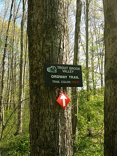
Trout Brook Valley State Park Reserve is a 300-acre (120 ha) parcel owned by the state of Connecticut that is part of the larger Trout Brook Valley Preserve, located in Easton, Connecticut. The full conservation area covers 1,009 acres (408 ha) and comprises several contiguous parcels in the towns of Easton and Weston, bordering the southeast corner of the Saugatuck Reservoir. It is managed by the Aspetuck Land Trust. The state park portion of the preserve offers opportunities for hiking and hunting.

Farm River State Park is a privately operated, publicly owned recreation area on the western shore of the Farm River estuary in the town of East Haven, Connecticut. Public access to the 62-acre state park is limited and boating is restricted to those with passes obtained from Quinnipiac University, which manages the park for the Connecticut Department of Energy and Environmental Protection. Park activities include nature trail hiking, bird watching, and fishing.
Pomeroy State Park is an undeveloped public recreation area covering 200 acres (81 ha) just south of Willimantic in the town of Lebanon, Connecticut. The state park is a forested area used for hiking and hunting with no entrance, markings, or parking that abuts preserved farmland. It is under the management of the Connecticut Department of Energy and Environmental Protection.

Becket Hill State Park Reserve is a public recreation area lying adjacent to Nehantic State Forest in the town of Lyme, Connecticut. The state park is as an undeveloped, walk-in park totaling 260 acres (110 ha) with no officially listed activities. It is managed by the Connecticut Department of Energy and Environmental Protection.
Selden Neck State Park is a 607-acre (246 ha) island and public recreation area on the Connecticut River in the town of Lyme, Connecticut. Accessible only by boat, the state park has four areas for primitive, riverside camping. Hiking, fishing, and hunting are also available. The park was among the first parcels secured for park purposes by the state, with initial land purchases on the island made in 1917. It is managed by Connecticut Department of Energy and Environmental Protection.

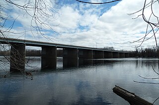
River Highlands State Park is a public recreation area located on the west bank of the Connecticut River in the town of Cromwell, Connecticut. The 177-acre (72 ha) state park is managed by Connecticut Department of Energy and Environmental Protection.

Sunrise State Park is a public recreation area occupying the site of the former Sunrise Resort in the town of East Haddam, Connecticut. The state park encompasses 143 acres (58 ha) on the east shore of Salmon River and shares an entrance with Machimoodus State Park to the south. The park is managed by the Connecticut Department of Energy and Environmental Protection.

Eagle Landing State Park is a public recreation area occupying 16 acres (6.5 ha) on the west bank of the Connecticut River in the town of Haddam, Connecticut. The state park has facilities for picnicking, fishing, and car-top boating. A private concessionnaire offers river excursions from a dock in the park.
Nathan Hale State Forest is a Connecticut state forest encompassing 1,455 acres (589 ha) in the towns of Coventry and Andover. The forest is managed to sustain a reliable source of forest products and renewable habitat for wildlife. The forest originated in 1946 through the bequest of George Dudley Seymour, which allowed the state to purchase 850 acres in the surrounds of the historic Nathan Hale Homestead. In addition to cultivated plantations, the forest includes a 200-acre natural area that is kept without management activity. A 57-acre (23 ha) parcel, Creaser Park, is leased to the Town of Coventry for recreational use. The park offers hiking trails, fishing, and a dog-friendly area. Recreational usage in the rest of the forest includes hiking, hunting and letterboxing.

Nehantic State Forest is a publicly owned forest and recreation area occupying two parcels, one in the town of Lyme and one in the towns of East Lyme and Salem, in the state of Connecticut. The forest, which totals 5,062 acres (2,049 ha), is the site of regular prescribed burns and timber-harvesting operations. Purchase of the land began in 1926, when it became the first state forest located in New London County. It is managed by the Connecticut Department of Energy and Environmental Protection.