| Nehantic Trail | |
|---|---|
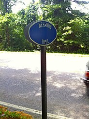
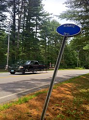
 Nehantic Trail sign at CT State Route 49 Crossing. | |
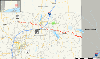
| Length | 13 miles (21 km) [1] |
| Location | Connecticut |
| Designation | CFPA Blue-Blazed Trail |
| Use | Hiking, running, cross-country skiing, snowshoeing |
| Hiking details | |
| Hazards | Hunters, deer ticks, poison ivy |
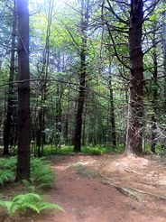
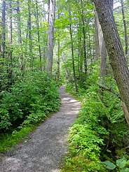
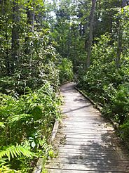
The Nehantic Trail is a 13-mile (21 km) Connecticut hiking trail and is one of the Blue-Blazed hiking trails maintained by the Connecticut Forest and Park Association.

Connecticut is the southernmost state in the New England region of the United States. As of the 2010 Census, it has the highest per-capita income, Human Development Index (0.962), and median household income in the United States. It is bordered by Rhode Island to the east, Massachusetts to the north, New York to the west, and Long Island Sound to the south. Its capital is Hartford and its most populous city is Bridgeport. It is part of New England, although portions of it are often grouped with New York and New Jersey as the Tri-state area. The state is named for the Connecticut River which approximately bisects the state. The word "Connecticut" is derived from various anglicized spellings of an Algonquian word for "long tidal river".

Hiking is the preferred term, in Canada and the United States, for a long, vigorous walk, usually on trails (footpaths), in the countryside, while the word walking is used for shorter, particularly urban walks. On the other hand, in the United Kingdom, and the Republic of Ireland, the word "walking" is acceptable to describe all forms of walking, whether it is a walk in the park or backpacking in the Alps. The word hiking is also often used in the UK, along with rambling, hillwalking, and fell walking. The term bushwalking is endemic to Australia, having been adopted by the Sydney Bush Walkers club in 1927. In New Zealand a long, vigorous walk or hike is called tramping. It is a popular activity with numerous hiking organizations worldwide, and studies suggest that all forms of walking have health benefits.
The Blue-Blazed Hiking Trail system, managed by the Connecticut Forest & Park Association (CFPA), and the related trail systems documented in the two volume 19th Edition of the "Connecticut Walk Book" comprise over 800 miles of hiking trails in Connecticut.
Contents
- Trail description
- Trail route
- Trail communities
- Landscape, geology, and natural environment
- History and folklore
- Origin and name
- Historic sites
- Folklore
- Hiking the trail
- Image gallery
- See also
- References
- Further reading
- External links
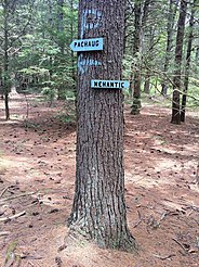
The trail is located in the towns of Voluntown and Griswold and is almost entirely within the Pachaug State Forest.

Voluntown is a town in New London County, Connecticut, United States. The population was 2,603 at the 2010 census. Voluntown was part of Windham County from 1726 to 1881.

Griswold is a town in New London County, Connecticut, United States. The population was 11,951 at the 2010 census. Griswold contains one borough, Jewett City, and also contains the villages of Doaneville, Rixtown, Glasgo, Hopeville, and Pachaug.

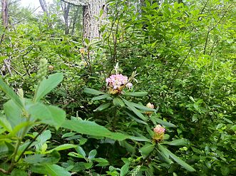
Pachaug State Forest is the largest forest in the Connecticut state forest system, encompassing over 27,000 acres (110 km²) of land. It is located on the Rhode Island border in New London County, and parcels of the forest lie in the towns of Voluntown, Griswold, Plainfield, Sterling, North Stonington, and Preston. The forest was founded in 1928, but most of the land came from purchases made later during the Great Depression. It is named after the Pachaug River, which runs through the center of the forest. The forest is part of the Northeastern coastal forests ecoregion.