Squantz Pond State Park is a public recreation area located 10 miles (16 km) north of Danbury in the town of New Fairfield, Connecticut. The state park encompasses 172 acres (70 ha) on the southwestern shore of 270-acre (110 ha) Squantz Pond, offering opportunities for boating, swimming, fishing, and hiking. The park is bordered on the west by Pootatuck State Forest and is managed by the Connecticut Department of Energy and Environmental Protection.
Mohawk State Forest, also known as Mohawk State Forest/Mohawk Mountain State Park, encompasses over 4,000 acres (1,600 ha) in the towns of Cornwall, Goshen, and Litchfield in the southern Berkshires of Litchfield County, Connecticut. As overseen by the Connecticut Department of Energy and Environmental Protection, the area is used for hiking, picnicking, and winter sports by the public, while being actively managed to produce timber and other forest products.
Pachaug State Forest is the largest forest in the Connecticut state forest system, encompassing over 27,000 acres (110 km²) of land. It is located on the Rhode Island border in New London County, and parcels of the forest lie in the towns of Voluntown, Griswold, Plainfield, Sterling, North Stonington, and Preston. The forest was founded in 1928, but most of the land came from purchases made later during the Great Depression. It is named after the Pachaug River, which runs through the center of the forest. The forest is part of the Northeastern coastal forests ecoregion.

Nipmuck State Forest is a Connecticut state forest. Its 9,000 acres (3,600 ha) surround Bigelow Hollow State Park in the town of Union and include parcels in Stafford, Ashford, and other towns. The forest is part of a larger network of forest lands making up some 40,000 acres (16,000 ha) in all.

Mount Tom State Park is a public recreation area lying south of US Route 202 in the towns of Washington, Litchfield, and Morris, Connecticut. The state park occupies 231 acres (93 ha) on the southwest shore of Mount Tom Pond and is home to the Mount Tom Tower, which was listed on the National Register of Historic Places in 1993. It is managed by the Connecticut Department of Energy and Environmental Protection.
Naugatuck State Forest is a Connecticut state forest consisting of five separate blocks in the towns of Oxford, Beacon Falls, Naugatuck, Bethany, Cheshire, Hamden, Seymour, and Ansonia. The five blocks are the Mount Sanford, East, West, Quillinan Reservoir, and Great Hill (Seymour) blocks.
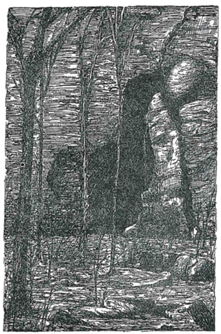
Bolton Notch State Park is a public, protected recreation area located at the junction of U.S. Route 44 and U.S. Route 6 in the town of Bolton, Connecticut. The site forms part of the boundary between the Thames River and Connecticut River watersheds. The state park's 95 acres (38 ha) offer opportunities for hiking, climbing, and cave exploration.

Beaver Brook State Park is an undeveloped public recreation area covering 401 acres (162 ha) in the towns of Windham and Chaplin, Connecticut. The state park encompasses Bibbins Pond, also known as Beaver Brook Pond, as well as the acreage northward as far as the Air Line State Park Trail, which forms the park's northern boundary. The park is a walk-in facility, open for hunting and trout fishing, managed by the Connecticut Department of Energy and Environmental Protection.

Horse Guard State Park is a public recreation area covering 105 acres (42 ha) in the town of Avon, Connecticut. The state park is managed by the Connecticut Department of Energy and Environmental Protection.

Mount Bushnell State Park is an undeveloped public recreation area located south of Lake Waramaug in the New England town of Washington, Connecticut. The state park provides 214 acres (87 ha) for hiking. The park had its genesis in the state's purchase of 70 acres in 1916. It is managed by the Connecticut Department of Energy and Environmental Protection.

Platt Hill State Park is an undeveloped public recreation area occupying 159 acres (64 ha) in the town of Winchester, Connecticut. The state park has hiking trails, picnicking sites, and views of the surrounding area.
George Waldo State Park is an undeveloped public recreation area on the eastern shore of Lake Lillinonah in the town of Southbury, Connecticut. Park activities include hiking, mountain biking, horseback riding, fishing, and hunting. The park's 2.1-mile (3.4 km) loop trail is described as a moderately challenging route. The state park is managed by the Connecticut Department of Energy and Environmental Protection.

Hopemead State Park is an undeveloped public recreation area on the eastern shore of Gardner Lake, 8 miles (13 km) west of Norwich, Connecticut. The state park covers 60 acres (24 ha) in the towns of Bozrah and Montville and is managed by the Connecticut Department of Energy and Environmental Protection.
Pomeroy State Park is an undeveloped public recreation area covering 200 acres (81 ha) just south of Willimantic in the town of Lebanon, Connecticut, managed by the Connecticut Department of Energy and Environmental Protection. The state park is a forested area used for hiking and hunting with no formal entrance, markings, or parking that abuts preserved farmland.

Becket Hill State Park Reserve is a public recreation area lying adjacent to Nehantic State Forest in the town of Lyme, Connecticut. The state park is as an undeveloped, walk-in park totaling 260 acres (110 ha) with no officially listed activities. It is managed by the Connecticut Department of Energy and Environmental Protection.

Brainard Homestead State Park, and alternatively Brainerd Homestead State Park, is a 25-acre (10 ha) undeveloped state park located in the town of East Haddam, Connecticut, United States. A farmhouse was built on the site by Timothy Green in 1842 before being purchased by Selden Tyler Brainerd in March 1854. The ownership of the property was willed to Geraldine W. Hayden. Upon her death in 1929, the property was willed to the State of Connecticut with the condition that William Brainerd be able to use the property for life. William Brainerd died in 1936, the buildings were later dismantled, but the Brainard Homestead State Park was established prior to May 1, 1932. The undeveloped park is said to offer bird watching, sports fields and hiking according to the Connecticut Department of Energy and Environmental Protection. As of 2012, the fields were noted to be farmed and there were no established trails for hiking.

Peoples State Forest is a Connecticut state forest occupying 3,059 acres (1,238 ha) along the West Branch Farmington River opposite American Legion State Forest in the town of Barkhamsted. It is managed for forest products, wildlife habitat, and recreational uses that include hiking, hunting, fishing, and snowmobiling.

Centennial Watershed State Forest is a Connecticut state forest of more than 15,000 acres with larger parcels located in the towns of Easton, Newtown, Redding, and Weston. Dozens of other properties are strung throughout much of Southwestern part of the state. In 2002, the lands were acquired from the Aquarion Water Company by the state in partnership with The Nature Conservancy. Those three entities continue to manage the property by committee. The forest was named in honor of the hundredth anniversary of the state forest system.

Nassahegon State Forest is a Connecticut state forest occupying 1,227 acres (497 ha) in the town of Burlington.The forest is managed for forestry and recreational purposes and is operated by the Connecticut Department of Energy and Environmental Protection.

Nehantic State Forest is a publicly owned forest and recreation area occupying two parcels, one in the town of Lyme and one in the towns of East Lyme and Salem, in the state of Connecticut. The forest, which totals 5,062 acres (2,049 ha), is the site of regular prescribed burns and timber-harvesting operations. Purchase of the land began in 1926, when it became the first state forest located in New London County. It is managed by the Connecticut Department of Energy and Environmental Protection.