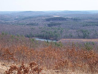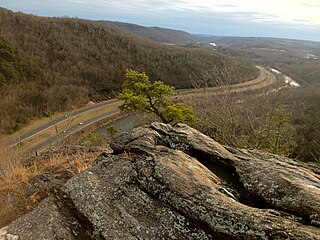
Chatfield Hollow State Park is a public recreation area occupying 412 acres (167 ha) that lie adjacent to Cockaponset State Forest in the town of Killingworth, Connecticut. The state park offers hiking trails, a swimming beach, trout fishing, mountain biking, rock climbing, and picnicking areas. Park attractions include 6.67-acre (2.70 ha) Schreeder Pond, Indian caves, historic sites, a restored water wheel, and a reproduction covered bridge. The park is managed by the Connecticut Department of Energy and Environmental Protection.

Squantz Pond State Park is a public recreation area located 10 miles (16 km) north of Danbury in the town of New Fairfield, Connecticut. The state park encompasses 172 acres (70 ha) on the southwestern shore of 270-acre (110 ha) Squantz Pond, offering opportunities for boating, swimming, fishing, and hiking. The park is bordered on the west by Pootatuck State Forest and is managed by the Connecticut Department of Energy and Environmental Protection.

Mohawk State Forest, also known as Mohawk State Forest/Mohawk Mountain State Park, encompasses over 4,000 acres (1,600 ha) in the towns of Cornwall, Goshen, and Litchfield in the southern Berkshires of Litchfield County, Connecticut. As overseen by the Connecticut Department of Energy and Environmental Protection, the area is used for hiking, picnicking, and winter sports by the public, while being actively managed to produce timber and other forest products.

Wadsworth Falls State Park, or simply Wadsworth Falls, is a public recreation and preserved natural area located on the Coginchaug River in the towns of Middletown and Middlefield, Connecticut. The state park's 285 acres (115 ha) offer trails, fishing, swimming, and picnicking. It is managed by the Connecticut Department of Energy and Environmental Protection.

Silver Sands State Park is a public recreation area located on Long Island Sound in the city of Milford, Connecticut. The state park consists of 297 acres (120 ha) of beach, dunes, restored salt marsh, open areas and woods as well as the 14-acre (5.7 ha) bird sanctuary of Charles Island. The park offers swimming, picnicking, trails, boardwalks, and opportunities for bird-watching. It is managed by the Connecticut Department of Energy and Environmental Protection.

Talcott Mountain State Park is a 574-acre (232 ha) public recreation area located on Talcott Mountain in the towns of Avon, Bloomfield, and Simsbury, Connecticut. The state park features the Heublein Tower, a 165-foot-high (50 m) mountaintop lookout. Access to the tower and its associated museum is via a 1.25-mile-long (2 km) trail that takes 30 to 40 minutes to walk. The park offers picnicking, views of the surrounding area, and hiking along the Metacomet Trail.

Seth Low Pierrepont State Park Reserve is a public recreation area covering 305 acres (123 ha) in the town of Ridgefield, Connecticut. The state park offers opportunities for hiking, fishing, and boating.

Naugatuck State Forest is a Connecticut state forest consisting of five separate blocks in the towns of Oxford, Beacon Falls, Naugatuck, Bethany, Cheshire, Hamden, Seymour, and Ansonia. The five blocks are the Mount Sanford, East, West, Quillinan Reservoir, and Great Hill (Seymour) blocks.

Ross Pond State Park is a public recreation area covering 314 acres (127 ha) in the town of Killingly, Connecticut. The state park offers hiking, hunting, fishing, and a boat launch. It sits adjacent to Old Furnace State Park and a blue-blazed trail connects the two. Ross Pond State Park entered the Connecticut Register and Manual in 1964 as a state park of 181 acres (73 ha).

Sunnybrook State Park is a public recreation area encompassing 464 acres (188 ha) in the town of Torrington, Connecticut. The state park is the southwestern terminus for the blue-blazed John Muir Trail which crosses Paugnut State Forest for two miles to the loop trail at Burr Pond State Park. Another park trail bears the name of former property owner Edwin Fadoir. In addition to hiking, the park offers picnicking, hunting, and fishing along the East Branch Naugatuck River. The park opened in 1970 and entered the state roles in the 1971 edition of the Connecticut Register and Manual.

Rocky Glen State Park is an undeveloped public recreation area covering 46 acres (19 ha) along the west side of the Pootatuck River in the town of Newtown, Connecticut. The state park offers opportunities for hiking to a scenic cascade and includes a one-and-a-half mile stretch of Al's Trail, a 10.7-mile (17.2 km) greenway trail that winds through Newtown. It appeared as the state's forty-seventh state park in the 1943 edition of the Connecticut Register and Manual. The park is managed by the Connecticut Department of Energy and Environmental Protection.

Bennett's Pond State Park is a public recreation area located in the town of Ridgefield, Connecticut. The state park occupies a portion of the estate once owned by industrialist Louis D. Conley. The park features the 56-acre pond for which it is named and many miles of hiking trails in a pristine woodland environment. It is contiguous with Wooster Mountain State Park and is crossed by the Ives Trail. In addition to hiking, the park offers fishing, biking, and seasonal bow hunting. It is managed by the Connecticut Department of Energy and Environmental Protection.

Farm River State Park is a privately operated, publicly owned recreation area on the western shore of the Farm River estuary in the town of East Haven, Connecticut. Public access to the 62-acre state park is limited and boating is restricted to those with passes obtained from Quinnipiac University, which manages the park for the Connecticut Department of Energy and Environmental Protection. Park activities include nature trail hiking, bird watching, and fishing.

Day Pond State Park is a public recreation area covering 180 acres (73 ha) in the town of Colchester, Connecticut. The state park abuts Salmon River State Forest and is managed by the Connecticut Department of Energy and Environmental Protection. The park offers opportunities for hiking, swimming, shoreline fishing, picnicking and mountain biking.

Hopeville Pond State Park is a public recreation area located on Hopeville Pond, an impoundment of the Pachaug River, in the town of Griswold, Connecticut. A portion of the 554-acre (224 ha) state park occupies the site of the lost village of Hopeville. The park manager's house occupies Avery House, which is listed on the National Register of Historic Places. The park offers fishing, swimming, camping, and trails for hiking and biking. It is managed by the Connecticut Department of Energy and Environmental Protection.

Pomeroy State Park is an undeveloped public recreation area covering 200 acres (81 ha) just south of Willimantic in the town of Lebanon, Connecticut. The state park is a forested area used for hiking and hunting with no entrance, markings, or parking that abuts preserved farmland. It is under the management of the Connecticut Department of Energy and Environmental Protection.

James L. Goodwin State Forest is a Connecticut state forest covering approximately 2,000 acres (810 ha) in the towns of Chaplin and Hampton. The lands became public property when James L. Goodwin donated the personal forest he had been developing since 1913 to the state in 1964.

Housatonic State Forest is a Connecticut state forest occupying 10,894 acres (4,409 ha) in the towns of Sharon, Canaan, Cornwall, and North Canaan. The state forest includes two Connecticut natural area preserves, Gold’s Pines and Canaan Mountain, and is the only Connecticut state forest that includes a portion of the Appalachian Trail. The forest is open for hiking, hunting, mountain biking, and snowmobiling.

Nassahegon State Forest is a Connecticut state forest occupying 1,227 acres (497 ha) in the town of Burlington.The forest is managed for forestry and recreational purposes and is operated by the Connecticut Department of Energy and Environmental Protection.

Nehantic State Forest is a publicly owned forest and recreation area occupying two parcels, one in the town of Lyme and one in the towns of East Lyme and Salem, in the state of Connecticut. The forest, which totals 5,062 acres (2,049 ha), is the site of regular prescribed burns and timber-harvesting operations. Purchase of the land began in 1926, when it became the first state forest located in New London County. It is managed by the Connecticut Department of Energy and Environmental Protection.


