Hurd State Park | |
---|---|
Location | East Hampton, Connecticut, United States |
Coordinates | 41°31′26″N72°32′51″W / 41.52389°N 72.54750°W [1] |
Area | 991 acres (401 ha) [2] |
Elevation | 177 ft (54 m) [1] |
Established | 1914 |
Administered by | Connecticut Department of Energy and Environmental Protection |
Designation | Connecticut state park |
Website | Official website |
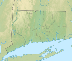
Hurd State Park is a public recreation area lying adjacent to George Dudley Seymour State Park on the east bank of the Connecticut River in the town of East Hampton, Connecticut. [3] In addition to offering hiking, picnicking, and mountain biking, it is one of four Connecticut state parks that offer primitive camping for boaters on the Connecticut River. [4]
The park is named for the Hurd family, who came to the region from Massachusetts in 1710. The state purchased the park's first 150 acres in 1914. [5] Shortly after its acquisition, the park became the focus of legal action to determine the ownership of mining privileges when Jesse S. Miller claimed rights to the feldspar on the property; the state ultimately prevailed in the Connecticut State Supreme Court in 1935. [6]
Putnam Memorial State Park is a history-oriented public recreation area in the town of Redding, Connecticut. The state park preserves the site that Major General Israel Putnam chose as the winter encampment for his men in the winter of 1778/1779 during the American Revolutionary War. It is Connecticut's oldest state park, created in 1887 at the instigation of Redding town residents. The park was listed on the National Register of Historic Places in 1970.
Kent Falls State Park is a public recreation area located in the town of Kent, Connecticut, within the Litchfield Hills region of the southern Berkshires. The state park is home to Kent Falls, a series of waterfalls on Falls Brook, a tributary of the Housatonic River. The falls drop 250 feet (76 m) in under a quarter mile. The largest cascade drops more than 70 feet (21 m) into a reflecting pool, before traveling over the lesser falls.
Millers Pond State Park is a public recreation area lying adjacent to Cockaponset State Forest in the towns of Durham and Haddam, Connecticut. The park's central feature is 33-acre (13 ha) Millers Pond, whose principal source of water is large springs that create a body of unpolluted water excellent for trout and smallmouth bass. The park offers fishing, hiking, mountain biking, and hunting.
Salmon River State Forest is a Connecticut state forest located in the towns of Hebron, Marlborough, Colchester, East Haddam, and East Hampton. It includes 1,300 acres (530 ha) leased from the United States government. The forest features Comstock's Bridge, the only remaining covered bridge in eastern Connecticut, which spans the Salmon River near Route 16 in East Hampton.
Bigelow Hollow State Park is public recreation area in the town of Union, Connecticut, in the Quinebaug Highlands. The state park's 516 acres (209 ha) border Nipmuck State Forest on the east and west and Mashapaug Lake on the north. The park and forest are located in a large hollow or depression approximately 700' below the surrounding ridgelines. They are managed by the Connecticut Department of Energy and Environmental Protection.
Indian Well State Park is a public recreation area occupying 153 acres (62 ha) on the west bank of Lake Housatonic, an impoundment of the Housatonic River, within the city limits of Shelton, Connecticut. The state park's scenic features include a 15-foot (4.6 m) horsetail waterfalls with splash pool at bottom. The park is managed by the Connecticut Department of Energy and Environmental Protection.
Devil's Hopyard State Park is a public recreation area located at the Eightmile River's Chapman Falls in the town of East Haddam, Connecticut. The 1,000-acre (400 ha) state park includes facilities for hiking, fishing, bicycling, picnicking, and camping. It is managed by the Connecticut Department of Energy and Environmental Protection.
Shenipsit State Forest is a state forest located in northeastern Connecticut with 11 parcels scattered between the towns of Somers, Ellington, and Stafford. The forest's headquarters is home to the Civilian Conservation Corps Museum, which houses memorabilia from CCC camps throughout the eastern United States. The forest is managed for forestry products and offers various recreational pursuits.
Osbornedale State Park is a public recreation area occupying 417 acres (169 ha) on the east bank of the Housatonic River primarily in the town of Derby, Connecticut, with a small portion in Ansonia. The state park includes the historic Osborne Homestead, the Kellogg Environmental Center, and an extensive system of hiking trails. The park is managed by the Connecticut Department of Energy and Environmental Protection.
Lovers Leap State Park is a public recreation area on the Housatonic River in the town of New Milford, Litchfield County, Connecticut. The state park's 160 acres (65 ha) straddle the Housatonic Gorge near the intersection of Connecticut Route 67 and Connecticut Route 202. The park offers hiking to scenic and historic locations and is managed by the Connecticut Department of Energy and Environmental Protection.
Beaver Brook State Park is an undeveloped public recreation area covering 401 acres (162 ha) in the towns of Windham and Chaplin, Connecticut. The state park encompasses Bibbins Pond, also known as Beaver Brook Pond, as well as the acreage northward as far as the Air Line State Park Trail, which forms the park's northern boundary. The park is a walk-in facility, open for hunting and trout fishing, managed by the Connecticut Department of Energy and Environmental Protection.
Housatonic Meadows State Park is a public recreation area covering 452 acres (183 ha) along the Housatonic River in the towns of Sharon and Cornwall, Connecticut. The state park offers opportunities for camping, hiking, picnicking, canoeing, and fly-fishing. It is crossed by the Appalachian Trail and is managed by the Connecticut Department of Energy and Environmental Protection.
Macedonia Brook State Park is a public recreation area covering 2,302 acres (932 ha) in the town of Kent, Connecticut, United States. Visitors can camp in a 51-site campground, picnic, fish, and hike the blue-blazed Macedonia Ridge Trail, which crosses Cobble Mountain and other peaks. The park's first 1,552 acres (628 ha) were a gift made in 1918 by the White Memorial Foundation.
Sunnybrook State Park is a public recreation area encompassing 464 acres (188 ha) in the town of Torrington, Connecticut. The state park is the southwestern terminus for the blue-blazed John Muir Trail which crosses Paugnut State Forest for two miles to the loop trail at Burr Pond State Park. Another park trail bears the name of former property owner Edwin Fadoir. In addition to hiking, the park offers picnicking, hunting, and fishing along the East Branch Naugatuck River. The park opened in 1970 and entered the state rolls in the 1971 edition of the Connecticut Register and Manual.
Day Pond State Park is a public recreation area covering 180 acres (73 ha) in the town of Colchester, Connecticut. The state park abuts Salmon River State Forest and is managed by the Connecticut Department of Energy and Environmental Protection. The park offers opportunities for hiking, swimming, shoreline fishing, picnicking and mountain biking.
Becket Hill State Park Reserve is a public recreation area lying adjacent to Nehantic State Forest in the town of Lyme, Connecticut. The state park is as an undeveloped, walk-in park totaling 260 acres (110 ha) with no officially listed activities. It is managed by the Connecticut Department of Energy and Environmental Protection.
George Dudley Seymour State Park is a public recreation area occupying 222 acres (90 ha) on the east bank of the Connecticut River in the town of Haddam, Connecticut. Hurd State Park abuts the park to the north. The park bears the name of George Dudley Seymour (1859-1945), whose philanthropic efforts enabled the state to purchase land for this and several other Connecticut state parks. It is managed by the Connecticut Department of Energy and Environmental Protection.
Haddam Meadows State Park is a public recreation area occupying 175 acres (71 ha) on the west bank of the Connecticut River in the town of Haddam, Connecticut. The state park offers picnicking, fishing, and a boat launch. Park trails lend access to a diversity of riverside landscapes: marsh, beach, sand bar, fern growths, meadow lands, and hardwood forest. The park was established through the donation of land in 1944 by the Edward W. Hazen Foundation. It is managed by the Connecticut Department of Energy and Environmental Protection.
American Legion State Forest is a Connecticut state forest that sits on the West Branch Farmington River opposite Peoples State Forest in the town of Barkhamsted.
Nepaug State Forest is a Connecticut state forest located primarily in the town of New Hartford.