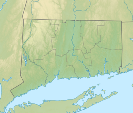
Squantz Pond State Park is a public recreation area located 10 miles (16 km) north of Danbury in the town of New Fairfield, Connecticut. The state park encompasses 172 acres (70 ha) on the southwestern shore of 270-acre (110 ha) Squantz Pond, offering opportunities for boating, swimming, fishing, and hiking. The park is bordered on the west by Pootatuck State Forest and is managed by the Connecticut Department of Energy and Environmental Protection.
Mohawk State Forest, also known as Mohawk State Forest/Mohawk Mountain State Park, encompasses over 4,000 acres (1,600 ha) in the towns of Cornwall, Goshen, and Litchfield in the southern Berkshires of Litchfield County, Connecticut. As overseen by the Connecticut Department of Energy and Environmental Protection, the area is used for hiking, picnicking, and winter sports by the public, while being actively managed to produce timber and other forest products.

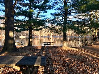
Lake Waramaug State Park is a 95-acre (38 ha) public recreation area located on the northwest shore of Lake Waramaug in the town of Kent, Litchfield County, Connecticut. The state park's first 75 acres (30 ha) were purchased by the state in 1920. The park offers swimming, fishing, picnicking, camping, and a launch for car-top boating and canoeing.
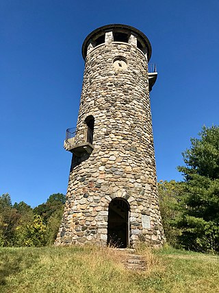
Talcott Mountain State Park is a 574-acre (232 ha) public recreation area located on Talcott Mountain in the towns of Avon, Bloomfield, and Simsbury, Connecticut. The state park features the Heublein Tower, a 165-foot-high (50 m) mountaintop lookout. Access to the tower and its associated museum is via a 1.25-mile-long (2 km) trail that takes 30 to 40 minutes to walk. The park offers picnicking, views of the surrounding area, and hiking along the Metacomet Trail.

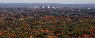
Black Rock State Park is a seasonal public recreation area adjoining Mattatuck State Forest in the town of Watertown, Connecticut. The state park covers 444 acres (180 ha) and is known for its large rock face, Black Rock, that offers views of Thomaston, Watertown, and portions of Waterbury. The park is managed by the Connecticut Department of Energy and Environmental Protection.

Trimountain or Tri-mountain, est. 760 feet (230 m), is a traprock mountain located 6 miles (10 km) southeast of Meriden, Connecticut. It is part of the narrow, linear Metacomet Ridge that extends from Long Island Sound near New Haven, Connecticut, north through the Connecticut River Valley of Massachusetts to the Vermont border. Trimountain is known for its scenic cliff faces, unique microclimate ecosystems, and rare plant communities. The mountain is traversed by the 51-mile (82 km) Mattabesett Trail.

Fowler Mountain, est. 750 feet (230 m), is a traprock mountain located 7 miles (11 km) southeast of the center of Meriden, Connecticut. It is part of the narrow, linear Metacomet Ridge that extends from Long Island Sound near New Haven, Connecticut, north through the Connecticut River Valley of Massachusetts to the Vermont border. Fowler Mountain is known for its rugged topography, unique microclimate ecosystems, and rare plant communities. It rises steeply 300 feet (91 m) above the Ulbrich Reservoir and the Quinnipiac River valley to the west. The mountain is traversed by the 50-mile (80 km) Mattabesett Trail.
Wharton Brook State Park is a public recreation area located off U.S. Route 5 in the towns of North Haven and Wallingford, Connecticut. Activities in the 96-acre (39 ha) state park center on Allen Brook Pond, a 5-acre (2.0 ha) pond that empties into Wharton Brook. The park is managed by the Connecticut Department of Energy and Environmental Protection.

Penwood State Park is a public recreation area located on Talcott Mountain in the town of Bloomfield, Connecticut. The state park's 787 acres (318 ha) are contiguous with the north end of Talcott Mountain State Park. Both parks are managed by the Connecticut Department of Energy and Environmental Protection.

Shenipsit State Forest is a state forest located in northeastern Connecticut with 11 parcels scattered between the towns of Somers, Ellington, and Stafford. The forest's headquarters is home to the Civilian Conservation Corps Museum, which houses memorabilia from CCC camps throughout the eastern United States. The forest is managed for forestry products and offers various recreational pursuits.

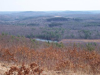
Nipmuck State Forest is a Connecticut state forest. Its 9,000 acres (3,600 ha) surround Bigelow Hollow State Park in the town of Union and include parcels in Stafford, Ashford, and other towns. The forest is part of a larger network of forest lands making up some 40,000 acres (16,000 ha) in all.
Mashamoquet Brook State Park is a public recreation area in the town of Pomfret, Connecticut. Notable features of the state park include the Wolf Den national historic site, the Brayton Grist Mill, and the Table Rock and Indian Chair natural stone formations. The state park offers facilities for camping, swimming, fishing, and picnicking. It is managed by the Connecticut Department of Energy and Environmental Protection.
Camp Columbia State Park/State Forest is a public recreation area and state forest located in the town of Morris in Litchfield County, Connecticut. The 600-acre (240 ha) site was once the rural campus of Columbia University's Engineering Department. The majority of the property has been designated as a state forest; the acreage designated as a state historic park includes the frontage on Bantam Lake and the site of the former university buildings. It is managed by the Connecticut Department of Energy and Environmental Protection.

Wooster Mountain State Park is an undeveloped public recreation area located within the city limits of Danbury, Connecticut. The state park covers 444 acres (180 ha) and is managed by the Connecticut Department of Energy and Environmental Protection.
Pomeroy State Park is an undeveloped public recreation area covering 200 acres (81 ha) just south of Willimantic in the town of Lebanon, Connecticut, managed by the Connecticut Department of Energy and Environmental Protection. The state park is a forested area used for hiking and hunting with no formal entrance, markings, or parking that abuts preserved farmland.

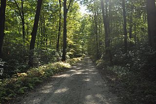
Housatonic State Forest is a Connecticut state forest occupying 10,894 acres (4,409 ha) in the towns of Sharon, Canaan, Cornwall, and North Canaan. The state forest includes two Connecticut natural area preserves, Gold’s Pines and Canaan Mountain, and is the only Connecticut state forest that includes a portion of the Appalachian Trail. The forest is open for hiking, hunting, mountain biking, and snowmobiling.

Nassahegon State Forest is a Connecticut state forest occupying 1,227 acres (497 ha) in the town of Burlington.The forest is managed for forestry and recreational purposes and is operated by the Connecticut Department of Energy and Environmental Protection.

Nehantic State Forest is a publicly owned forest and recreation area occupying two parcels, one in the town of Lyme and one in the towns of East Lyme and Salem, in the state of Connecticut. The forest, which totals 5,062 acres (2,049 ha), is the site of regular prescribed burns and timber-harvesting operations. Purchase of the land began in 1926, when it became the first state forest located in New London County. It is managed by the Connecticut Department of Energy and Environmental Protection.

Tunxis State Forest is a state forest located in the towns of Hartland, Barkhamsted, and Granby in Connecticut, United States. The forest surrounds Barkhamsted Reservoir and borders the Granville State Forest in Massachusetts. The forest is used for hiking, mountain biking, cross-country skiing, fishing, hunting, and letterboxing. Several trails cross the forest, including the northern end of the blue-blazed Tunxis Trail.

Farm River is a south-flowing river located entirely within the U.S. state of Connecticut. Because it begins as freshwater in its northern reaches and flows into tidal salt water at Long Island Sound, Farm River is by definition an estuary. The river is 16.5 miles (26.6 km) long.