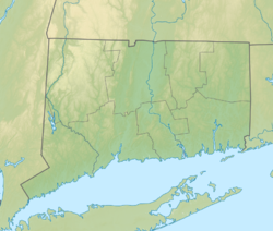
East Haddam is a town in Middlesex County, Connecticut, United States. The town is part of the Lower Connecticut River Valley Planning Region. The population was 8,875 at the time of the 2020 census.

Moodus is a village in the town of East Haddam, Connecticut, United States. The village is the basis of a census-designated place (CDP) of the same name. The population of the CDP was 1,982 as of the census of 2020.
Salmon River State Forest is a Connecticut state forest located in the towns of Hebron, Marlborough, Colchester, East Haddam, and East Hampton. It includes 1,300 acres (530 ha) leased from the United States government. The forest features Comstock's Bridge, the only remaining covered bridge in eastern Connecticut, which spans the Salmon River near Route 16 in East Hampton.

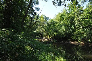
The Salmon River is formed at the confluence of the Blackledge and Jeremy rivers about one mile west of North Westchester, Connecticut. It drains 96,000 acres and courses for 10.4 miles (16.7 km) to Salmon Cove near Moodus where it flows into the Connecticut River. The Salmon River is probably the largest stream and watershed whose sources and mouth are entirely within the limits of Connecticut.

Route 151 is a Connecticut state highway in the Connecticut River valley running from East Haddam via Moodus to the village of Cobalt in East Hampton.

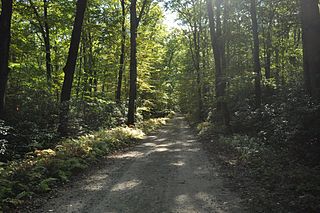
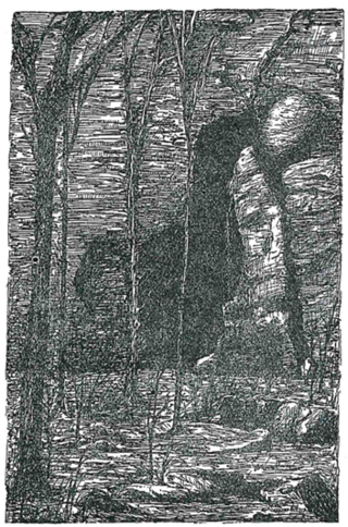
Devil's Hopyard State Park is a public recreation area located at the Eightmile River's Chapman Falls in the town of East Haddam, Connecticut. The 1,000-acre (400 ha) state park includes facilities for hiking, fishing, bicycling, picnicking, and camping. It is managed by the Connecticut Department of Energy and Environmental Protection.
Mashamoquet Brook State Park is a public recreation area in the town of Pomfret, Connecticut. Notable features of the state park include the Wolf Den national historic site, the Brayton Grist Mill, and the Table Rock and Indian Chair natural stone formations. The state park offers facilities for camping, swimming, fishing, and picnicking. It is managed by the Connecticut Department of Energy and Environmental Protection.
Scantic River State Park is a public recreation area consisting of several separated parcels totaling 784 acres (317 ha) along the Scantic River in the towns of Enfield, East Windsor, and Somers, Connecticut. The state park is suitable for hiking, fishing, and hunting and is managed by the Connecticut Department of Energy and Environmental Protection.
Bolton Notch State Park is a public, protected recreation area located at the junction of U.S. Route 44 and U.S. Route 6 in the town of Bolton, Connecticut. The site forms part of the boundary between the Thames River and Connecticut River watersheds. The state park's 95 acres (38 ha) offer opportunities for hiking, climbing, and cave exploration.

Horse Guard State Park is a public recreation area covering 105 acres (42 ha) in the town of Avon, Connecticut. The state park is managed by the Connecticut Department of Energy and Environmental Protection.

Above All State Park is an undeveloped public recreation area located in the town of Warren, Connecticut. Remnants of a Cold War-era military radar installation may be seen. The only park amenities are informal trails not maintained by the Connecticut Department of Energy and Environmental Protection.

Mount Bushnell State Park is an undeveloped public recreation area located south of Lake Waramaug in the New England town of Washington, Connecticut. The state park provides 214 acres (87 ha) for hiking. The park had its genesis in the state's purchase of 70 acres in 1916. It is managed by the Connecticut Department of Energy and Environmental Protection.

Sunnybrook State Park is a public recreation area encompassing 464 acres (188 ha) in the town of Torrington, Connecticut. The state park is the southwestern terminus for the blue-blazed John Muir Trail which crosses Paugnut State Forest for two miles to the loop trail at Burr Pond State Park. Another park trail bears the name of former property owner Edwin Fadoir. In addition to hiking, the park offers picnicking, hunting, and fishing along the East Branch Naugatuck River. The park opened in 1970 and entered the state rolls in the 1971 edition of the Connecticut Register and Manual.

Farm River State Park is a privately operated, publicly owned recreation area on the western shore of the Farm River estuary in the town of East Haven, Connecticut. Public access to the 62-acre state park is limited and boating is restricted to those with passes obtained from Quinnipiac University, which manages the park for the Connecticut Department of Energy and Environmental Protection. Park activities include nature trail hiking, bird watching, and fishing.

River Highlands State Park is a public recreation area located on the west bank of the Connecticut River in the town of Cromwell, Connecticut. The 177-acre (72 ha) state park is managed by Connecticut Department of Energy and Environmental Protection.

Brainard Homestead State Park, and alternatively Brainerd Homestead State Park, is a 25-acre (10 ha) undeveloped state park located in the town of East Haddam, Connecticut, United States. A farmhouse was built on the site by Timothy Green in 1842 before being purchased by Selden Tyler Brainerd in March 1854. The ownership of the property was willed to Geraldine W. Hayden. Upon her death in 1929, the property was willed to the State of Connecticut with the condition that William Brainerd be able to use the property for life. William Brainerd died in 1936, the buildings were later dismantled, but the Brainard Homestead State Park was established prior to May 1, 1932. The undeveloped park is said to offer bird watching, sports fields and hiking according to the Connecticut Department of Energy and Environmental Protection. As of 2012, the fields were noted to be farmed and there were no established trails for hiking.

Sunrise State Park is a public recreation area occupying the site of the former Sunrise Resort in the town of East Haddam, Connecticut. The state park encompasses 143 acres (58 ha) on the east shore of Salmon River and shares an entrance with Machimoodus State Park to the south. The park is managed by the Connecticut Department of Energy and Environmental Protection.

Hurd State Park is a public recreation area lying adjacent to George Dudley Seymour State Park on the east bank of the Connecticut River in the town of East Hampton, Connecticut. In addition to offering hiking, picnicking, and mountain biking, it is one of four Connecticut state parks that offer primitive camping for boaters on the Connecticut River.

Eagle Landing State Park is a public recreation area occupying 16 acres (6.5 ha) on the west bank of the Connecticut River in the town of Haddam, Connecticut. The state park has facilities for picnicking, fishing, bird watching and car-top boating. A private concessionnaire offers river excursions from a dock in the park.

Haddam Meadows State Park is a public recreation area occupying 175 acres (71 ha) on the west bank of the Connecticut River in the town of Haddam, Connecticut. The state park offers picnicking, fishing, and a boat launch. Park trails lend access to a diversity of riverside landscapes: marsh, beach, sand bar, fern growths, meadow lands, and hardwood forest. The park was established through the donation of land in 1944 by the Edward W. Hazen Foundation. It is managed by the Connecticut Department of Energy and Environmental Protection.