Stratton Brook State Park

Last updated
Stratton Brook State Park
Massacoe Forest Pavilion.JPG
Pavilion built by the CCC
Relief map USA Connecticut.png
Red pog.svg
Location in Connecticut
Location Simsbury, Connecticut, United States
Coordinates 41°51′49″N72°50′07″W / 41.86361°N 72.83528°W / 41.86361; -72.83528 Coordinates: 41°51′49″N72°50′07″W / 41.86361°N 72.83528°W / 41.86361; -72.83528 [1]
Area145 acres (59 ha) [2]
Elevation236 ft (72 m) [1]
Designation Connecticut state park
Established1949 [3]
Administrator Connecticut Department of Energy and Environmental Protection
Website Stratton Brook State Park

Stratton Brook State Park
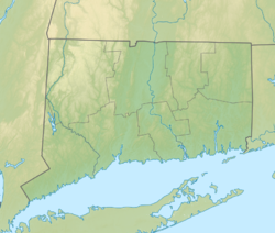
 is a public recreation area located in the town of Simsbury, Connecticut. Among its notable features is the Massaco Forest Pavilion, built by the Civilian Conservation Corps in 1935. The state park offers picnicking, fishing, swimming, hiking, biking, cross-country skiing, and ice fishing [3] as well as a seasonal nature center. [4]

Related Research Articles

Chatfield Hollow State Park

Chatfield Hollow State Park is a public recreation area occupying 412 acres (167 ha) that lie adjacent to Cockaponset State Forest in the town of Killingworth, Connecticut. The state park offers hiking trails, a swimming beach, trout fishing, mountain biking, rock climbing, and picnicking areas. Park attractions include 6.67-acre (2.70 ha) Schreeder Pond, Indian caves, historic sites, a restored water wheel, and a reproduction covered bridge. The park is managed by the Connecticut Department of Energy and Environmental Protection.

Squantz Pond State Park

Squantz Pond State Park is a public recreation area located 10 miles (16 km) north of Danbury in the town of New Fairfield, Connecticut. The state park encompasses 172 acres (70 ha) on the southwestern shore of 270-acre (110 ha) Squantz Pond, offering opportunities for boating, swimming, fishing, and hiking. The park is bordered on the west by Pootatuck State Forest and is managed by the Connecticut Department of Energy and Environmental Protection.

Wadsworth Falls State Park

Wadsworth Falls State Park, or simply Wadsworth Falls, is a public recreation and preserved natural area located on the Coginchaug River in the towns of Middletown and Middlefield, Connecticut. The state park's 285 acres (115 ha) offer trail hiking and fishing. Swimming, picnicking, and alcohol are no longer allowed. It is managed by the Connecticut Department of Energy and Environmental Protection.

Millers Pond State Park

Millers Pond State Park is a public recreation area lying adjacent to Cockaponset State Forest in the towns of Durham and Haddam, Connecticut. The park's central feature is 33-acre (13 ha) Millers Pond, whose principal source of water is large springs that create a body of unpolluted water excellent for trout and smallmouth bass. The park offers fishing, hiking, mountain biking, and hunting.

Bigelow Hollow State Park

Bigelow Hollow State Park is public recreation area in the town of Union, Connecticut, in the Quinebaug Highlands. The state park's 516 acres (209 ha) border Nipmuck State Forest on the east and west and Mashapaug Lake on the north. The park and forest are located in a large hollow or depression approximately 700' below the surrounding ridgelines. They are managed by the Connecticut Department of Energy and Environmental Protection.

Hammonasset Beach State Park

Hammonasset Beach State Park is a public recreation area occupying two miles of beach front on Long Island Sound in the town of Madison, Connecticut. It is the state's largest shoreline park and one of the most popular attractions in the state, drawing an estimated one million visitors annually. The state park offers beach activities, large campground, and nature center. It is managed by the Connecticut Department of Energy and Environmental Protection.

Wharton Brook State Park

Wharton Brook State Park is a public recreation area located off U.S. Route 5 in the towns of North Haven and Wallingford, Connecticut. Activities in the 96-acre (39 ha) state park center on Allen Brook Pond, a 5-acre (2.0 ha) pond that empties into Wharton Brook. The park is managed by the Connecticut Department of Energy and Environmental Protection.

Southford Falls State Park

Southford Falls State Park is a public recreation area covering 126 acres (51 ha) in the towns of Oxford and Southbury, Connecticut. The state park offers fishing, hiking, waterfalls, and a covered bridge over Eight Mile Brook. It is managed by the Connecticut Department of Energy and Environmental Protection.

Mashamoquet Brook State Park

Mashamoquet Brook State Park is a public recreation area in the town of Pomfret, Connecticut. Notable features of the state park include the Wolf Den national historic site, the Brayton Grist Mill, and the Table Rock and Indian Chair natural stone formations. The state park offers facilities for camping, swimming, fishing, and picnicking. It is managed by the Connecticut Department of Energy and Environmental Protection.

Beaver Brook State Park

Beaver Brook State Park is an undeveloped public recreation area covering 401 acres (162 ha) in the towns of Windham and Chaplin, Connecticut. The state park encompasses Bibbins Pond, also known as Beaver Brook Pond, as well as the acreage northward as far as the Air Line State Park Trail, which forms the park's northern boundary. The park is a walk-in facility, open for hunting and trout fishing, managed by the Connecticut Department of Energy and Environmental Protection.

Quinebaug Lake State Park

Quinebaug Lake State Park is a public recreation area covering 181 acres (73 ha) in the town of Killingly, Connecticut. The state park offers opportunities for fishing and non-motorized boating on Wauregan Reservoir. The park is managed by the Connecticut Department of Energy and Environmental Protection.

Quaddick State Park

Quaddick State Park is a public recreation area located on 203-acre (82 ha) Middle Quaddick Reservoir in the town of Thompson, Connecticut. The state park is managed by the Connecticut Department of Energy and Environmental Protection and offers opportunities for boating, swimming, fishing, and picnicking.

John A. Minetto State Park

John A. Minetto State Park is a public recreation area encompassing 715 acres (289 ha) in the towns of Goshen and Torrington, Connecticut. Facilities are available for picnicking, fishing, and cross-country skiing. The state park is managed by the Connecticut Department of Energy and Environmental Protection.

Farm River State Park

Farm River State Park is a privately operated, publicly owned recreation area on the western shore of the Farm River estuary in the town of East Haven, Connecticut. Public access to the 62-acre state park is limited and boating is restricted to those with passes obtained from Quinnipiac University, which manages the park for the Connecticut Department of Energy and Environmental Protection. Park activities include nature trail hiking, bird watching, and fishing.

Kettletown State Park

Kettletown State Park is a public recreation area on the eastern shore of the Housatonic River's Lake Zoar in the towns of Oxford and Southbury, Connecticut. Park activities include swimming, camping, hiking, picnicking, and fishing. The state park is managed by the Connecticut Department of Energy and Environmental Protection.

Day Pond State Park

Day Pond State Park is a public recreation area covering 180 acres (73 ha) in the town of Colchester, Connecticut. The state park abuts Salmon River State Forest and is managed by the Connecticut Department of Energy and Environmental Protection. The park offers opportunities for hiking, swimming, shoreline fishing, picnicking and mountain biking.

Bluff Point State Park

Bluff Point State Park is a public recreation area and nature preserve on an undeveloped peninsula located between the Poquonnock River and Mumford Cove on Long Island Sound in the town of Groton, Connecticut. The state park's 806 acres (326 ha) encompass a barrier beach, steep cliffs, forested sections, and tidal wetlands; 778 acres (315 ha) are designated as a coastal reserve. Recreational opportunities include hiking, mountain biking, boating, saltwater fishing, and shell fishing. The park is managed by the Connecticut Department of Energy and Environmental Protection.

James L. Goodwin State Forest

James L. Goodwin State Forest is a Connecticut state forest covering approximately 2,000 acres (810 ha) in the towns of Chaplin and Hampton. The lands became public property when James L. Goodwin donated the personal forest he had been developing since 1913 to the state in 1964.

Centennial Watershed State Forest

Centennial Watershed State Forest is a Connecticut state forest of more than 15,000 acres with larger parcels located in the towns of Easton, Newtown, Redding, and Weston. Dozens of other properties are strung throughout much of Southwestern part of the state. In 2002, the lands were acquired from the Aquarion Water Company by the state in partnership with The Nature Conservancy. Those three entities continue to manage the property by committee. The forest was named in honor of the hundredth anniversary of the state forest system.

Massacoe State Forest

Massacoe State Forest is a Connecticut state forest located in the town of Simsbury. The forest comprises two noncontiguous sections: the Great Pond Block, which encompasses 36-acre (15 ha) Great Pond, and the Massacoe Block, which lies next to Stratton Brook State Park. Forest recreational activities include hiking, fishing, and bird watching.

References

  1. 1 2 "Stratton Brook State Park". Geographic Names Information System . United States Geological Survey.
  2. "Appendix A: List of State Parks and Forests" (PDF). State Parks and Forests: Funding. Staff Findings and Recommendations. Connecticut General Assembly. January 23, 2014. p. A-3. Retrieved March 20, 2014.
  3. 1 2 "Stratton Brook State Park". State Parks and Forests. Connecticut Department of Energy and Environmental Protection. August 7, 2017. Retrieved October 25, 2017.
  4. "Stratton Brook State Park Nature Center". CT Museum Quest. Retrieved August 8, 2013.