
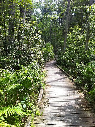
Chatfield Hollow State Park is a public recreation area occupying 412 acres (167 ha) that lie adjacent to Cockaponset State Forest in the town of Killingworth, Connecticut. The state park offers hiking trails, a swimming beach, trout fishing, mountain biking, rock climbing, and picnicking areas. Park attractions include 6.67-acre (2.70 ha) Schreeder Pond, Indian caves, historic sites, a restored water wheel, and a reproduction covered bridge. The park is managed by the Connecticut Department of Energy and Environmental Protection.
Pachaug State Forest is the largest forest in the Connecticut state forest system, encompassing over 27,000 acres (110 km²) of land. It is located on the Rhode Island border in New London County, and parcels of the forest lie in the towns of Voluntown, Griswold, Plainfield, Sterling, North Stonington, and Preston. The forest was founded in 1928, but most of the land came from purchases made later during the Great Depression. It is named after the Pachaug River, which runs through the center of the forest. The forest is part of the Northeastern coastal forests ecoregion.
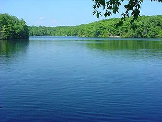
Millers Pond State Park is a public recreation area lying adjacent to Cockaponset State Forest in the towns of Durham and Haddam, Connecticut. The park's central feature is 33-acre (13 ha) Millers Pond, whose principal source of water is large springs that create a body of unpolluted water excellent for trout and smallmouth bass. The park offers fishing, hiking, mountain biking, and hunting.

Bigelow Hollow State Park is public recreation area in the town of Union, Connecticut, in the Quinebaug Highlands. The state park's 516 acres (209 ha) border Nipmuck State Forest on the east and west and Mashapaug Lake on the north. The park and forest are located in a large hollow or depression approximately 700' below the surrounding ridgelines. They are managed by the Connecticut Department of Energy and Environmental Protection.

Mansfield Hollow Lake is a reservoir resting on the border of Windham County and Tolland County, Connecticut. The reservoir provides drinking water for Willimantic and helps control flooding in the 159-square-mile Thames River watershed. It was created by the Mansfield Hollow Dam and is entirely contained within Mansfield Hollow State Park and the Mansfield Hollow Wildlife Area. Designed and constructed by the United States Army Corps of Engineers, the dam substantially reduces flooding along the Quinebaug, Shetucket, and Thames rivers. Construction of the project began in 1949 with completion in 1952 at a cost of US$6.5 million. The Mansfield Hollow reservoir is located within the Shetucket River Watershed and is part of the Thames River Basin. Access to the site is available from US Route 6 and State Route 195. The damsite, covering an area of 25 acres (10 ha), was listed on the National Register of Historic Places in 2003.

Indian Well State Park is a public recreation area occupying 153 acres (62 ha) on the west bank of Lake Housatonic, an impoundment of the Housatonic River, within the city limits of Shelton, Connecticut. The state park's scenic features include a 15-foot (4.6 m) horsetail waterfalls with splash pool at bottom. The park is managed by the Connecticut Department of Energy and Environmental Protection.
Wharton Brook State Park is a public recreation area located off U.S. Route 5 in the towns of North Haven and Wallingford, Connecticut. Activities in the 96-acre (39 ha) state park center on Allen Brook Pond, a 5-acre (2.0 ha) pond that empties into Wharton Brook. The park is managed by the Connecticut Department of Energy and Environmental Protection.

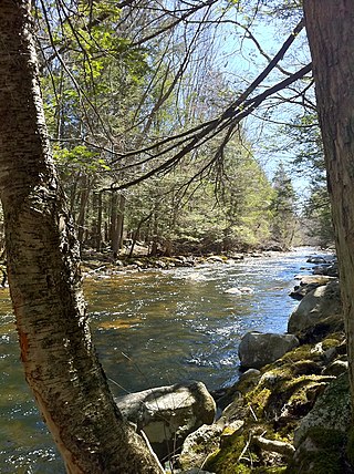
Nipmuck State Forest is a Connecticut state forest. Its 9,000 acres (3,600 ha) surround Bigelow Hollow State Park in the town of Union and include parcels in Stafford, Ashford, and other towns. The forest is part of a larger network of forest lands making up some 40,000 acres (16,000 ha) in all.
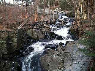
Southford Falls State Park is a public recreation area covering 126 acres (51 ha) in the towns of Oxford and Southbury, Connecticut. The state park offers fishing, hiking, waterfalls, a fire tower, and a covered bridge over Eight Mile Brook. It is managed by the Connecticut Department of Energy and Environmental Protection.
The Natchaug River is a 17.9-mile-long (28.8 km) river in Windham and Tolland Counties in northeastern Connecticut. The name Natchaug comes from the Nipmuc language and is believed to mean land between rivers.

Quinnipiac River State Park is a public recreation area located in the town of North Haven, Connecticut. The four sections of the state park protect 6 miles (9.7 km) of the Quinnipiac River.
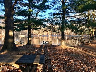
Mono Pond State Park Reserve is a public recreation area covering 218 acres (88 ha) in the town of Columbia, Connecticut, 8 miles (13 km) southwest of Willimantic. The state park surrounds Mono Pond, a 113-acre (46 ha) body of water averaging depths of 3.5 feet (1.1 m) with an area near the dam reaching a depth of nine feet (2.7 m). The park offers fishing, hiking, picnicking, cross-country skiing, bow hunting, and a boat launch for motorized and non-motorized boating. The park is managed by the Connecticut Department of Energy and Environmental Protection and was added to the roll of Connecticut state parks in 2008.

Beaver Brook State Park is an undeveloped public recreation area covering 401 acres (162 ha) in the towns of Windham and Chaplin, Connecticut. The state park encompasses Bibbins Pond, also known as Beaver Brook Pond, as well as the acreage northward as far as the Air Line State Park Trail, which forms the park's northern boundary. The park is a walk-in facility, open for hunting and trout fishing, managed by the Connecticut Department of Energy and Environmental Protection.

Day Pond State Park is a public recreation area covering 180 acres (73 ha) in the town of Colchester, Connecticut. The state park abuts Salmon River State Forest and is managed by the Connecticut Department of Energy and Environmental Protection. The park offers opportunities for hiking, swimming, shoreline fishing, picnicking and mountain biking.
Pomeroy State Park is an undeveloped public recreation area covering 200 acres (81 ha) just south of Willimantic in the town of Lebanon, Connecticut. The state park is a forested area used for hiking and hunting with no entrance, markings, or parking that abuts preserved farmland. It is under the management of the Connecticut Department of Energy and Environmental Protection.

Becket Hill State Park Reserve is a public recreation area lying adjacent to Nehantic State Forest in the town of Lyme, Connecticut. The state park is as an undeveloped, walk-in park totaling 260 acres (110 ha) with no officially listed activities. It is managed by the Connecticut Department of Energy and Environmental Protection.

Haddam Meadows State Park is a public recreation area occupying 175 acres (71 ha) on the west bank of the Connecticut River in the town of Haddam, Connecticut. The state park offers picnicking, fishing, and a boat launch. Park trails lend access to a diversity of riverside landscapes: marsh, beach, sand bar, fern growths, meadow lands, and hardwood forest. The park was established through the donation of land in 1944 by the Edward W. Hazen Foundation. It is managed by the Connecticut Department of Energy and Environmental Protection.

Dart Island State Park is a public recreation area comprising an undeveloped 19-acre (7.7 ha) sandbar island in the Connecticut River that is only accessible by boat. The island is within the corporate boundaries of the city of Middletown, Connecticut, its nearest neighbors being the Middletown Generating Station and Pratt and Whitney plant on the river's west bank. The island is wooded with "typical river trees like willow, poplar and red maple." It is managed by Connecticut Department of Energy and Environmental Protection, which lists boating, fishing, and bird watching as activities for visitors.
Nathan Hale State Forest is a Connecticut state forest encompassing 1,455 acres (589 ha) in the towns of Coventry and Andover. The forest is managed to sustain a reliable source of forest products and renewable habitat for wildlife. The forest originated in 1946 through the bequest of George Dudley Seymour, which allowed the state to purchase 850 acres in the surrounds of the historic Nathan Hale Homestead. In addition to cultivated plantations, the forest includes a 200-acre natural area that is kept without management activity. A 57-acre (23 ha) parcel, Creaser Park, is leased to the Town of Coventry for recreational use. The park offers hiking trails, fishing, and a dog-friendly area. Recreational usage in the rest of the forest includes hiking, hunting and letterboxing.

Nassahegon State Forest is a Connecticut state forest occupying 1,227 acres (497 ha) in the town of Burlington.The forest is managed for forestry and recreational purposes and is operated by the Connecticut Department of Energy and Environmental Protection.


