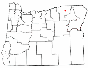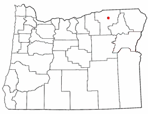
Umatilla County is one of the 36 counties in the U.S. state of Oregon. The population of 81,826 ranks it as the 14th largest in Oregon, and largest in Eastern Oregon. Hermiston is the largest city in Umatilla County, but Pendleton remains the county seat. Umatilla County is part of the Hermiston-Pendleton, OR Micropolitan Statistical Area, which has a combined population of 94,833. It is included in the eight-county definition of Eastern Oregon.

Morrow County is one of the 36 counties in the U.S. state of Oregon. As of the 2020 census, the population was 12,186. The county seat is Heppner. The county is named for one of its first settlers, Jackson L. Morrow, who was a member of the state legislature when the county was created. Half of the Umatilla Chemical Depot, which includes the Umatilla Chemical Agent Disposal Facility, and the Naval Weapons Systems Training Facility Boardman are located within the county. Morrow County is part of the Pendleton-Hermiston, OR, Micropolitan Statistical Area. It is located on the south side of the Columbia River and is included in the eight-county definition of Eastern Oregon.

Boardman is a city in Morrow County, Oregon, United States on the Columbia River and Interstate 84. As of the 2020 census the population was 3,828. It is currently the largest town in Morrow County, Oregon.

Cayuse is a census-designated place (CDP) and unincorporated community in Umatilla County, Oregon, United States, located 11 miles (18 km) east of Pendleton on the Umatilla Indian Reservation. The population was 59 at the 2000 census. It is part of the Pendleton–Hermiston Micropolitan Statistical Area.

Hermiston is a city in Umatilla County, Oregon, United States. Its population of 20,322 makes it the largest city in Eastern Oregon. Hermiston is the largest and fastest-growing city in the Hermiston-Pendleton Micropolitan Statistical Area, the eighth largest Core Based Statistical Area in Oregon with a combined population of 92,261 at the 2020 census. Hermiston sits near the junction of I-82 and I-84, and is 7 miles south of the Columbia River, Lake Wallula, and the McNary Dam. The Hermiston area has become a hub for logistics and data center activity due to the proximity of the I-82 and I-84 interchange, Pacific Northwest fiber optic backbone, and low power costs.

Kirkpatrick is a census-designated place (CDP) in Umatilla County, Oregon, United States. The population was 172 at the 2000 census. It is part of the Pendleton–Hermiston Micropolitan Statistical Area.

Mission is an unincorporated community in Umatilla County, Oregon, United States. For statistical purposes, the United States Census Bureau has defined Mission as a census-designated place (CDP). The population was 1,019 at the 2000 census.

Tutuilla is a census-designated place (CDP) in Umatilla County, Oregon, United States. The population was 460 at the 2000 census. It is part of the Pendleton–Hermiston Micropolitan Statistical Area.

Umatilla is a city in Umatilla County, Oregon, United States. The population in 2010 was 6,906, but the city's population includes approximately 2,000 inmates incarcerated at Two Rivers Correctional Institution.

The Danville Micropolitan Statistical Area is a Micropolitan Statistical Area (μSA) in Virginia as defined by the United States Office of Management and Budget (OMB). As of the 2010 census, the μSA had a population of 106,561
Riverside is a census-designated place (CDP) in Umatilla County, Oregon, United States. The population was 189 at the 2000 census. It is part of the Pendleton–Hermiston Micropolitan Statistical Area.

The Laurel Micropolitan Statistical Area is a micropolitan statistical area (μSA) in southeastern Mississippi that covers two counties - Jasper and Jones. The 2010 census placed the Laurel micropolitan area population at 84,823, though as of 2019, estimates indicate the population has slightly decreased to 84,481.

The Kearney Micropolitan Statistical Area, as defined by the United States Census Bureau, is an area consisting of two counties in Nebraska, anchored by the city of Kearney.

The Jackson Micropolitan Statistical Area, as defined by the United States Census Bureau, is an area consisting of two counties, one in Wyoming and one in Idaho, anchored by the town of Jackson.
The Tullahoma–Manchester Micropolitan Statistical Area, as defined by the United States Census Bureau, is an area consisting of two counties in central Tennessee, anchored by the cities of Tullahoma and Manchester.

The Roanoke Rapids, NC Micropolitan Statistical Area (μSA) as defined by the United States Census Bureau, is an area consisting of two counties in North Carolina, anchored by the city of Roanoke Rapids.

The Waycross Micropolitan Statistical Area (μSA), as defined by the United States Census Bureau, is an area consisting of two counties in Georgia, anchored by the city of Waycross.

The Minot Metropolitan Statistical Area, as defined by the United States Census Bureau, is an area consisting of three counties in North Dakota, anchored by the city of Minot. As of the 2010 census, the area had a population of 69,540. In 2012, it was estimated that the population of the Minot Micropolitan Area was 73,146.

The Martinsville Micropolitan Statistical Area is a United States Micropolitan Statistical Area (USA) in Virginia, as defined by the Office of Management and Budget (OMB) as of June, 2003. As of the 2000 census, the μSA had a population of 73,346.

The London, KY Micropolitan Statistical Area is a United States Census Bureau defined Micropolitan Statistical Area located in the vicinity of London, Kentucky. The London Micropolitan Statistical Area encompasses Laurel County entirely. The Micropolitan Statistical Area had a population of 52,715 at the 2000 Census. A July 1, 2009 U.S. Census Bureau estimate placed the population at 57,749.


