Hillsborough | |
---|---|
Coordinates: 45°55′N64°42′W / 45.92°N 64.70°W | |
Country | Canada |
Province | New Brunswick |
County | Albert County |
Erected | 1786 |
Area | |
• Land | 304.03 km2 (117.39 sq mi) |
Population (2021) [1] | |
• Total | 1,397 |
• Density | 4.6/km2 (12/sq mi) |
• Change 2016-2021 | 6.8% |
• Dwellings | 656 |
Time zone | UTC-4 (AST) |
• Summer (DST) | UTC-3 (ADT) |
Figures do not include portion within the village of Hillsborough |
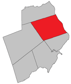
Hillsborough is a geographic parish in eastern Albert County, New Brunswick, Canada. [4]
For governance purposes, Hillsborough is divided between the village of Fundy Albert, [5] which includes most of the parish, and the Southeast rural district; [6] both are members of the Southeast Regional Service Commission. [7]
Prior to the 2023 governance reform, the parish was divided between the village of Hillsborough [8] and the local service district of the parish of Hillsborough. [9]
Hillsborough was probably named in honour of the Earl of Hillsborough, [10] First Lord of Trade in 1765.
Hillsborough was originally established in 1765 as a township within Nova Scotia, a grant of 100 000 acres to Robert Cummings and four others [11] that included modern Hillsborough Parish and most of Coverdale Parish. In 1786 the township's boundaries were explicitly used for the newly erected Hillsborough Parish. [12]
Hillsborough Parish is bounded: [2] [13] [14]
Originally the western line of Hillsborough extended north to the Petitcodiac River west of Upper Coverdale.
In 1828 all of the parish north of a line running west from the mouth of Stoney Creek was erected as Coverdale Parish. [16]
The northern boundary was moved slightly south in 1850 to its modern starting point. [17] 1850 was also the first year the parish's southern and western boundaries were described without referring to the original boundaries of the pre-Loyalist township.
The village of Hillsborough is on the Petitcodiac River, from south of Weldon Creek to north of Christopher Lane; the inland boundary is irregular, based partly on grant lines and partly on property lines of the late 1960s. [18]
The local service district of the parish of Hillsborough included the entire parish outside the village of Hillsborough. [19]
The LSD was established on 23 November 1966 to assess for fire protection [20] following the abolition of rural governments by the new Municipalities Act. First aid & ambulance services were added on 17 November 1976. [21]
In 2020, the LSD assessed for community & recreation services in addition to the basic LSD services of fire protection, police services, land use planning, emergency measures, and dog control. [22] The taxing authority was 615.00 Hillsborough.
Communities at least partly within the parish; [13] [14] [23] bold indicates an incorporated municipality
Bodies of water [lower-alpha 2] at least partly in the parish: [13] [14] [23]
Islands at least partly in the parish: [13] [14] [23]
Parks, historic sites, and other noteworthy places at least partly in the parish. [13] [14] [23]
PopulationParish population total does not include the village of Hillsborough
LanguageMother tongue (2016) [26]
|
Highways and numbered routes that run through the parish, including external routes that start or finish at the parish limits: [27]
Moncton is a geographic parish in Westmorland County, New Brunswick, Canada.
Kingsclear is a geographic parish in York County, New Brunswick, Canada.
Addington is a geographic parish in Restigouche County, New Brunswick, Canada.
Wicklow is a geographic parish in Carleton County, New Brunswick, Canada, forming the northwestern corner of Carleton County.
Coverdale is a geographic parish in Albert County, New Brunswick, Canada, located along the Petitcodiac River opposite Moncton and Dieppe.
Bathurst is a geographic parish in Gloucester County, New Brunswick, Canada.
Simonds is a geographic parish in Carleton County, New Brunswick, Canada, located north of Woodstock on the western bank of the Saint John River.
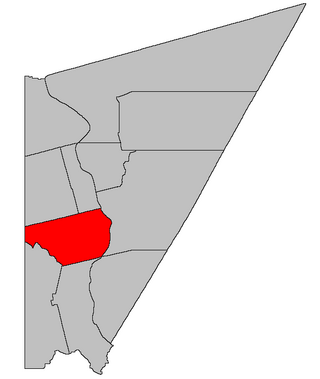
Wakefield is a geographic parish in Carleton County, New Brunswick, Canada, located north on the west bank of the Saint John River north of Woodstock.
Brighton is a geographic parish in Carleton County, New Brunswick, Canada, northeast of Woodstock, extending from the eastern bank of the Saint John River to the York County line.
Woodstock is a geographic parish in Carleton County, New Brunswick, Canada, surrounding the town of the same name on its landward side.
Saint Marys is a geographic parish in York County, New Brunswick, Canada.
Elgin is a geographic parish in the interior of Albert County, New Brunswick, Canada, the only one of the county's parishes that does not border either the Bay of Fundy or the Petitcodiac River.
Hopewell is a geographic parish in eastern Albert County, New Brunswick, Canada.
Harvey is a geographic parish in southern Albert County, New Brunswick, Canada.
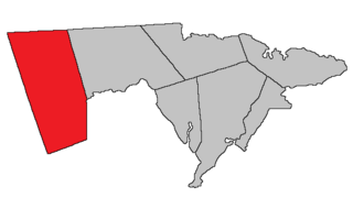
Salisbury is a geographic parish in Westmorland County, New Brunswick, Canada.
Shediac is a geographic parish in Westmorland County, New Brunswick, Canada.
Dorchester is a geographic parish in Westmorland County, New Brunswick, Canada.
Pennfield is a geographic parish in Charlotte County, New Brunswick, Canada, located west of Saint John located east of St. George and west of Saint John.
Saint George is a geographic parish in Charlotte County, New Brunswick, Canada, located between St. Stephen and Saint John.
Saint Stephen is a geographic parish in Charlotte County, New Brunswick, Canada, located in the southwestern corner of the province.