Hobe Sound, Florida

Last updated

Hobe Sound, Florida
Hobe Sound Jupiter Island.jpg
Martin County Florida Incorporated and Unincorporated areas Hobe Sound Highlighted.svg
Location in Martin County and the state of Florida
Hobe Sound, Florida
Hobe Sound, Florida
Hobe Sound, Florida
Coordinates: 27°04′N80°08′W / 27.067°N 80.133°W / 27.067; -80.133
Country Flag of the United States.svg  United States
State Flag of Florida.svg  Florida
County   Martin
Area
[1]
  Total7.72 sq mi (20.00 km2)
  Land7.11 sq mi (18.41 km2)
  Water0.61 sq mi (1.59 km2)
Elevation
20 ft (6 m)
Population
 (2020) [2]
  Total13,163
  Density1,852.4/sq mi (715.2/km2)
Time zone UTC-5 (Eastern (EST))
  Summer (DST) UTC-4 (EDT)
ZIP Codes
33455, 33475
Area code 772
FIPS code 12-30975 [3]
GNIS feature ID0284064 [4]
Sunset from the Intracoastal Waterway in Hobe Sound HobeSoundFlorida-sunset.jpg
Sunset from the Intracoastal Waterway in Hobe Sound

Hobe Sound is an unincorporated area and census-designated place (CDP) in Martin County, Florida, United States, located along Florida's Treasure Coast. The population was 13,163 at the 2020 census, [2] up from 11,521 in 2010.

Contents

Geography

Hobe Sound is located in southeastern Martin County at 27°04′36″N80°08′31″W / 27.076737°N 80.142076°W / 27.076737; -80.142076 . [5] It is an exurban area near the Atlantic Ocean, approximately 25 miles (40 km) north of West Palm Beach and 12 miles (19 km) southeast of Stuart. It stretches along the coast between Port Salerno to the north and Jonathan Dickinson State Park to the south. To the east, across South Jupiter Narrows, is Jupiter Island. Hobe Sound Public Beach, within the town of Jupiter Island, is one of Martin County's four guarded beaches.

History

Hobe Sound is the anglicized form of the name of a village of the Jaega, a Native American group that lived in the area before European settlement. The Spanish recorded the village name as "Jobe" or "Jove" [ˈxoβe] . [6] Jonathan Dickinson, whose party was shipwrecked near the town in 1696, spelled the name of the village "Hoe-bey". [7]

Parts of Hobe Sound were included in the 12,000-acre (49 km2) Gomez grant given by Spain to Don Eusebio in 1815. In 1821, Gomez sold 8,000 acres (32 km2), including Jupiter Island, to Joseph Delespine for $1 per acre.

Shortly after the turn of the 20th century, Henry Flagler built his railroad along the east coast of Florida, passing through Hobe Sound. This gradually created many opportunities including jobs, the birth of tourism, and other related industries.

A "Bubble House" in Hobe Sound Bubble Houses, Hobe Sound, Florida 006.JPG
A "Bubble House" in Hobe Sound

During the land boom of the 1920s elaborate plans were announced for Hobe Sound by the Olympia Improvement Corporation. Their goal was to create a town, in Greek style, where motion pictures could be produced. Street names bore such names as Zeus, Saturn, Mercury, Mars, Olympus, Venus, Pluto and Athena. For a brief time Hobe Sound was renamed "Picture City" and plans were presented for a movie picture production center. The boom collapsed after the 1928 Okeechobee hurricane, and the original name was restored. Street names remained, however, as did the cement streetlights along Dixie Highway.

In 1924, the building which soon would become the new schoolhouse in Hobe Sound was constructed. The Martin County Board of Public Instruction secured the use of the new school building from the Picture City Corporation in 1925, and in October of that year, the Olympia School opened. The school was designated the "Picture City School" of Martin County. It remained in use as a school until 1962.

Other mementos of the past are gone, including the ice plant, which was south of Bridge Road; the old train station, which now, refurbished and relocated west of Hobe Sound, serves as an office building for Becker Groves; and the Texaco station east of the Winn-Dixie plaza, which no longer supplies gasoline but continues to serve the community with car rentals and a livery service, operated by its founding family.

Hobe Sound is positioned at the southern end of environmentally-sensitive Martin (named after Governor Martin) County. It has been stated[ citation needed ] that at Hobe Sound's front door lies the Gold Coast and that at her back door lies the Treasure Coast. Thus, Hobe Sound can lend to both while retaining its proud heritage and unique personality. Hobe Sound's proximity to the coast affords immediate access to the Atlantic Ocean and the deep-channeled Intracoastal Waterway, a 1,200-mile (1,900 km) water route that provides a sheltered passage for boats along the eastern seaboard.

Another significant historical association possessed by Hobe Sound is the brief stay there of former Defense Secretary James Forrestal in 1949 between his resignation from that post and his death.

Around 1:30 a.m. on March 14, 1997, President Bill Clinton fell on the steps and twisted his knee at golfer Greg Norman's 80-acre oceanside estate in Hobe Sound. Clinton was staying there to play in a golf tournament sponsored by Norman. [8]

Residence of Worthington and Marion Margery Scranton, Hobe Sound (1942) Mrs. Worthington Scranton, residence in Hobe Sound, Florida. LOC gsc.5a08346.tif
Residence of Worthington and Marion Margery Scranton, Hobe Sound (1942)

Hobe Sound is a predominantly wealthy community whose residents have included such celebrities and other prominent persons as "Tiger" Woods, Alan Jackson, Celine Dion, Burt Reynolds, and Marion Margery Scranton, among others. [9] Over the decades, it was home or a winter home for wealthy businessman and industrialists, politicians, and sports and entertainment celebrities.

Police protection for Hobe Sound is provided by the Martin County Sheriff's Department. The Martin County Fire Rescue Department provides modern fire, rescue, as well as EMS Services. State-of-the-art inter-facility EMS services are also provided by the Martin Health System.

Counties

Hobe Sound has been part of the following counties:

Demographics

Historical population
CensusPop.Note
2000 11,376
2010 11,5211.3%
2020 13,16314.3%
U.S. Decennial Census [10]

2020 census

Hobe Sound racial composition
(Hispanics excluded from racial categories)
(NH = Non-Hispanic) [11]
RaceNumberPercentage
White (NH)10,38778.91%
Black or African American (NH)7445.65%
Native American or Alaska Native (NH)190.14%
Asian (NH)1260.96%
Pacific Islander (NH)70.05%
Some Other Race (NH)340.26%
Mixed/Multi-Racial (NH)4583.48%
Hispanic or Latino 1,38810.54%
Total13,163

As of the 2020 U.S. census, there were 13,163 people, 6,079 households, and 3,397 families residing in the CDP.

2000 census

As of the census [3] of 2000, there were 11,376 people, 5,176 households, and 3,266 families residing in the CDP. The population density was 2,082.8 persons per square mile (804.5/km2). There were 6,042 housing units at an average density of 1,106.2 houses per square mile (427.3/km2). The racial makeup of the CDP was 91.98% White, 5.79% African American, 0.15% Native American, 0.60% Asian, 0.03% Pacific Islander, 0.64% from other races, and 0.81% from two or more races. Hispanic or Latino of any race were 2.22% of the population.

There were 5,176 households, out of which 18.7% had children under the age of 18 living with them, 54.1% were married couples living together, 6.4% had a female householder with no husband present, and 36.9% were non-families. 31.2% of all households were made up of individuals, and 17.0% had someone living alone who was 65 years of age or older. The average household size was 2.14 and the average family size was 2.66.

In the CDP, the population was spread out, with 16.8% under the age of 18, 4.8% from 18 to 24, 20.5% from 25 to 44, 24.9% from 45 to 64, and 33.0% who were 65 years of age or older. The median age was 51 years. For every 100 females, there were 93.3 males. For every 100 females age 18 and over, there were 90.6 males.

The median income for a household in the CDP was $36,541, and the median income for a family was $45,412. Males had a median income of $36,943 versus $27,773 for females. The per capita income for the CDP was $21,603. About 3.7% of families and 5.5% of the population were below the poverty line, including 3.7% of those under age 18 and 6.0% of those age 65 or over.

Transportation

Travel in Hobe Sound is predominantly performed by private automobile. There are no interstate highways in Hobe Sound; the nearest, Interstate 95, is 7 miles (11 km) west. Hobe Sound is dominated by US 1, a four- and six-lane arterial road that runs north to south. Other important throughways include Florida State Road A1A (locally known as a part of the old 'Dixie Highway'), Bridge Road, Gomez Avenue, and Osprey Street. US 1 arguably represents the central business district though some commercial activity occurs on Dixie Highway (A1A) near Bridge Road.

Mass transit

Martin County Public Transit (MARTY) provides fixed-route bus service through Hobe Sound. Hobe Sound located on MARTY bus route 4 and route 20x. Bus route 20x offers service to Palm Beach County, and connects with Palm Tran bus service. [12] The Community Coach, a service of the Council on Aging of Martin County, is an additional public transportation service for Martin County. It operates a curb-to-curb, advance reservation, shared ride service and also operates fixed-route services in other parts of the county. The closest Tri-Rail commuter railroad station is located in Mangonia Park to the south.

Railroads

The Florida East Coast Railway runs through Hobe Sound parallel to A1A. At-grade crossings can be found at (from north to south) A1A, Osprey Street, Crossrip Street, Pettway Street, Bridge Road, and Gleason Street.

Until 1963 long distance trains, East Coast Champion, City of Miami,Havana Special and South Wind, served Hope Sound's station. Until 1957 the Dixieland, (nee Dixie Flagler ) made stops there as well. [13] [14] [15] Until 1968 local Jacksonville to Miami trains made stops at Hobe Sound. [16]

There are plans to extend the high-speed Brightline rail system and add a station in Stuart to the north. Currently, the West Palm Beach Brightline station is the closest stop to Hobe Sound. The historic West Palm Beach station is also served by Tri-Rail, and is the closest Amtrak stop to Hobe Sound.

Airports

The closest airport to Hobe Sound is Witham Field, and is located in Stuart. This airport is primarily used for general aviation. The closest airport offering commercial service is Palm Beach International Airport.

Education

The Hobe Sound Bible College is the only institution that provides post-secondary education within Hobe Sound. Private schools include the Hobe Sound Christian Academy. Publicly run schools include Hobe Sound Elementary and Seawind Elementary Schools. Residents of Hobe Sound attend Murray Middle School and South Fork High School.

The Pine School (formerly St. Michael's Independent) is now located on its new campus in Hobe Sound. This prestigious private school has a college preparatory program and educational opportunities for Kindergarten through 12th grade students. The campus offers education covering the basic arts (graphics, music, and media).

Notable people

Sources

Related Research Articles

<span class="mw-page-title-main">Flagler County, Florida</span> County in Florida, United States

Flagler County is a county located in the northeastern portion of the U.S. state of Florida. As of the 2020 census, the population was 115,378. Its county seat is Bunnell, and the largest city is Palm Coast. Created in 1917 from portions of Saint Johns and Volusia Counties, it was named for Henry Flagler, who built the Florida East Coast Railway.

<span class="mw-page-title-main">Martin County, Florida</span> County in Florida, United States

Martin County is a county located in the southeastern part of the state of Florida, in the United States. As of the 2020 census, the population was 158,431. Its county seat is Stuart. Martin County is in the Port St. Lucie, FL Metropolitan Statistical Area.

<span class="mw-page-title-main">St. Lucie County, Florida</span> County in Florida, United States

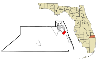
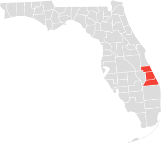
St. Lucie County is a county located in the southeastern portion of the U.S. state of Florida. As of the 2020 census, the population was 329,226. The county's seat is Fort Pierce, while the largest city is Port St. Lucie, making up 62% of the county's population. St. Lucie County is the principal county of the Port St. Lucie, FL Metropolitan Statistical Area.

<span class="mw-page-title-main">Gifford, Florida</span> Census-designated place in Florida, United States

Gifford is an unincorporated community and census-designated place (CDP) in Indian River County, Florida, United States. It is part of the Sebastian–Vero Beach Metropolitan Statistical Area. The population was 5,511 at the 2020 census. Gifford has a rich African American history. Gifford is one of the poorest communities in Florida.

<span class="mw-page-title-main">Jensen Beach, Florida</span> Census-designated place in Florida, United States

Jensen Beach is an unincorporated community and census-designated place (CDP) in Martin County, Florida, United States. The population was 12,652 at the 2020 census. It is part of the Port St. Lucie, Florida Metropolitan Statistical Area.

<span class="mw-page-title-main">Jupiter Island, Florida</span> Town in the state of Florida, United States

The town of Jupiter Island is located on the barrier island called Jupiter Island, in Martin County, Florida, United States; the town is part of Florida's Treasure Coast. The town is located next to the unincorporated community of Hobe Sound. The population of Jupiter Island was 804 at the 2020 census. Some of the wealthiest people in the United States live in Jupiter Island: the June 1999 issue of Worth magazine ranked it #1 in the country for having the highest median home sale, and it has the highest per capita income by ZIP Code Tabulation Area of any place in the US.

<span class="mw-page-title-main">Palm City, Florida</span> Census-designated place in Florida, United States

Palm City is an unincorporated area and census-designated place (CDP) in Martin County, Florida, United States. The population was 25,883 at the 2020 census. It is part of the Port St. Lucie Metropolitan Statistical Area.

<span class="mw-page-title-main">Port Salerno, Florida</span> Census-designated place in Florida, United States

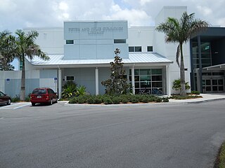
Port Salerno is an unincorporated community and census-designated place (CDP) in Martin County, Florida, United States. The population was 10,401 at the 2020 census. It is part of the Port St. Lucie Metropolitan Statistical Area.

<span class="mw-page-title-main">Goulds, Florida</span> Census-designated place in Florida

Goulds is an unincorporated community and census-designated place (CDP) in Miami-Dade County, Florida, United States. The area was originally populated as the result of a stop on the Florida East Coast Railroad. The railroad depot was located near the current Southwest 224th Street. The community was named after its operator, Lyman Gould, who cut trees for railroad ties. It is part of the Miami metropolitan area of South Florida. As of the 2020 US census, the population stood at 11,446, up from 10,103 in 2010 US census.

<span class="mw-page-title-main">Canal Point, Florida</span> CDP in Florida, United States

Canal Point is a census-designated place (CDP) and unincorporated community in Palm Beach County, Florida, United States. It is part of the Miami metropolitan area of South Florida despite its local culture and location being way more similar to the Florida Heartland. Canal Point has a population of 344 people counted in the 2020 US census.

<span class="mw-page-title-main">Jupiter, Florida</span> Town in the state of Florida, United States

Jupiter is the northernmost town in Palm Beach County, Florida, United States. According to the 2020 US Census, the town had a population of 61,047. It is 84 miles north of Miami and 15 miles north of West Palm Beach, and is the northernmost community in the Miami metropolitan area. It was named the 9th Best Southern Beach Town to live in by Stacker Newsletter for 2022, was rated as the 12th Best Beach Town in the United States by WalletHub in 2018, and as the 9th Happiest Seaside Town in the United States by Coastal Living in 2012.

<span class="mw-page-title-main">Lake Harbor, Florida</span> CDP in Florida, United States

Lake Harbor is a census-designated place (CDP) in Palm Beach County, Florida, United States. It is part of the Miami metropolitan area of South Florida despite being physically and culturally closer to the Florida Heartland. The population was 49 at the 2020 US census.

<span class="mw-page-title-main">Tequesta, Florida</span> Village in Florida, United States

Tequesta is an incorporated village in Palm Beach County, Florida, United States. It is the northernmost municipality in the Miami metropolitan area, which according to the 2020 United States Census, had a total population of 6,138,333 South Florida residents. As of 2020, the US Census had the village's total at 6,158 of the population.

<span class="mw-page-title-main">East Lake, Pinellas County, Florida</span> Census-designated place in Florida, United States

East Lake is a census-designated place (CDP) in Pinellas County, Florida, United States. The population was 30,962 at the 2010 census. It was one of the last areas in the densely populated county to develop. It is often confused with East Lake in neighboring Hillsborough County.

<span class="mw-page-title-main">Fort Pierce, Florida</span> City in Florida, United States

Fort Pierce is a city in and the county seat of St. Lucie County, Florida, United States. The city is part of the Treasure Coast region of Atlantic Coast Florida. It is also known as the Sunrise City,. Per the 2020 census, the population was 47,297.

<span class="mw-page-title-main">Jupiter Island</span>

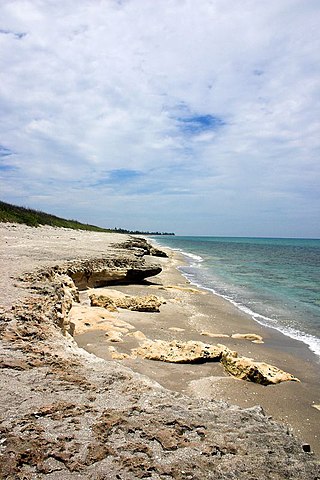
Jupiter Island is a barrier island on the coast of Martin and Palm Beach counties, Florida. It is bounded on the east by the Atlantic Ocean, on the north by the St. Lucie Inlet, on the west by the Indian River, and on the south by the Jupiter Inlet. Jupiter Island originally was two islands, Long Island on the north and Jupiter Island on the south, which were once separated by an inlet in the vicinity of North Jupiter Narrows and what is officially called Peck Lake, but commonly called Peck's Lake.

<span class="mw-page-title-main">Miami metropolitan area</span> Metropolis in the U.S. state of Florida

The Miami metropolitan area, officially known as the Miami–Fort Lauderdale–West Palm Beach Metropolitan Statistical Area, is a coastal metropolitan area in the southeastern part of the state of Florida. It is the ninth-largest metropolitan statistical area in the United States, the fifth-largest in the Southern United States, and the largest in the state of Florida. With a population of 6.14 million, it has more people than 31 of the nation's 50 states as of 2022. It comprises the three most populated counties in the state: Miami-Dade County, Broward County, and Palm Beach County.

<span class="mw-page-title-main">Treasure Coast</span> Region in Florida

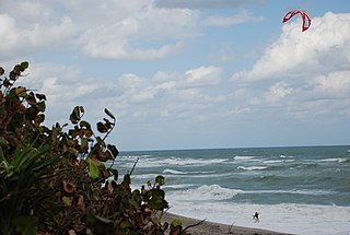
The Treasure Coast is a region in the southeast of the U.S. state of Florida. It borders the Atlantic Ocean and comprises Indian River, Martin, and St. Lucie counties. The region, whose name refers to the Spanish Treasure Fleet that was lost in a 1715 hurricane, evidently emerged from residents' desire to distinguish themselves from the Gold Coast to the south.

<span class="mw-page-title-main">U.S. Route 1 in Florida</span> Highway in Florida

U.S. Highway 1 (US 1) in Florida runs 545 miles (877 km) along the state's east coast from Key West to its crossing of the St. Marys River into Georgia north of Boulogne and south of Folkston. US 1 was designated through Florida when the U.S. Numbered Highway System was established in 1926. With the exception of Monroe County, the highway runs through the easternmost tier of counties in the state, connecting numerous towns and cities along its route, including nine county seats. The road is maintained by the Florida Department of Transportation (FDOT).

Cabana Colony is a census-designated place (CDP) in Palm Beach County, Florida, United States. The CDP is part of the Miami metropolitan area of South Florida. Its population was 2,460 as of the 2020 census.

References

  1. "2022 U.S. Gazetteer Files: Florida". United States Census Bureau. Retrieved December 21, 2022.
  2. 1 2 "P1. Race – Hobe Sound CDP, Florida: 2020 DEC Redistricting Data (PL 94-171)". U.S. Census Bureau. Retrieved December 21, 2022.
  3. 1 2 "U.S. Census website". United States Census Bureau . Retrieved January 31, 2008.
  4. "US Board on Geographic Names". United States Geological Survey. October 25, 2007. Retrieved January 31, 2008.
  5. "US Gazetteer files: 2010, 2000, and 1990". United States Census Bureau. February 12, 2011. Retrieved April 23, 2011.
  6. Hann, John H. (2003). Indians of Central and South Florida 1513-1763. Gainesville, Florida: University Press of Florida. pp. 61, 180. ISBN   0-8130-2645-8.
  7. Dickinson, Jonathan (1945) [1700]. Andrews, Evangeline Walker; Andrews, Charles McLean (eds.). God's Protecting Providence ... p. 19. LCCN   61-11399.{{cite book}}: |work= ignored (help)
  8. Fournier, Ron (March 14, 1997). "Clinton hurts right knee in fall at golfer Greg Norman's home". Associated Press. Retrieved May 25, 2021.
  9. "W. Scranton Dies in Florida." Hazleton, Pennsylvania: The Plain Speaker, February 14, 1955, p. 20.
  10. "United States Census Bureau QuickFacts". United States Census Bureau. Retrieved March 18, 2022.
  11. "Explore Census Data". data.census.gov. Retrieved February 12, 2022.
  12. https://www.martin.fl.us/BusSchedule Martin County MARTY bus services
  13. "Florida East Coast Railway". Official Guide of the Railways. National Railway Publication Company. 86 (7). December 1953.
  14. "Florida East Coast Railway". Official Guide of the Railways. National Railway Publication Company. 90 (7). December 1957.
  15. "Florida East Coast Railway". Official Guide of the Railways. National Railway Publication Company. 91 (3). January 1962.
  16. Bramson, Seth H. Speedway to Sunshine: the story of the Florida East Coast Railway, Boston Mills Press, 2010, p. 153. ISBN   9781554077533.
  17. 'Mary Oliver', Encyclopædia Britannica Online , retrieved January 30, 2019.