Guerrero is a state in Southwest Mexico that is divided into 85 municipalities. According to the 2020 Mexican census, Guerrero is the 13th most populous state with 3,540,685 inhabitants and the 14th largest by land area spanning 63,803.42 square kilometres (24,634.64 sq mi).

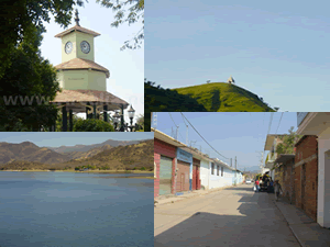
Zihuatanejo de Azueta is a municipality located on the Pacific coast in the western part of the Mexican state of Guerrero. It includes the major resort communities of Zihuatanejo and Ixtapa in addition to numerous other towns. In 2010 it had a population of 118,211 inhabitants. It has an area of 1468 km². Its municipal seat is the city of Zihuatanejo. Its municipal president for the 2005-08 period was Silvano Blanco Deaquino.
Montecristo de Guerrero is a town and municipality in the Mexican state of Chiapas in southern Mexico.
Alcozauca de Guerrero is a municipality in the Mexican state of Guerrero. The municipal seat lies at Alcozauca de Guerrero. The municipality covers an area of 55,160 hectares.
Arcelia is a municipality in the Mexican state of Guerrero. The municipal seat lies at Arcelia. The municipality covers an area of 725.1 km².

Cutzamala de Pinzón is a municipality in the Mexican state of Guerrero. The municipal seat lies at Cutzamala de Pinzón. The municipality covers an area of 611.1 km2.
Juchitán is a municipality in the Mexican state of Guerrero. The municipal seat lies at Juchitán. Founded in 2004, it is one of the newest municipalities in Guerrero.

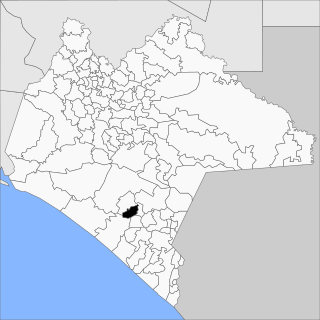
Tixtla de Guerrero is one of the 81 municipalities of Guerrero, in south-western Mexico. The municipal seat lies at Tixtla de Guerrero. The municipality covers an area of 290 square kilometres (110 sq mi).

Tlapehuala is one of the 81 municipalities of Guerrero, in south-western Mexico. The municipal seat lies at Tlapehuala. The municipality covers an area of 266.7 km².
Buenavista de Cuéllar is a municipality in the Mexican state of Guerrero. The municipal seat is Buenavista de Cuéllar. The municipality covers an area of 338.1 km².
Cochoapa el Grande is a municipality in the Mexican state of Guerrero. The municipal seat lies at Cochoapa el Grande. As of 2005, the municipality had a total population of 15,572. It is one of the newer municipalities of Guerrero, formed on June 13, 2003
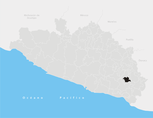
Florencio Villarreal is a municipality in the Mexican state of Guerrero. The municipal seat lies at Cruz Grande. The municipality covers an area of 372.9 km2. It is named after Col. Florencio Villarreal, who drafted the 1854 Plan of Ayutla that ousted the conservative dictator Antonio López de Santa Anna. Ousting Santa Anna initiated a new era in Mexican politics with the liberals in charge, known as La Reforma. Leaders in Guerrero took the lead in rebelling against Santa Anna's government.
Pilcaya is one of the 81 municipalities of Guerrero, in south-western Mexico. The municipal seat lies at Pilcaya. The municipality covers an area of 62.1 km².
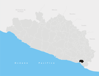
Tecoanapa is one of the 81 municipalities of Guerrero, in south-western Mexico. The municipal seat lies at Tecoanapa. The municipality covers an area of 776.9 square kilometres (300.0 sq mi).
Teloloapan is one of 81 municipalities in the state of Guerrero. The municipal seat is the city of Teloloapan. It is enclosed in the heart of the Southern Sierra Madre in the northern part of said region. It has the geographical coordinates 18°22′04″N 99°52′26″O and an altitude of 1,860 metres above sea level.
Tlapa de Comonfort is one of the 81 municipalities of Guerrero, in south-western Mexico. The municipal seat lies at Tlapa de Comonfort. The municipality covers an area of 1,054 km².
Xochistlahuaca Municipality is one of the 81 municipalities of Guerrero, in south-western Mexico. The municipal seat lies at Xochistlahuaca. The municipality covers an area of 321.1 km².
Zitlala is one of the 81 municipalities of Guerrero, in south-western Mexico. The municipal seat lies at Zitlala. The municipality covers an area of 308.2 km².
Pilcaya is a town and municipal seat of the Municipality of Pilcaya in the state of Guerrero, Mexico, located 153 kilometres (95 mi) from Mexico City, 105 kilometres (65 mi) from Cuernavaca, 84 kilometres (52 mi) from Toluca, 68 kilometres (42 mi) from Taxco and 5 kilometres (3 mi) from Ixtapan de la Sal. The name "Pilcaya" is from the Nahuatl word pilcacyan, place of a hanging object.
San Simón de Guerrero is one of 125 municipalities in the State of Mexico in Mexico. The municipality covers an area of 127.42 km².