Vadakkencherry is a town and gram panchayat in the Palakkad district, state of Kerala, India. It is located about 35 km from Palakkad along National Highway 544. Vadakkencherry-Mannuthy section of NH-544 is the first six lane National Highway in the state.

Shekharipuram is a residential area in Palakkad city, Kerala, India. Sekharipuram is famous for its agraharam or also known as heritage village. A road which starts from Sekharipuram usually known as Calicut bypass road is a 4 lane bypass road constructed for the vehicles coming from other parts of Kerala going towards Tamil Nadu side by bypassing Palakkad city.
Othara or Othera is an Indian village in Kerala state. It is located in Taluk Tiruvalla, in Pathanamthitta district.
Edavilangu is a village in Kodungallur, in Thrissur district, Kerala, India, 5 km distance from its Taluk Main Town Kodungallur and 38 km distance from its District Main City Thrissur. Edavilangu Pin Code is 680671. The west side of Edavilangu is the Arabian sea. Many devotees pass through this village at the time of Kodungallur bharani mahotsavam. GHS Edavilangu is the main educational institution in Edavilangu.

Chandranagar is a commercial and residential area in Palakkad city, Kerala, India. Chandranagar housing Society, founded in 1956, is the first housing colony in the state and one of the largest.
Mulavana is a village in Kollam district in the state of Kerala, India. The place is filled with almost all types of shops,which includes stationary,fancy,textile etc. The Mulavana fish market is regarded as the best market while comparing with the surrounding places.
Pirayiri is a residential and commercial area in Palakkad city.It is located about 8 km (5.0 mi) from the city centre.It belongs to Pirayiri gram panchayat in the Palakkad district, state of Kerala, India.
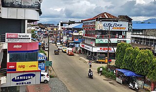
Puthuppariyaram is a suburb of Palakkad city in Palakkad District of Kerala,India. Puthuppariyaram lies on National Highway 966 and is located about 5 km from district headquarters and 124 km from Kozhikode. Puthuppariyaram Panchayat is one among the Panchayat which is supposed to be part of proposed Palakkad Municipal Corporation.
Chattikulam is a small high range village near Chalakudy in Thrissur district, Kerala, India. It is 9 km from Chalakudy on the way to Vellikulangara.
Nichar is a village located in the Kinnaur district of Himachal Pradesh state, India, at an altitude of 2100 meters. It is located on the old Hindustan-Tibet road. Most of the people follows Hinduism as well as Buddhism. It is known for natural water body called "chhalang bayu". The Usha Mata temple is in Nichar. The people of Nichar celebrate a fair called 'HU HU mela'. Nichar is one of the three administrative areas of Kinnaur distt. The region has a variety of flora and fauna and is home to wildlife species such as red bears, antelopes, and Ghoral. Nichar has wide range of alpine forest. That's why it is called as green valley. It is most green village in distt Kinnaur. The temperature of Nichar remains moderate throughout the year and hence, tourist can visit here in any season. With its natural environment and wildlife, it has become one of the most sought-after places to visit in Kinnaur. It has PIN-code 172103.
Perumpillichira is a small village that comes under the Panchayat of Kumaramangalam in Idukki district in the Indian state of Kerala. The name ‘Perumpillichira’ comes from the name of a large water reservoir adjacent to a Hindu temple at the heart of the village. This temple is the center point of the village. Water from Perumpillichira reservoir flows to nearby paddy field throughout the year except in peak summer and it finally reaches the Thodupuzha river. This place is 70 km away from the largest city Cochin in the state of Kerala.
Mundur is a town and gram panchayat in the Palakkad district, state of Kerala, India. Mundur is an important junction which connects National Highway 966 and State Highway 53. It is located about 11 km from Palakkad city and is one of the growing suburbs.
Kongad is a town and gram panchayat in Palakkad taluk, Kerala, India. It is a local government organisation that serves the villages of Kongad-I and Kongad-II. Kongad is located about 18 km from the district headquarters Palakkad.
Kingaon is a village in Yawal taluka of Jalgaon district, Maharashtra, India. It is located between the foot hill of Satpura mountain and the bank of Tapti River. Kingaon is 25 km from the city of Jalgaon. Majority of the population consisting of farmers with banana & onion as the major product.

Ambalapara is a gram panchayat in the Palakkad district, state of Kerala, India. It is the local government organisation that serves the villages of Ambalapara-I and Ambalapara-II and forms a part of the Ottapalam taluk.

Palot (पालोट) is a village in Didwana Tehsil in Nagaur district of Rajasthan, India. It belongs to Ajmer Division Division. It is located 85 km towards East from district headquarters Nagaur district. 15 km from Didwana. 171 km from the state capital Jaipur.
Mathamangalam or M. M. Bazar is a small town in Kannur district of Kerala state, India. Mathamagalam is a main trading centre, especially for hill products.
Mor Dioscorus Kuriakose is a Syriac Orthodox bishop, currently the Abbot of Malecuriz Dayro and Metropolitan of Simhasana Churches in North Kerala. Kuriakose belongs to the Ponnamkuzhy family, Arakunnam.
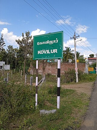
Kovilur is a small Village in Nallampalli Block in Dharmapuri District of Tamil Nadu State, India. It comes under Nallampalli Panchayath. It is located 10 km towards South from District headquarters Dharmapuri. 4 km from Nallampalli.


