
Alappuzha district, is one of the 14 districts in the Indian state of Kerala. It was formed as Alleppey district on 17 August 1957, the name of the district being changed to Alappuzha in 1990. Alappuzha is the smallest district of Kerala. Alleppey town, the district headquarters, was renamed Alappuzha in 2012.

Neyyattinkara, is a significant municipal town and a prominent center for both industry and commerce, positioned at the southernmost tip of the Thiruvananthapuram metropolitan area in Trivandrum, the capital of Kerala State. It also serves as the administrative headquarters of Neyyattinkara Taluk.Nestled along the banks of the Neyyar River, one of the district's principal rivers, the town derives its name from its location, with 'Neyyatinkara' in Malayalam translating to 'the shore of the river Neyyar.' Neyyattinkara ranks as the second most densely populated municipality in the district, following Varkala. Notably, the Vizhinjam International Seaport Thiruvananthapuram is situated within Neyyattinkara Taluk."In the Vizhinjam International Seaport Thiruvananthapuram, the port international code IN NYY 1, the "NYY" represents Neyyattinkara

Parangimalai is a small hillock in the Chennai district of Tamil Nadu, India, near the neighbourhood of Guindy and very close to Chennai International Airport. By extension, it is also the name of the neighbourhood surrounding the hillock.

Perumbavoor is a municipality in the Ernakulam district of Kerala, India. It is located 18 km (11.2 mi) north of the district collectorate in Thrikkakara and about 187 km (116.2 mi) north of the state capital Thiruvananthapuram. Perumbavoor is part of the Kochi metropolitan area and is located 26 km (16.2 mi) northeast of the Kochi city centre. As per the 2011 Indian census, Perumbavoor has a population of 28,110 people, and a population density of 2,065/km2 (5,350/sq mi).
Alappuzha, also known as Alleppey, is a municipality in the Alappuzha district of Kerala, India. It is the district headquarters of the district, and is located about 130 km (80.8 mi) north of the state capital Thiruvananthapuram. As per the 2011 Indian census, Alappuzha has a population of 240,991 people, and a population density of 3,675/km2 (9,520/sq mi).

Thalayolaparambu is a town situated in Kottayam district in Kerala, India. Spanning over an area of 19.3 square kilometres with a population of 22,571 people, this mini-town is home to some of the well-known personalities such as the former Chief minister of Travancore-Cochin A. J. John, Anaparambil, the late Malayalam novelist/writer Vaikom Muhammed Basheer, the former Chief Justice of India K. G. Balakrishnan, and KK. Thalayolaparambu also hosts the major market established during the administration of Velu Thampi Dalawa, and is one of those few Keralite markets that still retains its old-world charm till date.

Nayarambalam is a suburb of Cochin city and coastal village on Vypin island in Ernakulam district in the state of Kerala, India.
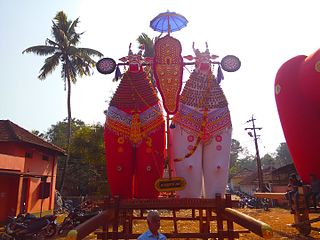
Mannar is a census town in Chengannur Taluk in Alappuzha District of Kerala state, India, on State Highway 6. It is also known as the Bell Metal Town.
Ramankary is a village in the Kuttanad region of India. It is 9 km away from Changanacherry town and 17 km from Alappuzha city. It is one of the villages in Alapuzha on the bank of the Manimala River with picturesque vast paddy fields.
Karuvatta is a village in Alappuzha District of Kerala region of India. It lies in between Haripad and Thottappally in Alappuzha, on National Highway 66. Karuvatta has a railway station, and the nearest airports are Trivandrum International Airport and Cochin International Airport.
Neerattupuram is a place in Kuttanad, Alappuzha district, Kerala, India. It is a part of Thalavady Grama Panchayat, situated near the junction of Alappuzha, Pathanamthitta and Kottayam districts, at the confluence of Pamba and Manimala rivers.

Karthikappally is a village in Alappuzha district in the Indian state of Kerala.Haripad is the headquarter of Karthikappally Taluk. Taluk office is located at revenue tower Haripad.
Mannancherry is a village in Alappuzha district in Kerala, India. It is situated about 10 km north of Alappuzha town. Vembanad Lake forms the eastern boundary of the village. In governance, Mannancherry is a Panchayat. In parliamentary representation, it is part of the Alappuzha Assembly constituency, as well as the Alappuzha LokSabha constituency. The primary occupation of the village's inhabitants has been coir-making for the past several decades.

Nooranad is a developing town in Mavelikkara taluk of Alappuzha district in the Indian state of Kerala. It is located at a distance of 8 Km south-west of Pandalam, in Kayamkulam route. Padanilam is the cultural centre of Nooranad region. The Padanilam Parabrahma Temple, known for the biggest Shivarathri Kettukazhcha in Kerala, is situated in Nooranad. Nooranad is declared by the Government of Kerala as the Nandikesha Paithruka Gramam due to its importance in Kettukala making, which is an icon of Onattukara region of Central Travancore. Nooranad is also known as Pakshi Gramam of kerala.
Kattoor is a small village in Irinjalakuda Block of Thrissur district, Kerala, India.
Kudassanad is a village near Pandalam in the State of Kerala in India. Geographically it is situated in the eastern ending of Alappuzha District and western part of Pathanamthitta District. The southern end of Kudassanad is on the verge of Kollam District. Part of Palamel Panchayat and Mavelikara Taluk, Kudassanad comes under the Mavelikara Parliamentary and Mavelikara Assembly Constituencies.
Charummood is a town in Mavelikkara Taluk of Alappuzha district in Kerala. Charummood is 12 km east of the nearest town Kayamkulam, 15 km west of Adoor and 12 km south of Mavelikkara. Charummood Junction is at the intersection of KP Road and NH 183. The Vetticode Nagaraja Temple is located 4 kilometres from Charummood. Chunakkara mahadevar temple, also located 4 Km from Charummood, is famous for sarvam swayambhoo deity and its festival is the first main festival of the Onattukara area. Padanilam Parabrahma Temple, which is famous for its Sivarathri festival, is about 5 kilometers from Charummood.
The Canossians are a family of two Catholic religious institutes and three affiliated lay associations that trace their origin to Magdalen of Canossa, a religious sister canonized by Pope John Paul II in 1988.

Thuravoor is a gram panchayat in the Pattanakkad Block of Cherthala Taluk of the Alappuzha District, State of Kerala, India. It comes under Aroor Assembly constituency. Thuravoor lies under Kochi UA in future. A four lane(six lane is progressing) National Highway 66 passes through the village, which along with a railway station gives it excellent connectivity with the remainder of the state. The new 6 lane elevated highway is from Thuravoor to Aroor. Upon completion, it will become the longest elevated highway in the country. Thuravoor is a rapid developing town. It lies in Aroor Assembly constituency. Thuravoor Kumbalangi road is a main road parallel to NH 66. Thuravoor is the major entry to Kochi city.

Government T D Medical College, Alappuzha is a government medical colleges situated in the suburban area of Vandanam, nine kilometres (5.6 mi) south of the Alappuzha, facing the NH 66, in Alappuzha district of Kerala State, South India. The initials T.D. stand for Thirumala Devaswom, as the Medical College was started in 1963 under the patronage of the T.D. Temple at Anantha Narayana Puram of Alappuzha.The founder of T.D.Medical College is Sri. N.V.Prabhu aka Narayana Venkateshwara Prabhu, a great personality hailing from Alappuzha. The emblem of the college, designed by Sri.N.V.Prabhu shows the Hindu god Narasimha, on top as the college was first under the TD trust The first batch of MBBS classes were started in August 1963 for 50 students. The Kerala government had agreed to upgrade the district headquarters hospital at Alappuzha and handed it over to the Medical College management, to be used as teaching hospital for the medical students and Government Order No.G.O.(MS).263/73/HD dt. 23 October 1973 was issued accordingly. Thus this became the fourth Government Medical College in the state.

