Kentland Farm Historic and Archeological District

Last updated

Kentland Farm Historic and Archeological District
Kentland Farm.jpg
Kentland Farm, September 2012
USA Virginia location map.svg
Red pog.svg
Usa edcp location map.svg
Red pog.svg
LocationAt end of VA 623 along New River, near Blacksburg, Virginia
Coordinates 37°11′23″N80°34′35″W / 37.18972°N 80.57639°W / 37.18972; -80.57639
Area350 acres (140 ha)
Built1745 (1745), 1834-1835
Built bySwope, John
Architectural styleGreek Revival, Federal
MPS Montgomery County MPS
NRHP reference No. 91000833, 06000801 [1]
VLR No.060-0202
Significant dates
Added to NRHPJuly 3, 1991, September 6, 2006 (Boundary Increase)
Designated VLRApril 17, 1991, June 8, 2006 [2]

Kentland Farm Historic and Archeological District is a historic home, archaeological site, and national historic district located near Blacksburg, Montgomery County, Virginia. The district encompasses a complex of 19th century agricultural outbuildings associated with a Federal and Greek Revival style brick dwelling built 1834–1835. Located in the district are significant archaeological resources that include a complex of Late Woodland village or camp sites. [3] [4]

Contents

Native American Occupation

There is archeological evidence of a Late Woodland Period occupation on the site. "An archeological survey, conducted in 1991, confirmed that there is at least one extensive Late Woodland Period (AD 800-1600) prehistoric Indian village located on the farm. The investigation resulted in the recovery of hundreds of artifacts including weapons, stone tools and lithic debris from tool manufacture, fragments of aboriginal clay pottery, fire-cracked rocks from hearths or fireplaces, and other pieces. There is also evidence of Native American Shawnee habitation and migration in the late 1700s through Kentland Farm, Toms Creek, Virginia, and the New River (Kanawha River)." [5]

Kent Family

James Randal Kent [6] acquired the farm in the early 1800s. According to the U.S. Census just prior to the Civil War, Kent produced corn, wheat, wool, butter, hay, clover seed, oats, flax seed, plus horses, cattle, sheep and swine, and owned 123 slaves. His property holdings were twice as valuable as the next wealthiest landowner in Montgomery County. [5]

James Kent also owned the largest number of slaves in the region. Before the Civil War, along with his daughter who owned another farm across the river, that is now the site of the Radford Arsenal, they owned 250 slaves in 1860. [7]

Farm Buildings

The site today still maintains several buildings from the Kent family farm period. This includes the antebellum brick manor house, and other buildings including a mill, numerous early farm buildings, garden areas, an antebellum cemetery for the Kent family and for the slave community. [7]

Many of the farm buildings "were constructed in the 1950s and have been retrofitted over and over again. Some have been abandoned, like two old concrete block silos that still stand on the site." Other buildings are more recently constructed, from the 1980s to the present. [8] Some of the old barns held unexpected finds, such as an old apple cider press and early chain saws, now refurbished and used by the students. [9]

The house is considered modest today, but was built of brick to keep it cool during the summers. German stonemasons mined limestone from Brush Mountain, while slaves mined clay from nearby pits and made the bricks for the home and the six-sided smokehouse. "Other, long forgotten artisans worked on the house's interior, including a perfectly preserved and ornately carved wooden handrail on the main staircase." [10]

The manor house was built in 1834-35 [11] as a two-story, five-bay, Flemish bond brick I house, extended two story ell, stone foundation, metal-sheathed gable roof, Federal and Greek revival interior and exterior detailing, and adjacent cistern, two-story kitchen, and hexagonal brick meat house (Patricia Givens Johnson, 1995 [12] ). [5]

Virginia Tech

Virginia Tech acquired the 1,785 acre Kentland Farm in a controversial land swap on December 31, 1986. The acquisition expanded the college farm to over 3,000 acres. The farm was purchased for the support of teaching, research, and extension programs in the Virginia Tech College of Agriculture and Life Sciences. [5]

There has been some discussion about the preservation and demonstration of African American habitation on the site. This includes the location and preservation of slave cemeteries, cabins and other evidence of their use of the land. [13] [14] [7]

in 2015, construction began on Virginia Tech's $14 million dairy center on Kentland Farm. Subsequently, Virginia Tech's 500-head dairy herd and production facility was relocated to the farm. [8] Other projects at the time included improving soil characteristics on the farm. [15]

National Register of Historic Places

It was listed on the National Register of Historic Places in 1991, with a boundary increase in 2006. [1]

Related Research Articles

<span class="mw-page-title-main">Montgomery County, Virginia</span> County in Virginia, United States

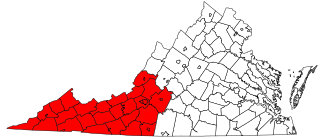
Montgomery County is a county located in the Valley and Ridge area of the U.S. state of Virginia. As population in the area increased, Montgomery County was formed in 1777 from Fincastle County, which in turn had been taken from Botetourt County. As of the 2020 census, the population was 99,721. Its county seat is Christiansburg, and Blacksburg is the largest town. Montgomery County is part of the Blacksburg-Christiansburg metropolitan area. It is dominated economically by the presence of Virginia Tech, Virginia's third largest public university, which is the county's largest employer.

<span class="mw-page-title-main">Blacksburg, Virginia</span> Town in Virginia, United States

Blacksburg is an incorporated town in Montgomery County, Virginia, United States, with a population of 44,826 at the 2020 census. Blacksburg, and the surrounding county is dominated economically and demographically by the presence of Virginia Tech.

<span class="mw-page-title-main">Christiansburg, Virginia</span> Town in Montgomery County, Virginia, USA

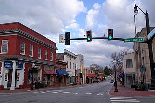
Christiansburg is a town in Montgomery County, Virginia, United States.The population was 21,041 at the 2010 census. It is the county seat of Montgomery County. Christiansburg, Blacksburg and the city of Radford are the three principal municipalities of the Blacksburg–Christiansburg Metropolitan Statistical Area, which encompasses those municipalities, all of Montgomery County, and three other counties.

<span class="mw-page-title-main">Virginia Tech</span> Public university in Blacksburg, Virginia

Virginia Tech (VT), formally Virginia Polytechnic Institute and State University (VPI), is a public land-grant research university with its main campus in Blacksburg, Virginia. It also has educational facilities in six regions statewide, a research center in Punta Cana, Dominican Republic, and a study-abroad site in Riva San Vitale, Switzerland. Through its Corps of Cadets ROTC program, Virginia Tech is a senior military college.

<span class="mw-page-title-main">Hokie Stone</span>

Hokie Stone is a grey dolomite—limestone rock found near Blacksburg, in western Virginia. It gets its name from the traditional nickname attributed to students and alumni of Virginia Tech.

<span class="mw-page-title-main">Kentlands, Gaithersburg, Maryland</span> Neighborhood of Gaithersburg in Montgomery, Maryland, United States

Kentlands is a neighborhood of the U.S. city of Gaithersburg, Maryland.

Kentland may refer to a location in the United States:

Prices Fork is a small traditionally agricultural census-designated place (CDP), in Montgomery County, Virginia, United States. The population as of the 2010 Census was 1,066. It is located about three miles west of Blacksburg and the campus of Virginia Polytechnic Institute and State University.

<span class="mw-page-title-main">Southwest Virginia</span> Mountainous region of Virginia in the westernmost part of the commonwealth

Southwest Virginia, often abbreviated as SWVA, is a mountainous region of Virginia in the westernmost part of the commonwealth. Located within the broader region of western Virginia, Southwest Virginia has been defined alternatively as all Virginia counties on the Appalachian Plateau, all Virginia counties west of the Eastern Continental Divide, or at its greatest expanse, as far east as Blacksburg and Roanoke. Another geographic categorization of the region places it as those counties within the Tennessee River watershed. Regardless of how borders are drawn, Southwest Virginia differs from the rest of the commonwealth in that its culture is more closely associated with Appalachia than the other regions of Virginia. Historically, the region has been and remains a rural area, but in the 20th century, coal mining became an important part of its economy. With the decline in the number of coal jobs and the decline of tobacco as a cash crop, Southwest Virginia is increasingly turning to tourism as a source of economic development. Collectively, Southwest Virginia's craft, music, agritourism and outdoor recreation are referred to as the region's "creative economy."

<span class="mw-page-title-main">Henry A. Edmundson</span> American politician

Henry Alonzo Edmundson was a nineteenth-century Virginia lawyer, congressman, farmer, slaveowner and Confederate officer.

William Edward Lavery was the 12th President of Virginia Tech. He served from January 1, 1975 to December 31, 1987.

The Preston and Olin Institute was a Methodist academy for boys in Blacksburg, Virginia which operated from 1851 to 1872. They chose the name Preston for Colonel William Ballard Preston, of nearby Smithfield Plantation, a well-known Montgomery County businessman, farmer, and statesman and a nationally known politician. The Methodist Church selected the name Olin after Stephen Olin, a beloved Methodist minister and former president of Randolph-Macon College. Olin and Preston Institute, a school for boys, opened in 1851, with William R. White as principal. The town already had a school for girls: the Blacksburg Female Academy, incorporated by legislative act in 1840. Until it was rechartered in 1869, it was named The Olin and Preston Institute.

<span class="mw-page-title-main">Huckleberry Trail</span>

The Huckleberry Trail is a multipurpose trail that measures almost 15 miles in length in Montgomery County, Virginia, connecting the towns of Blacksburg and Christiansburg. The trail is 12 feet (3.7 m) wide with an asphalt surface.

The Roanoke Region is the area of the Commonwealth of Virginia surrounding the city of Roanoke. Its usage may refer to the metropolitan statistical area or the Roanoke Valley, but it sometimes includes areas in the Allegheny Mountains and New River Valley which includes Alleghany County, Montgomery County, Covington, Clifton Forge, Blacksburg, Christiansburg, and Radford. Bedford County and Floyd County are sometimes included as part of the region.

Walker Prehistoric Village Archeological Site is an archeological site located near Poolesville, Montgomery County, Maryland. The site is a large Late Woodland village located on Selden Island in the Potomac River. Excavations carried out in the 1930s and 1940s revealed a 40-foot section of a palisade, circular house patterns, shallow oval pits and cylindrical pits, and flexed burials interred in the floors of the houses.

<span class="mw-page-title-main">Solitude (Blacksburg, Virginia)</span> Historic house in Virginia, United States

Solitude is a historic home located on the campus of Virginia Polytechnic Institute at Blacksburg, Montgomery County, Virginia. The earliest section was built about 1802, and expanded first in circa 1834 and then in the 1850s by Col. Robert Preston, who received the land surrounding Solitude from his father, Virginia Governor James Patton Preston. Dating back over 200 years, Solitude is the oldest building on the Virginia Tech Blacksburg campus.

<span class="mw-page-title-main">North Fork Valley Rural Historic District</span> Historic district in Virginia, United States

North Fork Valley Rural Historic District is a national historic district located near Blacksburg, Montgomery County, Virginia. The district encompasses 125 contributing buildings, 5 contributing sites, and 18 contributing structures. It consists of a significant rural landscape and an important collection of domestic and agricultural buildings, reflecting important agricultural practices in the region from 1745–1940. It includes domestic and agricultural buildings, a historic archaeological site, as well as an early-20th century school, two late-19th century churches, and five mid- to late-19th century industrial resources including three standing mills, a tanyard site, and a brick kiln site.

<span class="mw-page-title-main">Back Creek Farm</span> Historic house in Virginia, United States

Back Creek Farm is a historic home located near Dublin, Pulaski County, Virginia. It dates to the late-18th century, and is a two-story, five bay, brick I-house with a side gable roof. It has a two-story rear ell, sits on a rubble limestone basement, and has interior end chimneys with corbelled caps. The front facade features a pedimented tetrastyle Ionic order porch with an elegant frontispiece doorway with stop-fluted Corinthian order pilasters. Its builder was Joseph Cloyd (1742-1833). During the American Civil War, on May 9, 1864, the Battle of Cloyd's Mountain was fought on the property. The house served that day as a hospital and as headquarters for the Union General George Crook, under whose command were Captains Rutherford B. Hayes and William McKinley.

<span class="mw-page-title-main">Madison Farm Historic and Archeological District</span> Archaeological site in Virginia, United States

The Madison Farm Historic and Archeological District is a complex of historic and prehistoric Native American and colonial sites in rural Montgomery County, Virginia. It is located in and near the flood plains of the South Fork of the Roanoke River, and covers 115 acres (47 ha). Its historic artifacts include a surviving hall-parlor log house, probably built late in the 18th century by William Madison, which is one of the few of its type to survive in the county. The building was substantially modified in the 19th century, refinishing the interior and adding a two-story porch. The farm site includes a number of historic outbuildings, and is a good prospect for archaeological investigation into period farming practices.

References

  1. 1 2 "National Register Information System". National Register of Historic Places . National Park Service. July 9, 2010.
  2. "Virginia Landmarks Register". Virginia Department of Historic Resources. Retrieved June 5, 2013.
  3. William and Mary Center for Archaeological Research (2005). "ARCHAEOLOGICAL SURVEY AND LIMITED EVALUATION, KENTLAND FARM HISTORIC AND ARCHAEOLOGICAL DISTRICT (060-0202), MONTGOMERY COUNTY, VIRGINIA" (PDF). Virginia Tech Libraries.
  4. Moore, William H., and Joe B. Jones. Archaeological Survey and Limited Evaluation, Kentland Farm Historic and Archaeological District (060-0202), Montgomery County, Virginia. Williamsburg, Va: William and Mary Center for Archaeological Research, 2005.
  5. 1 2 3 4 "Kentland" Archived 2016-07-29 at the Wayback Machine .
  6. Kern, John. 1996. "Kentland Farm, a New River Plantation". Journal of the Roanoke Valley Historical Society. 13, no. 2: 45-52. Abstract: Owners and/or occupants of Kentland Farm include John Buchanan, Abram Trigg, Gordon Cloyd, Thomas Cloyd, David Cloyd, James Randall Kent, Mary Cloyd Kent, Margaret Kent Cowan, John T. Cowan, James Randal Kent Cowan, Maude Battle Cowan, Francis Bell, and Virginia Polytechnic Institute and State University. Short biographical sketches are included. Kentland Farm was previously known as Buchanan's Bottom, The property also included Cowans Mill.
  7. 1 2 3 Cook, Samuel R. and Thomas Klatka. 2015. "Verifying a Slave Community at Kentland." Historical Society of Western Virginia. Journal. Volume XXII (1), 2016. Page 71.
  8. 1 2 Moxley, Tonia. 2015. "New Virginia Tech dairy science facilities under construction at Kentland Farm". Roanoke Times. April 1, 2015.
  9. Katherine Fairbanks. 2013. "Fall Fun Day Recap". Archived 2016-10-13 at the Wayback Machine November 5, 2013.
  10. Moxley, Tonia. 2015. "Historic Kentland manor still weathering the ages". Roanoke Times. June 28, 2015.
  11. Pezzoni, J. Daniel. 1996. "The Architecture of Kentland". Journal of the Roanoke Valley Historical Society. 13, no. 2: 53-58.
  12. Johnson, Patricia Givens. Kentland at Whitethorne: Virginia Tech's Agricultural Farm and Families That Owned It, Harmans, Buchanans, Triggs, Cloyds, Kents, Cowans, Bells, Adams. Blacksburg, Va: Walpa Pub, 1995.
  13. Cook, Samuel R., and Thomas S. Klatka. 2015. "The Nexus of Collaboration: Negotiating African American History and Public Interest in Southwest Virginia". Anthropology Now. 7, no. 2: 26-36.
  14. Klatka, Thomas S., Donna Dunay, Jessica Wirgau, Z. Scott Hurst, and Scott Gardner. The 2006 Historic Lecture Series. Blacksburg, VA: WTOB Blacksburg, 2006. Disc 1. Collective efforts to document the slave cemetery at Kentland Plantation / Tom Klatka (39 min.).
  15. "Soil Rehabilitation Experiment Site (SRES) at Kentland Farm".