Kiowa, Kansas

Last updated

Kiowa, Kansas
Barber County Kansas Incorporated and Unincorporated areas Kiowa Highlighted.svg
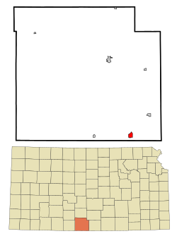
Location within Barber County and Kansas
Map of Barber Co, Ks, USA.png
Coordinates: 37°01′03″N98°29′05″W / 37.01750°N 98.48472°W / 37.01750; -98.48472 [1]
Country United States
State Kansas
County Barber
Founded1872
Incorporated 1885
Named for Kiowa people
Government
  Type Mayor–Council
   Mayor Bill Watson [ citation needed ]
Area
[2]
  Total1.11 sq mi (2.87 km2)
  Land1.11 sq mi (2.87 km2)
  Water0.00 sq mi (0.00 km2)
Elevation
[1]
1,332 ft (406 m)
Population
 (2020) [3]
  Total902
  Density810/sq mi (310/km2)
Time zone UTC-6 (CST)
  Summer (DST) UTC-5 (CDT)
ZIP code
67070
Area code 620
FIPS code 20-37125
GNIS ID 2395545 [1]
Website kiowaks.org

Kiowa is a city in Barber County, Kansas, United States. [1] As of the 2020 census, the population of the city was 902. [3] It is located 1 mile north of the Kansas / Oklahoma state border.

Contents

History

19th century

Kiowa was founded in 1872. [4] It was named for the Kiowa people. [5] [6]

20th century

On June 7, 1900, anti-saloon advocate Carrie Nation vandalized her first saloon in Kiowa. [7]

In 1905, the Denver, Enid and Gulf Railroad was built from Enid, Oklahoma to Kiowa. In 1907, it was sold to the Atchison, Topeka and Santa Fe Railway. [8] In 1996, the line from Kiowa to Blanton, Oklahoma was abandoned. [9]

Geography

According to the United States Census Bureau, the city has a total area of 1.07 square miles (2.77 km2), all of it land. [10]

Demographics

Historical population
CensusPop.Note
1880 42
1890 8932,026.2%
1900 765−14.3%
1910 1,52098.7%
1920 1,5391.3%
1930 1,501−2.5%
1940 1,379−8.1%
1950 1,56113.2%
1960 1,6747.2%
1970 1,414−15.5%
1980 1,409−0.4%
1990 1,160−17.7%
2000 1,055−9.1%
2010 1,026−2.7%
2020 902−12.1%
U.S. Decennial Census

2010 census

As of the census [11] of 2010, there were 1,026 people, 466 households, and 273 families living in the city. The population density was 958.9 inhabitants per square mile (370.2/km2). There were 578 housing units at an average density of 540.2 per square mile (208.6/km2). The racial makeup of the city was 95.3% White, 0.2% African American, 1.2% Native American, 0.2% Asian, 1.8% from other races, and 1.4% from two or more races. Hispanic or Latino of any race were 4.1% of the population.

There were 466 households, of which 24.5% had children under the age of 18 living with them, 48.1% were married couples living together, 6.9% had a female householder with no husband present, 3.6% had a male householder with no wife present, and 41.4% were non-families. 36.5% of all households were made up of individuals, and 19.3% had someone living alone who was 65 years of age or older. The average household size was 2.14 and the average family size was 2.79.

The median age in the city was 46.9 years. 21.8% of residents were under the age of 18; 7.6% were between the ages of 18 and 24; 18.5% were from 25 to 44; 28.5% were from 45 to 64; and 23.7% were 65 years of age or older. The gender makeup of the city was 49.0% male and 51.0% female.
2000 census

As of the census [12] of 2000, there were 1,055 people, 467 households, and 292 families living in the city. The population density was 995.3 inhabitants per square mile (384.3/km2). There were 569 housing units at an average density of 536.8 per square mile (207.3/km2). The racial makeup of the city was 95.83% White, 0.28% African American, 1.23% Native American, 1.71% from other races, and 0.95% from two or more races. Hispanic or Latino of any race were 4.27% of the population.

There were 467 households, out of which 25.7% had children under the age of 18 living with them, 54.6% were married couples living together, 5.8% had a female householder with no husband present, and 37.3% were non-families. 36.2% of all households were made up of individuals, and 24.0% had someone living alone who was 65 years of age or older. The average household size was 2.19 and the average family size was 2.87.

In the city, the population was spread out, with 23.6% under the age of 18, 4.7% from 18 to 24, 21.3% from 25 to 44, 24.4% from 45 to 64, and 26.0% who were 65 years of age or older. The median age was 45 years. For every 100 females, there were 84.1 males. For every 100 females age 18 and over, there were 76.8 males.

The median income for a household in the city was $31,141, and the median income for a family was $41,806. Males had a median income of $31,667 versus $21,083 for females. The per capita income for the city was $16,670. About 9.7% of families and 14.2% of the population were below the poverty line, including 23.1% of those under age 18 and 6.5% of those age 65 or over.

Education

The community is served by South Barber USD 255 public school district. [13]

The Kiowa Chieftains won the Kansas State High School class B Track & Field championship in 1940. [14]

Media

Kiowa is served by a weekly newspaper, The Kiowa News. [15]

Infrastructure

K-2 and K-8 highways, and the Southern Transcon main line of BNSF Railway pass through Kiowa.

Notable people

See also

Related Research Articles

<span class="mw-page-title-main">Garfield County, Oklahoma</span> County in Oklahoma, United States

Garfield County is a county located in the U.S. state of Oklahoma. As of the 2020 census, the population was 62,846. Enid is the county seat and largest city within Garfield County. The county is named after President James A. Garfield.

<span class="mw-page-title-main">Kiowa County, Kansas</span> County in Kansas, United States

Kiowa County is a county located in the U.S. state of Kansas. Its county seat and largest city is Greensburg. As of the 2020 census, the county population was 2,460. The county is named after the Kiowa tribe.

<span class="mw-page-title-main">Comanche County, Kansas</span> County in Kansas, United States

Comanche County is a county located in the U.S. state of Kansas. Its county seat and most populous city is Coldwater. As of the 2020 census, the county population was 1,689. The county was named after the Comanche tribe.

<span class="mw-page-title-main">Clark County, Kansas</span> County in Kansas, United States

Clark County is a county located in the U.S. state of Kansas. Its county seat and most populous city is Ashland. As of the 2020 census, the county population was 1,991. The county was named after Charles Clarke.

<span class="mw-page-title-main">Barber County, Kansas</span> County in Kansas, United States

Barber County is a county located in the south-central portion of the U.S. state of Kansas. Its county seat and most populous city is Medicine Lodge. As of the 2020 census, the county population was 4,228. The county was named for Thomas Barber, an abolitionist who was killed in Douglas County in 1855 during the Wakarusa War.

<span class="mw-page-title-main">Hardtner, Kansas</span> City in Kiowa County, Kansas

Hardtner is a city in Barber County, Kansas, United States. As of the 2020 census, the population of the city was 167. It is located 1 mile north of the Kansas / Oklahoma state border.

<span class="mw-page-title-main">Isabel, Kansas</span> City in Kiowa County, Kansas

Isabel is a city in Barber County, Kansas, United States. As of the 2020 census, the population of the city was 68.

<span class="mw-page-title-main">Medicine Lodge, Kansas</span> City in Kiowa County, Kansas

Medicine Lodge is a city in and the county seat of Barber County, Kansas, United States. As of the 2020 census, the population of the city was 1,781.

<span class="mw-page-title-main">Sharon, Kansas</span> City in Kiowa County, Kansas

Sharon is a city in Barber County, Kansas, United States. As of the 2020 census, the population of the city was 147.

<span class="mw-page-title-main">Sun City, Kansas</span> City in Kiowa County, Kansas

Sun City is a city in Barber County, Kansas, United States, along the Medicine Lodge River. As of the 2020 census, the population of the city was 37.

<span class="mw-page-title-main">Richmond, Kansas</span> City in Franklin County, Kansas

Richmond is a city in Franklin County, Kansas, United States. As of the 2020 census, the population of the city was 459.

<span class="mw-page-title-main">Haviland, Kansas</span> City in Kiowa County, Kansas

Haviland is a city in Kiowa County, Kansas, United States. As of the 2020 census, the population of the city was 678. It is home of Barclay College and known for meteorite finds connected to the Haviland Crater and for an annual meteorite festival held in July.

<span class="mw-page-title-main">Hunnewell, Kansas</span> City in Sumner County, Kansas

Hunnewell is a city in Sumner County, Kansas, United States. As of the 2020 census, the population of the city was 44.

<span class="mw-page-title-main">North Enid, Oklahoma</span> Town in Oklahoma, United States

North Enid is a town in Garfield County, Oklahoma, United States. The population was 860 at the 2010 census. The town is served by the Chisholm school district. North Enid was the original railroad town site in the Enid–Pond Creek Railroad War.

Hastings is a town in Jefferson County, Oklahoma, United States. The population was 143 at the 2010 census, a decline of 7.8 percent from the figure of 155 in 2000.

<span class="mw-page-title-main">Gotebo, Oklahoma</span> Town in Oklahoma, United States

Gotebo is a town in Kiowa County, Oklahoma, United States. The population was 226 at the 2010 census, a decline of 16.9 percent from 272 in 2000.

<span class="mw-page-title-main">Hobart, Oklahoma</span> City in Oklahoma, United States

Hobart is a city in, and the county seat of, Kiowa County, Oklahoma, United States. It was named for Garret Hobart, the 24th Vice President of the United States. The population was 3,756 at the 2010 census, a decline of 6.0 percent from the figure of 3,997 in 2000. It is served by Hobart Regional Airport. It also has two museums: the General Tommy Franks Museum and the Kiowa County Museum.

<span class="mw-page-title-main">Mountain View, Oklahoma</span> Town in Oklahoma, United States

Mountain View is a town in Kiowa County, Oklahoma, United States. The population was 795 at the 2010 census, a decline of 9.7 percent from 880 in 2000.

<span class="mw-page-title-main">Kiowa, Oklahoma</span> Town in Oklahoma, United States

Kiowa is a town in Pittsburg County, Oklahoma, United States. The population was 731 at the 2010 census.

<span class="mw-page-title-main">Rocky, Oklahoma</span> Town in Oklahoma, United States

Rocky is a town in Washita County, Oklahoma, United States. The population was 162 at the 2010 United States Census, a 6.9 percent decline from the figure of 174 in 2000. The town lies along U.S. Route 183.

References

  1. 1 2 3 4 U.S. Geological Survey Geographic Names Information System: Kiowa, Kansas
  2. "2019 U.S. Gazetteer Files". United States Census Bureau. Retrieved July 24, 2020.
  3. 1 2 "Profile of Kiowa, Kansas in 2020". United States Census Bureau. Archived from the original on March 17, 2022. Retrieved March 17, 2022.
  4. Kansas State Historical Society (1916). Biennial Report of the Board of Directors of the Kansas State Historical Society. Kansas State Printing Plant. pp.  144.
  5. Gannett, Henry (1905). The Origin of Certain Place Names in the United States. Govt. Print. Off. pp.  176.
  6. "Profile for Kiowa, Kansas". ePodunk. Archived from the original on June 6, 2014. Retrieved June 4, 2014.
  7. "Carry A. Nation (1846 – 1911)". The State Historical Society of Missouri. Archived from the original on April 7, 2014. Retrieved April 6, 2014.
  8. "Atchison, Topeka & Santa Fe / Denver, Enid & Gulf / Gulf, Colorado & Santa Fe / Kansas City, Mexico, & Orient / Oklahoma Central / San Francisco & San Joaquin Valley 2-6-0 "Mogul" Locomotives in the USA". www.steamlocomotive.com. Retrieved August 16, 2022.
  9. The Surface Transportation Board. "Docket Number: AB_480_0_X" . Retrieved June 23, 2016.
  10. "US Gazetteer files 2010". United States Census Bureau. Archived from the original on July 2, 2012. Retrieved July 6, 2012.
  11. "U.S. Census website". United States Census Bureau . Retrieved July 6, 2012.
  12. "U.S. Census website". United States Census Bureau . Retrieved January 31, 2008.
  13. "South Barber". USD 255. Retrieved January 6, 2017.
  14. "Track & Field". KSHSAA. Archived from the original on November 13, 2016. Retrieved January 6, 2017.
  15. "Homepage". The Kiowa News. Retrieved June 4, 2014.

Further reading