
Mingin is a town on the southern side of the Chindwin River in Kale District, Sagaing Division, Myanmar. It is the administrative center for Mingin Township.

Pyin Oo Lwin District is a district of the Mandalay Region in central Burma. It lies northeast of Mandalay, with the Myitnge River as its southern boundary. To the east it is bordered by Shan State and in part by the Chaung Magyi. It goes north as far as the town of Dakaung where it adjoins Htigyaing Township, Katha District in Sagaing Region. Its western boundary, is for the most part the Irrawaddy, but a very small portion of Thabeikkyin Township is west of the Irrawaddy, near the town of Baw in Sagaing Region. To the southwest it borders Mandalay District.
Thabeikkyin Township is a township of Pyin Oo Lwin District in the Mandalay Region of Burma. It is the northernmost township in Pyin Oo Lwin District and, although it primarily lies on the east bank of the Irrawaddy, it has a small enclave on the western bank extending as far as the village of Gagalaw, near the town of Baw in Katha District, Sagaing Region. On the south it borders Singu Township, on the east, Mogote Township and further north Shan State, while it abuts Tigyaing Township of Sagaing Region to the north.
Bhamo District is a district of the Kachin State in northern Burma (Myanmar). The capital is the city of Bhamo. The district covers an area of 10,742.9 km2. In 2002, the population of the Bhamo District was an estimated 363,300. The district consists of four townships:
Wetlet is a town in Shwebo District, Sagaing Region in Myanmar. It is the administrative seat for Wetlet Township. The town of Wetlet is located in the center of Wetlet Township, about halfway between the Mu River and the Irrawaddy. Wetlet is on the main Burmese north-south railroad between Sagaing and Shwebo.
Budalin is a town in Budalin Township, Monywa District, Sagaing Division in Burma (Myanmar). It is the administrative seat of Budalin Township. The town is connected by road and rail to Monywa, Dabayin, Kin-U and Ye-U, with a bridge over the Mu River.
Shwebo Township is a township of Shwebo District in the Sagaing Region of Burma (Myanmar). It is located on the plains between the Mu River and the Ayeyarwady River. The ancient palace of King Alaungmintaya is being excavated there. Its administrative seat is the city of Shwebo. As of 2014 it has a population of 266,807. 53.7% of its population is male while 46.3% is female.
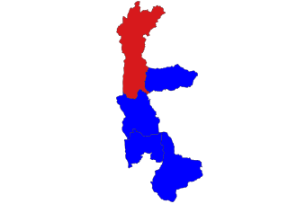
Htigyaing Township or Tigyaing Township is a township of Katha District in eastern Sagaing Region, in northern Myanmar. It lies on the border with the Shan State of Myanmar. The administrative seat is at Htigyaing.
Khamti, Hkamti, Singkawng, Kanti or Kantee is a town in Hkamti District, Sagaing Division, in north-western Myanmar. It is the administrative center for both the district and Hkamti Township.

Wetlet Township is a township of Shwebo District in the Sagaing Division of Burma (Myanmar). It is located on the plains between the Mu River and the Irrawaddy. Its administrative seat is the town of Wetlet.
Monywa District is an administrative district in southern Sagaing Division, Burma (Myanmar). Its administrative center is the city of Monywa.

Kalewa Township is a township of Kale District in Sagaing Division of Burma (Myanmar). The principal town and administrative seat is Kalewa. The Paluzawa coal mines are located in Kalewa township.
Sagaing Township is a township in Sagaing District in the Sagaing Division of Myanmar. The principal town is Sagaing and tourist spot of Mingun.
Katha Township is a township in Katha District in the Sagaing Region of Burma. The principal town is Katha. The township is served by a branch (east-west) railway line that leaves the main line just north of Indaw.

Ayadaw Township is a township in Monywa District in the Sagaing Division of Myanmar. The principal town is Ayadaw.

Ye-U Township is a township in Shwebo District in the Sagaing Region of Burma. The principal town is Ye-U.
Tamu Township is a township in Tamu District in the Sagaing Division of Burma.The principal town is Tamu. The only township of Tamu District, the township borders India.
Taze is a town in Shwebo District, Sagaing Division in Myanmar.
Yesagyo Township is a township of Pakokku District in the Magway Region of central Burma (Myanmar). The principal town and administrative seat is Yesagyo.
Kanbalu District is a district in Sagaing Division of Burma (Myanmar). Its administrative center is the city of Kanbalu.


