Indaw is a town in northern Myanmar and is the principal town of Indaw Township, Katha District, Sagaing Region. It is located 1 mile (1.6 km) south-east of Indaw Lake. The rail junction at Naba is located about 3 miles (4.8 km) to the north-east of the town.

Thabeikkyin Township is a township of Thabeikkyin District in the Mandalay Region of Burma. It is the northernmost township in Mandalay Region and, although it primarily lies on the east bank of the Irrawaddy, it has a small enclave on the western bank extending as far as the village of Gagalaw, near the town of Baw in Katha District, Sagaing Region. On the south it borders Singu Township, on the east, Mogote Township and further north Shan State, while it abuts Tigyaing Township of Sagaing Region to the north.

Bogale Township is a township of Pyapon District in the Ayeyarwady Region of Burma (Myanmar).

Ton Zang Township is a township of Tedim District in the Chin State of Myanmar. The 3,471.24-square-kilometre Ton Zang township is bordered by Tedim (Tiddim) Township in the south, Kale Township of the Sagaing Division in the south-east, Tamu Township of the Sagaing Division in the north-east, the Indian state of Manipur in the north and the Indian state of Mizoram in the west.

Thantlang Township is one of the nine townships in Chin State. Thantlang is the administrative town of inclusive nine circles attributed to the geographical and dialectical arrangements of the area. They are Khualhring Tlang, Vanzang Tlang, Zahnak Tlang, Bual Tlang, Vailam Tlang Lautu Tlang, Mara Tlang, Vailam Tlang, Zophei Tlang and Bawipa Tlang. Only four circles speak Lai dialect. Zophei(Zophei and Bawipa circles), Lautu, HawThai speak their tribal language. The other fives circles and in Thantlang town speak Lai dialect. In Thantlang township, Lai dialect is the common use dialect. Lai dialect is also spoken at Hakha township and Falam township.

Mohnyin Township is a township of Mohnyin District in the Kachin State of Burma (Myanmar). The principal town and administrative centre is Mohnyin. Jade and gem quality kyanite are produced in Mohnyin Township, as well as amber, gold, asafoetida, and jasper. Indawgyi Lake Wildlife Sanctuary is located in the central north of the township.

Htilin Township is a township of Pakokku District in the Magway Region of Burma (Myanmar). The principal town and administrative seat is Htilin.

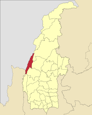
Chauk Township is a township of Magway District in the Magway Division of Burma (Myanmar). The principal town and administrative seat is Chauk.

Taunggyi Township is a township of Taunggyi District in the Shan State of Myanmar. The principal town is Taunggyi.

Wetlet Township is a township of Shwebo District in the Sagaing Division of Burma (Myanmar). It is located on the plains between the Mu River and the Irrawaddy. Its administrative seat is the town of Wetlet.

Pyinoolwin Township is a township in Pyinoolwin District, Mandalay Region of Burma (Mandalay). The administrative seat is Pyin U Lwin.

Kawlin Township is a township in Kawlin District in the Sagaing Division of Burma. The principal town is Kawlin.

Kani Township is a township in Yinmabin District, Sagaing Region, Myanmar. The township is subdivided into 188 villages grouped into 45 village tract and 1 town, the principal town of Kani, which contains 3 urban wards.
Tamu Township is a township in Tamu District in the Sagaing Division of Burma. The principal town is Tamu. Tamu township is the only township of Tamu District, which borders India.

Thayet Township is a township of Thayet District in the Magway Region of Burma (Myanmar). It lies on the west side of the Irrawaddy. The major town and administrative center is Thayet. Notable peaks are Mount Myinba (1688 ft.) and Mount Myinmagyi (1032 ft.).

Seikphyu Township is a township of Pakokku District in Magway Division of Burma (Myanmar). The principal town and administrative seat is Seikphyu. The township has its southeastern border along the Irrawaddy where its principal town, Seikphyu, is a port. The township lies between 20° 51' and 21° 15' north latitude and 94° 09' and 94° 48' east longitude. The Yaw River forms the township's eastern boundary. It is one of the areas destroyed by Cyclone Giri on 23 October 2010.

Pakokku Township is a township of Pakokku District in Magway Division of Burma (Myanmar). The principal town and administrative seat is Pakokku. The township has its eastern and southeastern border along the Irrawaddy where its principal town, Pakokku, is a port. The Yaw River forms the township's southwest border. There is a commercial airport at Lanywa (Lan).

Yesagyo Township is a township of Pakokku District in the Magway Region of central Burma (Myanmar). The principal town and administrative seat is Yesagyo.

Twante Township also Twantay Township is a township in the Yangon Region of Burma (Myanmar). It is located west across the Hlaing River from the city of Yangon. The principal town and administrative seat is Twante. The township is home to the Shwesandaw Pagoda and it is believed to contain strands of hair from the head of Gautama, and its annual pagoda festival is held on Burmese New Year. Built by the British in 1881, the Twante Canal The longest man made canal in Myanmar is Twante canal is the longest man-made canal in Myanmar, providing a shortcut waterway between Irawaddy River and Yangon river. This divides Twante Township across its which divides Twante Township with its length of 35 km and there is one bridge that spans the canal is called Twante bridge. Baungdawgyoke Monastery in Twante Township is famous as there are pagodas including the replica of Mahabodhi Temple
Maw Luu is a town in northern Indaw Township, Katha District, Sagaing Region located on the border with Kachin State in northern Myanmar. The town is located on the Shwebo-Myitkyina Road and has a major railway station. The town was elevated from a village tract in 2018 becoming the second town within Indaw Township. Its location connecting Kachin State with Sagaing makes the town a major transportation hub.


