Tamu District တမူးခရိုင်
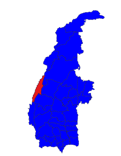
 တမူး | |
---|---|
Country | |
Region | Sagaing Region |
No. of Townships | 1 |
Capital | Tamu |
Time zone | UTC+6.30 (MST) |
Tamu District or Tuimu District is an administrative district in Sagaing Division, Burma (Myanmar). [1] Its administrative center is Tamu Town.
Tamu District consists of the following townships:
Sub-Township
Sagaing Region is an administrative region of Myanmar, located in the north-western part of the country between latitude 21° 30' north and longitude 94° 97' east. It is bordered by India’s Nagaland, Manipur, and Arunachal Pradesh States to the north, Kachin State, Shan State, and Mandalay Region to the east, Mandalay Region and Magway Region to the south, with the Ayeyarwady River forming a greater part of its eastern and also southern boundary, and Chin State and India to the west. The region has an area of 93,527 km2. In 1996, it had a population of over 5,300,000 while its population in 2012 was 6,600,000. The urban population in 2012 was 1,230,000 and the rural population was 5,360,000. The capital city of Sagaing Region is Sagaing.
Tamu or Tat Mu is a town in Sagaing Region in north-west Burma near the border with the eastern Indian state of Manipur. It is the administrative seat for Tamu Township.
Districts are the second-level administrative divisions of Myanmar. They are the sub-divisions of the States and Regions of Myanmar. According to the Myanmar Information Management Unit (MIMU), as of December 2015, there are 67 districts in Myanmar, which in turn are subdivided into townships, then towns, wards and villages.
Ton Zang Township is a township of Falam District in the Chin State of Burma (Myanmar). The 3,471.24-square-kilometre Ton Zang township is bordered by Tedim (Tiddim) Township in the south, Kale Township of the Sagaing Division in the south-east, Tamu Township of the Sagaing Division in the north-east, the Indian state of Manipur in the north and the Indian state of Mizoram in the west.
Bhamo District is a district of the Kachin State in northern Burma (Myanmar). The capital is the city of Bhamo. The district covers an area of 10,742.9 km2. In 2002, the population of the Bhamo District was an estimated 363,300. The district consists of four townships:
Sittwe Township Burmese: sittwe) is a township of Sittwe District in the Rakhine State of Myanmar. The principal town is Sittwe.
Ponnagyun Township is a township of Sittwe District in the Rakhine State of Myanmar. The principal town is Ponnagyun. There are 94 village groups in this township and about 200 villages. It has an ancient pagoda Uritetawdat Zaydhi which was innovated by King Mengphaloung (1571–1593) of the Mrauk Oo Dynasty. It is 25 miles distance to the south Sittwe, the district capital.
Ramree Township is a township of Kyaukpyu District in the Rakhine State of Myanmar. The principal town is Ramree. The local pronunciation of Ramree is Yangbye Myo.
Thandwe Township is a township of Thandwe District in the Rakhine State of Myanmar. The principal town is Thandwe.
Minbu District is a district of the Magway Division in central Myanmar. The city of Minbu is the administrative centre.
Katha District is the northeastern-most district in Sagaing Division of Burma (Myanmar). Its administrative center is the town of Katha. The district consists of the townships of Banmauk, Indaw, Katha, Kawlin, Pinlebu, Tigyaing, and Wuntho.
Shwebo District is a district in south-central Sagaing Division of Burma (Myanmar). Its administrative center is the city of Shwebo.
Hkamti District or Khamti District is a district in northern Sagaing Division of Burma (Myanmar). Its administrative center is the town of Singkaling Hkamti.
Mawlaik District is a district in central Sagaing Division of Burma (Myanmar). Its administrative center is the town of Mawlaik.
Kale District is the westernmost district in Sagaing Division of Myanmar (Burma).
Monywa District is an administrative district in southern Sagaing Division, Burma (Myanmar). Its administrative center is the city of Monywa.
Pauk Township is a township of Pakokku District in Magway Division of Burma (Myanmar). The principal town and administrative seat is Pauk.
Sagaing District is an administrative district in southern Sagaing Division, Burma (Myanmar). Its administrative center is the city of Sagaing.
Kale Township is a township in Kale District in the Sagaing Division of Burma (Myanmar). The principal town is Kalay.
Tamu Township is a township in Tamu District in the Sagaing Division of Burma.The principal town is Tamu. The only township of Tamu District, the township borders India.
Coordinates: 24°13′N94°24′E / 24.217°N 94.400°E
This Tamu District location article is a stub. You can help Wikipedia by expanding it. |