Tamu Township

Last updated
Tamu Township
တမူးမြို့နယ်
Tamu Township.svg
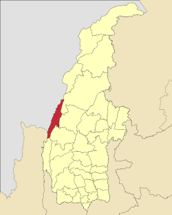
Location in Sagaing region
Coordinates: 24°12′49.06″N94°18′20.16″E / 24.2136278°N 94.3056000°E / 24.2136278; 94.3056000
Country Flag of Myanmar.svg  Myanmar
Region Sagaing Region
District Tamu District
Capital Tamu
Area
  Total
511.70 sq mi (1,325.30 km2)
Elevation
2,400 ft (700 m)
Population
 (2019) [1]
114,572
Time zone UTC+6.30 (MMT)

Tamu Township is a Kuki township in Tamu District in the Sagaing Division of Burma. [2] The principal town is Tamu. Tamu township is the only township of Tamu District, which borders India.

Contents

History

On January 7, 2024, in the midst of the Myanmar civil war, the Myanmar military engaged in airstrikes on the village of Kanan within Khampat, Tamu Township near the village church and a school, killing 17 civilians, including nine children, and wounded 20. [3] [4]

List of towns

TownBurmese namePopulation±% p.a.AreaDensity
(2019) [1] (2018) [1] km2sq mi/km2/sq mi
Khampat ခမ်းပါတ်15,40014,9103.29%33.3312.874621,197
Myothitမြို့သစ်1,3081,2742.67%3.341.293921,014
Tamu တမူး97,86493,0855.13%19.817.654,94012,795

Villages

References

  1. 1 2 3 Myanmar Information Management Unit (2019). Tamu Myone Daethasaingyarachatlatmya တမူးမြို့နယ် ဒေသဆိုင်ရာအချက်လက်များ [Tamu Township Regional Information](PDF) (Report) (in Burmese). Retrieved 25 January 2024.
  2. "Myanmar States/Divisions & Townships Overview Map" Myanmar Information Management Unit (MIMU)
  3. 1 2 "Air Attack in Myanmar Kills 17, Including Children, but Military Denies Responsibility". VOA . Bangkok. Associated Press. 7 January 2024.
  4. 1 2 Wei, Brian (January 13, 2024). "Witnesses Describe Aftermath of Myanmar Junta Airstrike". The Irrawaddy . Irrawaddy Publishing Group. Retrieved 25 January 2024.
  5. "Junta Torches Village In Tamu Township". Burma News International. 31 March 2023. Retrieved 25 January 2024. Of the 29 houses in Kun Tawng Ywar Thit (also called Chin village)...