Clermont is a rural town and locality in the Isaac Region, Queensland, Australia. At the 2021 census, the locality of Clermont had a population of 2952 people.

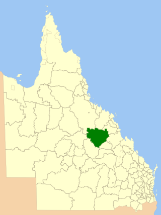
The Shire of Belyando was a local government area in Central Queensland, Australia. The Shire, administered from the town of Clermont, covered an area of 30,281.3 square kilometres (11,691.7 sq mi), and existed as a local government entity from 1879 until 2008, when it was amalgamated with the Shires of Broadsound and Nebo to form the Isaac Region.
Gilbert River is a rural locality in the Shire of Etheridge, Queensland, Australia. In the 2021 census, Gilbert River had a population of 32 people.

Torrens Creek is a rural town and locality in the Shire of Flinders, Queensland, Australia. In the 2016 census the locality of Torrens Creek had a population of 70 people.
Yarraden is a coastal rural locality in the Shire of Cook, Queensland, Australia. In the 2016 census Yarraden had a population of 11 people.
Mistake Creek is a former rural locality in Isaac Region, Queensland, Australia. In the 2016 census, Mistake Creek had a population of 38 people.

Argyll is a rural locality in the Central Highlands Region, Queensland, Australia. At the 2021 census, Argyll had a population of 25 people,
North Bungunya is a rural locality in the Goondiwindi Region, Queensland, Australia. In the 2016 census North Bungunya had a population of 39 people.
Linden is a rural locality in the Shire of Paroo, Queensland, Australia. In the 2021 census, Linden had "no people or a very low population".
Hawkwood is a rural locality in the North Burnett Region, Queensland, Australia. In the 2021 census, Hawkwood had a population of 34 people.
Strathmore is a locality split between the Shire of Mareeba and the Shire of Etheridge, in Queensland, Australia. In the 2016 census Strathmore had a population of 12 people.
Granite Vale is a rural locality in the City of Townsville, Queensland, Australia. In the 2021 census, Granite Vale had "no people or a very low population".
Kinnoul is a rural locality in the Shire of Banana, Queensland, Australia. In the 2021 census, Kinnoul had a population of 80 people.
Mantuan Downs is a rural locality in the Central Highlands Region, Queensland, Australia. In the 2021 census, Mantuan Downs had a population of 23 people.
Frankfield is a rural locality in the Isaac Region, Queensland, Australia. In the 2021 census, Frankfield had a population of 100 people.
Peak Vale is a rural locality split between the Isaac Region and the Central Highlands Region, Queensland, Australia. In the 2016 census, Peak Vale had a population of 39 people, but its boundaries were altered subsequently and its population was not separately reported in the 2021 census.

Gemini Mountains is a rural locality in the Isaac Region, Queensland, Australia. In the 2021 census, Gemini Mountains had a population of 65 people.
Mount Howe is a rural locality in the Maranoa Region, Queensland, Australia. In the 2021 census, Mount Howe had a population of 20 people.

Taldora is an outback locality in the Shire of Mckinlay, Queensland, Australia. In the 2016 census Taldora had a population of 37 people.

Barkly is an outback locality in the City of Mount Isa, Queensland, Australia. The locality is on the Queensland border with Northern Territory. In the 2021 census, Barkly had a population of 25 people.


