
Petit Jean State Park is a 3,471-acre (1,405 ha) park in Conway County, Arkansas managed by the Arkansas Department of Parks and Tourism. It is located atop Petit Jean Mountain adjacent to the Arkansas River in the area between the Ouachita Mountains and Ozark Plateaus.
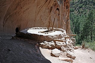
Bandelier National Monument is a 33,677-acre (13,629 ha) United States National Monument near Los Alamos in Sandoval and Los Alamos counties, New Mexico. The monument preserves the homes and territory of the Ancestral Puebloans of a later era in the Southwest. Most of the pueblo structures date to two eras, dating between 1150 and 1600 AD.

Meramec State Park is a public recreation area located near Sullivan, Missouri, about 60 miles from St. Louis, along the Meramec River. The park has diverse ecosystems such as hardwood forests and glades. There are over 40 caves located throughout the park, the bedrock is dolomite. The most famous is Fisher Cave, located near the campgrounds. The park borders the Meramec Conservation Area.

Scenic State Park is a Minnesota state park near Bigfork in Itasca County. It encompasses 3,936 acres (1,593 ha) of virgin pine forests that surround Sandwick Lake and Coon Lake. It also includes portions of Lake of the Isles, Tell Lake, Cedar Lake, and Pine Lake. Established in 1921, the Ojibwe tribe had previously used the area for hunting. The park has places for camping, hiking, swimming, fishing, and canoeing.
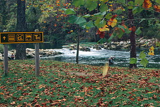
Bennett Spring State Park is a public recreation area located in Bennett Springs, Missouri, twelve miles (19 km) west of Lebanon on Highway 64 in Dallas and Laclede counties. It is centered on the spring that flows into the Niangua River and gives the park its name. The spring averages 100 million gallons of daily flow. The park offers fly fishing, camping, canoeing, hiking, and other activities.

National Park Service rustic – sometimes colloquially called Parkitecture – is a style of architecture that developed in the early and middle 20th century in the United States National Park Service (NPS) through its efforts to create buildings that harmonized with the natural environment. Since its founding in 1916, the NPS sought to design and build visitor facilities without visually interrupting the natural or historic surroundings. The early results were characterized by intensive use of hand labor and a rejection of the regularity and symmetry of the industrial world, reflecting connections with the Arts and Crafts movement and American Picturesque architecture.
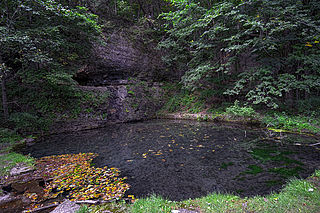
Backbone State Park is Iowa's oldest state park, dedicated in 1919. Located in the valley of the Maquoketa River, it is approximately three miles (5 km) south of Strawberry Point in Delaware County. It is named for a narrow and steep ridge of bedrock carved by a loop of the Maquoketa River originally known as the Devil's Backbone. The initial 1,200 acres (490 ha) were donated by E.M. Carr of Lamont, Iowa. Backbone Lake Dam, a relatively low dam built by the Civilian Conservation Corps (CCC) in the 1930s, created Backbone Lake. The CCC constructed a majority of trails and buildings which make up the park.

The Black Moshannon State Park Historic Districts are three separate historic districts on the National Register of Historic Places (NRHP) at Black Moshannon State Park in Rush Township, Centre County, Pennsylvania in the United States. The structures in the historic districts were constructed in the 1930s during the Great Depression by the Civilian Conservation Corps (CCC). The three districts are: the Beach and Day Use District, with 18 contributing structures, including 11 different picnic pavilions, concession building, bathhouse, museum, and four open pit latrines; the Family Cabin District with 16 contributing properties, including 13 cabins, one lodge and two latrines; and the Maintenance District with four contributing properties, including a storage building, three-bay garage, gas pump house, and ranger's residence.
Roaring River State Park is a public recreation area covering of 4,294 acres (1,738 ha) eight miles (13 km) south of Cassville in Barry County, Missouri. The state park offers trout fishing on the Roaring River, hiking on seven different trails, and the seasonally open Ozark Chinquapin Nature Center.

The Fall River Pump House and Catchment Basin in Rocky Mountain National Park, Colorado, are utility structures which treat water for the Fall River Pass Museum and the Alpine Visitor Center.

The historical buildings and structures of Zion National Park represent a variety of buildings, interpretive structures, signs and infrastructure associated with the National Park Service's operations in Zion National Park, Utah. Structures vary in size and scale from the Zion Lodge to road culverts and curbs, nearly all of which were designed using native materials and regional construction techniques in an adapted version of the National Park Service Rustic style. A number of the larger structures were designed by Gilbert Stanley Underwood, while many of the smaller structures were designed or coordinated with the National Park Service Branch of Plans and Designs. The bulk of the historic structures date to the 1920s and 1930s. Most of the structures of the 1930s were built using Civilian Conservation Corps labor.
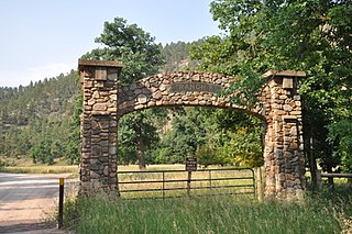
Ranch A, near Beulah, Wyoming, was built as a vacation retreat for newspaper publisher Moses Annenberg. The original log ranch structures in Sand Creek Canyon were designed in the rustic style by architect Ray Ewing. The principal building, a large log lodge, was built in 1932. Other buildings constructed at the time included a garage with an upstairs apartment, a barn, a hydroelectric power plant, stone entrance arches and a pump house. The lodge was furnished with Western furniture and light fixtures made by noted designer Thomas C. Molesworth. Many of these furnishings, among the first of Molesworth's career, are now the property of the state of Wyoming and are in the Wyoming State Museum.

Lake Ahquabi State Park is a state park of Iowa, US, featuring a 115-acre (47 ha) reservoir. Ahquabi means "resting place" in the Fox language. The park is 6 miles (9.7 km) south of Indianola and 22 miles (35 km) south of Des Moines. Three sections of the park were listed on the National Register of Historic Places in 1991.
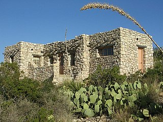
The Caverns Historic District comprises the central developed area of Carlsbad Caverns National Park. The complex was built between the early 1920s and 1942, initially in Pueblo Revival style, and later in New Mexico Territorial Revival style in the area around the natural entrance to Carlsbad Caverns. The earlier structures are built of local limestone, the later buildings in adobe. Thirteen buildings in the district are considered contributing structures. Buildings built between 1940 and 1942 were constructed with labor provided by the Civilian Conservation Corps.

Shady Lake Recreation Area is a campground and public recreation area in southwestern Ouachita National Forest, southwest of Mena, Arkansas and west of Glenwood, Arkansas. The area is oriented around Shady Lake, a body of water on the South Fork Saline River impounded by a dam built c. 1940 by the Civilian Conservation Corps (CCC). The area is administered by the United States Forest Service (USFS).

Pilot Knob State Park is located southeast of Forest City, Iowa, United States. Founded in 1923, it is one of the oldest state parks in Iowa. Between 1990 and 1995 one area was named nationally recognized historic district and five structures were individually listed on the National Register of Historic Places.

Lacey-Keosauqua State Park is located southwest of Keosauqua, Iowa, United States. The park is located along the Des Moines River in Van Buren County. First dedicated in 1921, it is the largest state park in size in Iowa. In 1990, three areas were named nationally recognized historic districts and listed on the National Register of Historic Places.
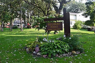
Pillsbury Point State Park is located in Arnolds Park, Iowa, United States. It is Iowa's smallest state park and unlike the others, it is an urban park. At 6.48 acres (2.62 ha), it is a narrow park that extends along a point of land into West Okoboji Lake adjacent to private summer houses. The overlook at the north end of the park was listed on the National Register of Historic Places in 1990. The historic designation includes walkways along the lake, stone steps, stone benches, and property boundary markers.

The St. Alban's Bay Culvert is a historic bridge in Garrison Township, Minnesota, United States. It carries the four-lane U.S. Route 169 (US 169) over the head of a stream flowing out of Mille Lacs Lake. It was built from 1938 to 1939 as part of a major New Deal project to create a scenic parkway along the lakeshore. The bridge was listed on the National Register of Historic Places in 2015 as the St. Alban's Bay Culvert at Mille Lacs Lake for having state-level significance in the themes of architecture and politics/government. It was nominated for being a well-preserved example of the Minnesota Highway Department's earliest scenic improvements, its rare status as a highway bridge built by the department's Roadside Development Division—a unit usually focused on overlooks and waysides—and for its fine National Park Service rustic design.
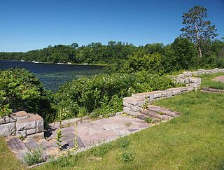
The Kenney Lake Overlook is a historic roadside park in Garrison Township, Minnesota, United States. Adjacent to the southbound lane of Minnesota State Highway 18 (MN 18), the two-acre (0.8 ha) site provides a parking area and an overlook of a small lake. The wayside was built in 1939 as part of a major New Deal project to create a scenic parkway along the shore of nearby Mille Lacs Lake. The Mille Lacs Highway Development Plan was the largest highway improvement project in the state constructed by the Civilian Conservation Corps (CCC). The Kenney Lake Overlook was listed on the National Register of Historic Places in 2015 for having state-level significance in the themes of landscape architecture and politics/government. It was nominated for being a key component of a major highway improvement project, for representing the work of the Veterans Division of the CCC and the earliest scenic improvements of the Minnesota Highway Department (MHD), and for its fine National Park Service rustic design.


