
Porter County is a county in the U.S. state of Indiana. As of 2020, the population was 173,215, making it the 10th most populous county in Indiana. The county seat is Valparaiso. The county is part of Northwest Indiana, as well as the Chicago metropolitan area. Porter County is the site of much of the Indiana Dunes, an area of ecological significance. The Hour Glass Museum in Ogden Dunes documents the region's ecological significance.

Lake County is a county located in the U.S. state of Indiana. In 2020, its population was 498,700, making it Indiana's second-most populous county. The county seat is Crown Point. The county is part of Northwest Indiana and the Chicago metropolitan area, and contains a mix of urban, suburban and rural areas. It is bordered on the north by Lake Michigan and contains a portion of the Indiana Dunes. It includes Marktown, Clayton Mark's planned worker community in East Chicago.
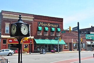
Chesterton is a town in Westchester, Jackson and Liberty townships in Porter County, in the U.S. state of Indiana. The population was 14,241 at the 2020 Census. The three towns of Chesterton, Burns Harbor, and Porter are known as the Duneland area.

Valparaiso, colloquially Valpo, is a city and the county seat of Porter County, Indiana, United States. The population was 34,151 at the 2020 census. It is part of the Chicago metropolitan area.
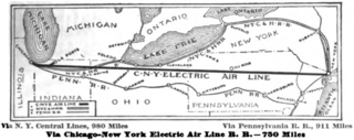
The Chicago – New York Electric Air Line Railroad (CNY) was a proposed high-speed electric air-line railroad between Chicago and New York City in the early 20th century. At roughly 750 miles (1,210 km) it would have been over 150 miles (240 km) shorter than the two primary steam railroads on that route, the New York Central Railroad and Pennsylvania Railroad. The promoters' vision proved wildly optimistic and, in the end, only a short interurban route in the vicinity of Gary, Indiana was built and operated. It was the most ambitious of several such proposals at the dawn of electric railroading, all of which ended in failure.
State Road 49 (SR 49) is a 44.15-mile (71.05 km), north–south state highway in the northwestern part of the U.S. state of Indiana. Its northern terminus is at an intersection with U.S. Route 12 in Porter near the entrance to Indiana Dunes State Park. The southern terminus is a rural intersection with State Road 14 in Barkley Township at Lewiston, 10 miles (16 km) northeast of Rensselaer.

Boone Township is one of twelve townships in Porter County, Indiana. As of the 2010 census, its population was 6,160.

Center Township is one of twelve townships in Porter County, Indiana, United States. As of the 2010 census, its population was 43,267.

Jackson Township is one of twelve townships in Porter County, Indiana. As of the 2010 census, its population was 5,328.

Morgan Township is one of twelve townships in Porter County, Indiana. As of the 2010 census, its population was 3,684.

Pine Township is one of twelve townships in Porter County, Indiana. As of the 2010 census, its population was 2,709. It is the least populated of the townships of Porter County.

Pleasant Township is one of twelve townships in Porter County, Indiana. As of the 2010 census, its population was 4,432.

Portage Township is one of twelve townships in Porter County, Indiana. As of the 2010 census, its population was 47,085. Portage Township was established in 1835.

Porter Township is one of twelve townships in Porter County, Indiana. As of the 2010 census, its population was 9,367.

Union Township is one of twelve townships in Porter County, Indiana. As of the 2010 census, its population was 8,811, and in 2020, it was 9,403.

Washington Township is one of twelve townships in Porter County, Indiana. As of the 2010 census, its population was 4,785.

Westchester Township is one of twelve townships in Porter County, Indiana. It is included in the Calumet, Northwest Indiana, and Great Lakes regions. It is located on the southern shore of Lake Michigan, about 50 miles (80 km) southeast of Chicago. It stretches from the famous Indiana Dunes on its northern border, south to the Valparaiso Moraine, a ridge of rolling hills left by the last glacier to pass through the area. As of the 2010 census, its population was 19,396.
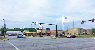
Portage is a city in Portage Township, Porter County, in the U.S. state of Indiana, on the border with Lake County. The population was 37,926 as of the 2020 census. It is the largest city in Porter County, and third largest in Northwest Indiana.
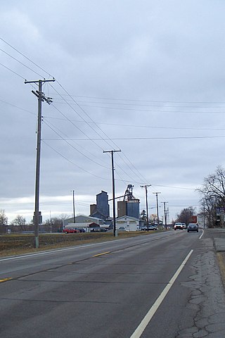
Wheeler is an unincorporated census-designated place (CDP) in northern Union Township, Porter County, in the U.S. state of Indiana. It lies along State Road 130, northwest of the city of Valparaiso. Although Wheeler is unincorporated, it had a post office, with the ZIP code of 46393. The population of Wheeler was 443 at the 2010 census.


