Limoeiro

Last updated
Limoeiro
Limoeiro.jpg
Limoeiro Overview
Bandeira limoeiro pe.jpg
Brasao limoeiro pe.PNG
Brazil location map.svg
Red pog.svg
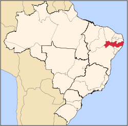
Limoeiro
Limoeiro located in Brazil map
Coordinates: 7°52′30″S35°27′00″W / 7.87500001°S 35.45000001°W / -7.87500001; -35.45000001
Country Flag of Brazil.svg Brazil
State Pernambuco
Region Agreste
Area
  Total
269.97 km2 (104.24 sq mi)
Elevation
138 m (453 ft)
Population
 (2020 [1] )
  Total
56,198
Time zone UTC−3 (BRT)
Average Temperature25.1 °C (77.2 °F)
Limoeiro's principal church Limoeiro - igreja matriz.jpg
Limoeiro's principal church

Limoeiro is a city in Pernambuco, Brazil.

Geography

Economy

The main economic activities in Limoeiro are based in industry, commerce, tourism and agribusiness; especially plantations of bananas and sugarcane, and the raising of cattle, goats, sheep, pigs and chickens.

Contents

Economic indicators

Population [2] GDP x(1000 R$). [3] GDP pc (R$) PE
57.243219.4963.9510.37%

Economy by sector (2006)

Primary sector Secondary sector Service sector
5.76%12.32%81.92%

Health indicators

HDI (2000)Hospitals (2007)Hospitals beds (2007)Children's mortality every 1000 (2005)
0.688214117.2

[4]

See also

References

  1. IBGE 2020
  2. http://www.ibge.gov.br/home/estatistica/populacao/estimativa2009/POP2009_DOU.pdf IBGE Population 2009 (Limoeiro, page 33)
  3. Limoeiro 2007 GDP IBGE page 30 Archived 2016-03-04 at the Wayback Machine
  4. "PE State site - City by city profile". Archived from the original on 2009-08-04. Retrieved 2009-08-05.