Venturosa

Last updated
Venturosa
Brazil location map.svg
Red pog.svg
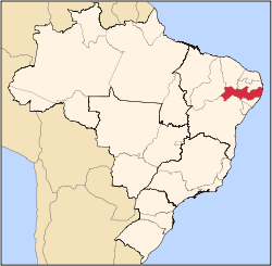
Venturosa
Venturosa located in Brazil Map
Coordinates: 8°34′29″S36°52′27″W / 8.57472°S 36.87417°W / -8.57472; -36.87417 Coordinates: 8°34′29″S36°52′27″W / 8.57472°S 36.87417°W / -8.57472; -36.87417
Country Flag of Brazil.svg Brazil
State Pernambuco
Region Agreste
Area
  Total338.12 km2 (130.55 sq mi)
Elevation
530 m (1,740 ft)
Population
 (2020 [1] )
  Total18,661

Venturosa is a city in northeastern Brazil, in the State of Pernambuco. It lies in the mesoregion of Agreste of Pernambuco and has 338.12 sq/km of total area.

Contents

Geography

Economy

The main economic activities in Venturosa are industry, commerce and agribusiness, especially beans, corn; and farming of cattle, sheep, goats, pigs and chickens.

Economic Indicators

Population [2] GDP x(1000 R$). [3] GDP pc (R$) PE
16.70658.9893.7870.096%

Economy by Sector (2006)

Primary sector Secondary sector Service sector
24.13%8.37%67.50%

Health Indicators

HDI (2000) [4] Hospitals (2007)Hospitals beds (2007)Children's Mortality every 1000 (2005)
0.63312418.1

Related Research Articles

São Vicente Ferrer, Pernambuco Municipality in Northeast, Brazil

São Vicente Ferrer is a Brazilian municipality in the state of Pernambuco. According with IBGE in 2020, has an estimated population of 18,085 inhabitants. It has a total area of 110.49 square kilometres (42.66 sq mi).

Alagoinha Municipality in Pernambuco, Brazil

Alagoinha is a Brazilian municipality in the state of Pernambuco. The name "Alagoinha" refers to the many small tanks, wells, cauldrons, and lagoons within the city. Nossa Senhora da Conceição Our Lady of Conceição is the patron saint of the city. The church of Nossa Senhora da Conceição, which has a simple style, was built by German Franciscan friars in 1916. The city has a strong connection to the German culture.

Caetés, Pernambuco Municipality in Northeast, Brazil

Caetés is a Brazilian municipality located within the state of Pernambuco, in northeastern Brazil. The city belongs to the mesoregion of Agreste Pernambucano and microregion of Garanhuns. It is the birthplace of former president of Brazil Luiz Inácio Lula da Silva. The name originates from the indigenous Caetés people who lived in Pernambuco in the 16th century.

Santa Cruz do Capibaribe Municipality in Northeast, Brazil

Santa Cruz do Capibaribe is a Brazilian municipality in the State of Pernambuco. It is the third largest city in the mesoregion of Agreste of Pernambuco with a population of 109,897 inhabitants in 2020. It has 335.309 km² of total area and it is located about 185.7 km from the capital Recife.

Taquaritinga do Norte

Taquaritinga do Norte is a city in the state of Pernambuco, Brazil.

Agrestina City in Pernambuco, Brazil

Agrestina (Wilding) is a Brazilian municipality in the state of Pernambuco, mesoregion of Agreste. It covers 200.58 km2 (77.44 sq mi), and has a population of 25,065 with a population density of 113 inhabitants per square kilometer.

Surubim Municipality in Northeast, Brazil

Surubim is a city in the state of Pernambuco, Brazil. It is the birthplace of Chacrinha, a famous Brazilian comedian and entertainer who died in 1988.

Limoeiro City in Pernambuco, Brazil

Limoeiro is a city in Pernambuco, Brazil.

Tacaimbó

Tacaimbó is a city in the state of Pernambuco, Brazil.

Riacho das Almas City in Pernambuco, Brazil

Riacho das Almas is a city in northeastern Brazil, in the State of Pernambuco. It lies in the mesoregion of Agreste of Pernambuco and has 313.99 sq/km of total area.

Sanharó

Sanharó is a city located in the state of Pernambuco, Brazil. Located at 198 km away from Recife, capital of the state of Pernambuco. Has an estimated population of 26,890 inhabitants.

Pedra, Pernambuco

Pedra (stone) is a city located in the state of Pernambuco, Brazil. Located at 255 km away from Recife, capital of the state of Pernambuco. Has an estimated population of 22,668 inhabitants.

Ibirajuba

Ibirajuba is a city located in the state of Pernambuco, Brazil. Located at 182 km away from Recife, capital of the state of Pernambuco. Has an estimated population of 7,768 inhabitants.

Poção

Poção is a city located in the state of Pernambuco, Brazil. Located at 241 km away from Recife, capital of the state of Pernambuco. Has an estimated population of 11,305 inhabitants.

Palmeirina

Palmeirina is a city located in the state of Pernambuco, Brazil. Located at 252 km from Recife, capital of the state of Pernambuco, Palmeirina has an estimated population of 7,600 inhabitants.

Panelas

Panelas is a city located in the state of Pernambuco, Brazil. Located at 182.6 km away from Recife, capital of the state of Pernambuco. Has an estimated population of 26,456 inhabitants.

Salgadinho, Pernambuco

Salgadinho is a city located in the state of Pernambuco, Brazil. Located at 124.6 km away from Recife, capital of the state of Pernambuco. Has an estimated population of 11,068 inhabitants.

Sairé

Sairé is a municipality located in the state of Pernambuco, Brazil. Located at 110.7 km away from Recife, capital of the state of Pernambuco. Has an estimated population of 9,764 inhabitants.

Terezinha

Terezinha is a city located in the state of Pernambuco, Brazil. Located at 251 km away from Recife, capital of the state of Pernambuco, it has an estimated population of 7,198 inhabitants.

São João, Pernambuco

São João is a city located in the state of Pernambuco, Brazil. Located at 240 km away from Recife, capital of the state of Pernambuco. Has an estimated population of 22,899 inhabitants.

References

  1. IBGE 2020
  2. IBGE, Population 2009 Venturosa, page 35
  3. "Venturosa 2007 GDP IBGE page 32" (PDF). Archived from the original (PDF) on 2016-03-04. Retrieved 2016-03-04.
  4. PE State site - City by city profile