Machados | |
|---|---|
 Machados Machados located in Brazil Map | |
| Coordinates: 7°41′09″S35°30′54″W / 7.68583°S 35.515°W | |
| Country | |
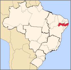
| State | Pernambuco |
| Region | Agreste |
| Area | |
• Total | 56.96 km2 (21.99 sq mi) |
| Elevation | 320 m (1,050 ft) |
| Population (2020 [1] ) | |
• Total | 16,321 |
| Time zone | UTC−3 (BRT) |
Machados (population 11.802) is a city in northeastern Brazil, in the State of Pernambuco. It lies in the mesoregion of Agreste of Pernambuco and has an area of 56.96 square kilometres (21.99 square miles ). It is the largest producer of bananas of the state, with over 21.000 ton.