Carpina

Last updated
Carpina
Carpina, Pernambuco.jpg
View of Carpina
Bandeiracarpinape.jpg
Brasao Carpina PE.jpg
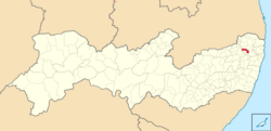
Mapa de Carpina (2).png
Location in Pernambuco state
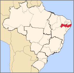
Brazil location map.svg
Red pog.svg
Carpina
Location in Brazil
Coordinates: 7°51′03″S35°15′17″W / 7.85083°S 35.25472°W / -7.85083; -35.25472
Country Brazil
Region Northeast
State Pernambuco
Area
  Total
146.1 km2 (56.4 sq mi)
Elevation
184 m (604 ft)
Population
 (2020 [1] )
  Total
84,395
  Density580/km2 (1,500/sq mi)
Time zone UTC−3 (BRT)

Carpina is a city in Pernambuco, Brazil. Its economy is based on commerce and footwear industry. Its current mayor is Manoel Botafogo.

Contents

Geography

Economy

The main economic activities in Carpina are based in the footwear industry, commerce and agriculture especially sugarcane.

Economic indicators

Population [2] GDP x(1000 R$). [3] GDP pc (R$) PE
68,070351.4485.3750.57%

Economy by Sector 2006

Primary sector Secondary sector Service sector
4.43%21.07%74.50%

Health indicators

[4]

HDI (2000)Hospitals (2007)Hospitals beds (2007)Children's Mortality every 1000 (2005)
0.72429915.2

Notable people

See also

Related Research Articles

<span class="mw-page-title-main">Camaragibe</span> City in Pernambuco, Brazil

Camaragibe is a city in the Northeast region of Brazil, in the state of Pernambuco. It lies within the Greater Recife — Brazil's 5th-largest metropolitan area.

<span class="mw-page-title-main">Nazaré da Mata</span> Municipality in Northeast, Brazil

Nazaré da Mata is a city located in the state of Pernambuco, Brazil. Located at 62 km from Recife, capital of the state of Pernambuco. It has an estimated population of 32,573 people, and it is well known as the town of Maracatu Rural and its engenhos de cana-de-açúcar. It is the seat of the Roman Catholic Diocese of Nazaré.

<span class="mw-page-title-main">Vitória de Santo Antão</span> Place in Northeast Region, Brazil

Vitória de Santo Antão is a city in Pernambuco State, Brazil, 46 kilometers west of Recife. Its territorial area is 335,942 km², 5,717 km² of which lies within the urban perimeter. In 2021, the Brazilian Institute of Geography and Statistics (IBGE) estimated its population at approximately 140 389 inhabitants, being the tenth most populous city in Pernambuco, the fourth most populous in the interior of the state and the most populous in Zona da Mata. According to the Firjan Municipal Development Index (IFDM), Vitória de Santo Antão was elected the 8th best city of Pernambuco to live in.

<span class="mw-page-title-main">Palmares, Pernambuco</span>

Palmares is a city in northeastern Brazil, in the state of Pernambuco, with 63,500 inhabitants, according with IBGE 2020. Its main activity is the combined field of agriculture and livestock. It received its name from the Portuguese people who named it that due to the number of palm trees in the area where run-away slaves had created approximately 16 quilombos, led by Zumbi.

<span class="mw-page-title-main">Paudalho</span> Municipality in Northeast, Brazil

Paudalho is a city in northeastern Brazil, in the State of Pernambuco.

<span class="mw-page-title-main">Limoeiro</span> City in Pernambuco, Brazil

Limoeiro is a city in Pernambuco, Brazil.

Maraial is a city in Pernambuco, Brazil. It is located in Zona da mata Pernambucana, 154 km from the state capital, Recife.

Lagoa do Carro is a city in Pernambuco, Brazil. It is located in Zona da mata Pernambucana region at 60 km of the state capital Recife.

Glória do Goitá is a city in Pernambuco, Brazil. It is located in Zona da mata Pernambucana at 75 km of the state capital Recife.

<span class="mw-page-title-main">Buenos Aires, Pernambuco</span> Place in Northeast, Brazil

Buenos Aires is a city located in the state of Pernambuco, Brazil. Located 78 km from the state capital of Recife, it has an estimated population of 13,190 people.

<span class="mw-page-title-main">Tracunhaém</span>

Tracunhaém is a city located in the state of Pernambuco, Brazil. Located at 63 km from Recife, capital of the state of Pernambuco. Has an estimated population of 13,813 inhabitants.

Ferreiros is a city located in the state of Pernambuco, Brazil, 118 km from Recife, capital of the state of Pernambuco, with an estimated population of 12,170 inhabitants.

Camutanga is a city located in the state of Pernambuco, Brazil. Located at 120 km from Recife, capital of the state of Pernambuco. Has an estimated population of 8,572 people and one of the strongest GDP per capita of Zona da mata Pernambucana.

Lagoa Grande is a city in the Brazilian state of Pernambuco, 665 km away from the state's capital, Recife. The population in 2020, according with IBGE was 25,849 inhabitants and the total area is 1850.07 km².

<span class="mw-page-title-main">Aliança</span> City in Pernambuco State, Brazil

Aliança (Alliance) is a city located in the state of Pernambuco, Brazil, 82 kilometres from Recife, capital of the state of Pernambuco. Aliança has an estimated population of 38,397 inhabitants.

Belém de Maria is a city located in the state of Pernambuco, Brazil. Located at 150 km away from Recife, capital of the state of Pernambuco, Belém de Maria has an estimated population of 12,122 inhabitants.

<span class="mw-page-title-main">Jaqueira</span>

Jaqueira is a city located in the state of Pernambuco, Brazil with an estimated population of 11,644.

Ribeirão is a city located in the state of Pernambuco, Brazil. Located at 87 km away from Recife, capital of the state of Pernambuco. Has an estimated population of 47,616 inhabitants.

Lagoa do Itaenga is a municipality located in the state of Pernambuco, Brazil. Located 78 km from Recife, capital of the state of Pernambuco. As of 2020, it has an estimated population of 21,460.

<span class="mw-page-title-main">São Benedito do Sul</span>

São Benedito do Sul is a city located in the state of Pernambuco, Brazil. It is located 172.5 km away from Recife, the capital of the state of Pernambuco. It has an estimated population of 16,069 inhabitants.

References