
The Riau Islands is a province of Indonesia. The capital of the province is Tanjung Pinang and the largest city is Batam. It shares a maritime border with Riau and Jambi to the east, Bangka Belitung Islands to the south, Singapore to the northeast, Malaysia and West Kalimantan to the west, and Vietnam and Cambodia to the north. It also shares a maritime border with the municipality of Kalayaan in the province of Palawan of the Philippines to the east. It comprises a total of 1,796 islands scattered between Sumatra, Malay Peninsula, and Borneo including the Riau Archipelago. Situated on one of the world's busiest shipping lanes along the Malacca Strait and the Natuna Sea, the province shares water borders with neighboring countries such as Singapore, Malaysia, and Brunei. The Riau Islands also have relatively large potential mineral resources and energy, as well as marine resources.

Natuna Regency is an islands regency located in the northernmost part of the Province of Riau Islands, Indonesia. It contains at least 154 islands, of which 127 of them are reported as uninhabited. This archipelago, with a land area of 1,978.31 km2 out of a total area of 264,198.37 km2 area, contains 15 districts, including the island district of Pulau Laut, Bunguran/Greater Natuna Island, the island district of Pulau Tiga, the island district of Midai, the island district of Subi, and the island district of Serasan.
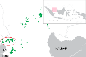
The Riau Archipelago is a geographic term for the core group of islands within the Riau Islands Province in Indonesia, and located south of Singapore and east of Riau on Sumatra. Before the province of Riau Islands was formed, there was no ambiguity in term; however, in Indonesian language, both the archipelago and administrative province are referred to as simply "Kepulauan Riau". The province may have the word "Provinsi" preceding it for clarity. Additionally the term BBK for Batam Bintan Karimun may refer to the archipelago.

Bintan Island or Negeri Segantang Lada is an island in the Riau archipelago of Indonesia. It is part of the Riau Islands province, the capital of which, Tanjung Pinang, lies in the island's south and is the island's main community.

Anambas Islands Regency is a small archipelago of Indonesia, located 150 nautical miles northeast of Batam Island in the North Natuna Sea between the Malaysian mainland to the west and the island of Borneo to the east. Geographically part of the Tudjuh Archipelago, it is administratively a regency within the Riau Islands Province. It covers a land area of 590.14 square kilometres (227.85 sq mi) and had a population of 37,411 at the 2010 Census and 47,402 at the 2020 Census; the officials estimate as at mid 2022 was 50,296. The administrative centre is at Tarempa on Siantan Island.

The Lingga Regency is a group of islands in Indonesia, located south of Singapore, along both sides of the equator, off the eastern coast of Riau Province on Sumatra island. They are south of the populated Riau Archipelago, known for the industrial island of Batam and the tourist-frequented island of Bintan, although the Lingga Islands themselves are rarely visited due to the infrequent local transportation. The equator goes through the northern tip of Lingga Island, the main island in the archipelago.

Tanjungpinang, also colloquially written as Tanjung Pinang, is the capital city of the Indonesian province of Riau Islands. It covers a land area of 144.56 km2, mainly on the southern Bintan Island, as well as other smaller islands such as Dompak Island and Penyengat Island. With a population of 227,663 at the 2020 Census, it is the second largest city of the province, after Batam; the official estimate as at mid 2022 was 239,854. Tanjungpinang is a historic city of the Malay culture, having served as the capital of both Johor Sultanate and Riau-Lingga Sultanate.

Dumai, is a coastal city in Riau Province on the island of Sumatra, Indonesia. The city has an area of 2,066.72 km2 and had 253,803 inhabitants at the 2010 census and 316,782 at the 2020 census; the official estimate as at mid 2022 was 331,832. Dumai has a domestic airport, Pinang Kampai Airport. Dumai is an important transport and trade centre, both regionally and internationally, especially to Malaysia. Dumai is rich in oil.

Bintan Regency is an administrative area in the Riau Islands Province of Indonesia. Bintan Regency includes all of Bintan Island and also includes many outlying islands including the Tambelan Archipelago and Badas Islands situated between Bintan and West Kalimantan.

The Karimun Regency is located in the Riau Islands Province, Indonesia. Besides the central island of Great Karimun, the regency also includes the islands of Kundur and over 240 smaller islands. The district covers a land area of 1,524 km2 and a sea area of 6,460 km2, and its population was 212,561 at the 2010 Census and 253,457 at the 2020 Census; the official estimate as at mid 2022 was 266,177.

Kundur Island is an island within the Riau Archipelago, part of the Riau Islands Province of Indonesia. It lies at about 80 kilometres southwest of Singapore, 76 kilometres (47 mi) southwest of Batam, 32 kilometres (20 mi) south of Great Karimun Island, 172 kilometres (107 mi) northwest of Lingga Islands and 120 kilometres (75 mi) west of Tanjung Pinang. It has an area of about 304 square kilometres (117 sq mi), not including Buru District. According to the 2010 Census population, the population of Kundur Island was 67,090. As Kundur does not have an airport, all visitors arrive by ferry.

Riau-Lingga Sultanate, also known as the Lingga-Riau Sultanate, Riau Sultanate or Lingga Sultanate was a Malay sultanate that existed from 1824 to 1911, before being dissolved following Dutch intervention.

The Natuna Sea is an extensive shallow sea located around the Natuna Regency, extending south of the Riau Islands, east of the Lingga Regency and west of Borneo, to the Bangka Belitung Islands. The islands of the Badas and Tambelan Archipelago are located at its center. Mostly located within Indonesian territorial waters, it is the southernmost portion of the South China Sea, and geologically part of Sunda Shelf. It communicates with the Java Sea to its southeast via the Karimata and Gaspar Strait east and west of Belitung, and with the Strait of Malacca to the west via the Berhala and Singapore Strait.
This is a list of emblems or coat of arms used in Indonesia. Indonesia is divided into 38 provinces, and each province is divided into regencies (kabupaten) and cities (kota). There are 416 regencies and 98 cities. Each province, regency, and city has its own emblem.