List of places in Arizona (I–J)

Last updated

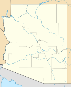
This is a list of cities, towns, unincorporated communities, counties, and other places in the U.S. state of Arizona, which start with the letters I and J. This list is derived from the Geographic Names Information System, which has numerous errors, so it also includes many ghost towns and historical places that are not necessarily communities or actual populated places. This list also includes information on the number and names of counties in which the place lies, its lower and upper ZIP code bounds, if applicable, its U.S. Geological Survey (USGS) reference number(s) (called the GNIS), class as designated by the USGS, and incorporated community located in (if applicable).
Contents

I

Name of placeNumber
of
counties
Principal
county
GNIS #(s)ClassLocated inZIP code
LowerUpper
Icehouse Canyon [1] 1 Maricopa County 2582800 CDP
Indian Gardens [2] 1 Coconino County 30342 Populated Place 86336
Indian Hot Springs [3] 1 Graham County 6214 Populated Place
Indian Pine [4] 1 Navajo County 30351 Populated Place
Indian Wells [5] 1 Navajo County 2582801 CDP 86031
Inspiration [6] 1 Gila County 30392 Populated Place 85532
Iron Springs [7] 1 Yavapai County 30427 Populated Place 86330
Itak [8] 1 Pima County 24471 Populated Place

J

Name of placeNumber
of
counties
Principal
county
GNIS #(s)ClassLocated inZIP code
LowerUpper
Jackrabbit House [9] 1 Pinal County 24472 Populated Place
Jacob Lake [10] 1 Coconino County 6336 Populated Place 86022
Jakes Corner [11] 1 Gila County 2582802 CDP 85541
Jeddito [12] 1 Navajo County 2408440 CDP 86034
Jerome [13] 1 Yavapai County 2412804 Civil (Town) 86331
Johnson [14] 1 Cochise County 6470 Populated Place 85609
Joseph City [15] 1 Navajo County 2582803 CDP 86032
Juniper Heights [16] 1 Yavapai County 30659 Populated Place

Related Research Articles

<span class="mw-page-title-main">Cherokee, California</span> Unincorporated community in California, United States

Cherokee is an unincorporated community and census-designated place in Butte County, California. It is an area inhabited by Maidu Indians prior to the gold rush, but that takes its name from a band of Cherokee prospectors who perfected a mining claim on the site. The population was 69 at the 2010 census. It lies at an elevation of 1306 feet.

<span class="mw-page-title-main">Stockwell, Indiana</span> Census-designated place in Indiana, United States

Stockwell, originally named Lauramie, is a census-designated place in Lauramie Township, Tippecanoe County, in the U.S. state of Indiana. It was once a stop along the Indianapolis, Cincinnati and Lafayette Railroad, but the rail line has since been removed.

<span class="mw-page-title-main">East Enterprise, Indiana</span> Census-designated place in Indiana, United States

East Enterprise is an unincorporated census-designated place in central Cotton Township, Switzerland County, in the U.S. state of Indiana. Although East Enterprise is unincorporated, it has a post office, with the ZIP code of 47019.

Crystal Springs is an unincorporated community and census-designated place (CDP) in Garland County, Arkansas, United States. It was first listed as a CDP in the 2020 census with a population of 129.

References

  1. "Feature Detail Report for: Icehouse Canyon Census Designated Place". Geographic Names Information System . United States Geological Survey, United States Department of the Interior.
  2. "Feature Detail Report for: Indian Gardens". Geographic Names Information System . United States Geological Survey, United States Department of the Interior.
  3. "Feature Detail Report for: Indian Hot Springs". Geographic Names Information System . United States Geological Survey, United States Department of the Interior.
  4. "Feature Detail Report for: Indian Pine". Geographic Names Information System . United States Geological Survey, United States Department of the Interior.
  5. "Feature Detail Report for: Indian Wells Census Designated Place". Geographic Names Information System . United States Geological Survey, United States Department of the Interior.
  6. "Feature Detail Report for: Inspiration". Geographic Names Information System . United States Geological Survey, United States Department of the Interior.
  7. "Feature Detail Report for: Iron Springs". Geographic Names Information System . United States Geological Survey, United States Department of the Interior.
  8. "Feature Detail Report for: Ironwood Terrace". Geographic Names Information System . United States Geological Survey, United States Department of the Interior.
  9. "Feature Detail Report for: Jackrabbit House". Geographic Names Information System . United States Geological Survey, United States Department of the Interior.
  10. "Feature Detail Report for: Jacob Lake". Geographic Names Information System . United States Geological Survey, United States Department of the Interior.
  11. "Feature Detail Report for: Jakes Corner Census Designated Place". Geographic Names Information System . United States Geological Survey, United States Department of the Interior.
  12. "Feature Detail Report for: Jeddito". Geographic Names Information System . United States Geological Survey, United States Department of the Interior.
  13. "Feature Detail Report for: Town of Jerome". Geographic Names Information System . United States Geological Survey, United States Department of the Interior.
  14. "Feature Detail Report for: Johnson". Geographic Names Information System . United States Geological Survey, United States Department of the Interior.
  15. "Feature Detail Report for: Jordan Meadows". Geographic Names Information System . United States Geological Survey, United States Department of the Interior.
  16. "Feature Detail Report for: Juniper Heights". Geographic Names Information System . United States Geological Survey, United States Department of the Interior.