List of places in Arizona (U–V)

Last updated

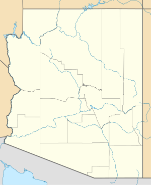
This is a list of cities, towns, unincorporated communities, counties, and other places in the U.S. state of Arizona, which start with the letters U or V. This list is derived from the Geographic Names Information System, which has numerous errors, so it also includes many ghost towns and historical places that are not necessarily communities or actual populated places. This list also includes information on the number and names of counties in which the place lies, its lower and upper ZIP code bounds, if applicable, its U.S. Geological Survey (USGS) reference number(s) (called the GNIS), class as designated by the USGS, and incorporated community located in (if applicable).

Contents

U

Name of placeNumber
of
counties
Principal
county
GNIS #(s)ClassLocated inZIP code
LowerUpper
Uhs Kug [1] 1 Pima County 24668 Populated Place
Upper Wheatfields [2] 1 Apache County 13134 Populated Place 86507
Utting [3] 1 La Paz County 2582885 CDP 85348

V

Name of placeNumber
of
counties
Principal
county
GNIS #(s)ClassLocated inZIP code
LowerUpper
Vail [4] 1 Pima County 2409387 CDP 85641
Vainom Kug [5] 1 Pima County 24670 Populated Place
Vaiva Vo [6] 1 Pinal County 2582886 CDP 85634
Vakamok [7] 1 Pima County 24671 Populated Place
Valencia West [8] 1 Pima County 2409391 CDP
Valentine [9] 1 Mohave County 2582887 CDP 86437
Valle [10] 1 Coconino County 2582888 CDP
Valle Vista [11] 1 MohaveCounty 2582889 CDP
Valley Farms [12] 1 Maricopa County 13168 Populated Place
Vamori [13] 1 Pima County 13182 Populated Place 85634
Vanar [14] 1 Cochise County 24673 Populated Place
Vaya Chin [15] 1 Pima County 13199 Populated Place 85634
Venezia [16] 1 Yavapai County 35758 Populated Place
Ventana [17] 1 Pima County 2582890 CDP 85634
Verde Village [18] 1 Pima County 2407671 CDP 86326
Vernon [19] 1 Apache County 2582891 CDP 85940
Viason Chin [20] 1 Pima County 24674 Populated Place
Vicksburg [21] 1 La Paz County 2582892 CDP 85348
Village of Oak Creek [22] 1 YavapaiCounty 2407842 CDP
Vopolo Havoka [23] 1 Pima County 24676 Populated Place

Related Research Articles

<span class="mw-page-title-main">Ak Chin, Pima County, Arizona</span> CDP in Pima County, Arizona

Ak Chin, is a rural native village and a census-designated place on the Tohono Oʼodham Reservation, in Pima County, Arizona, United States. It had a population of 30 as of the 2010 U.S. Census and an estimated population of 31 as of July 1, 2015. Ak Chin has an estimated elevation of 1,854 feet (565 m) above sea level.

Chiuli Shaik is a populated place situated in Pima County, Arizona, United States. Chiuli Shaik became its official name through a decision of the U.S. Geological Survey's Board on Geographic Names in 1941. It is also known by several unofficial names, including Fresnal, Kohi Kug, Koxikux, Resnal, and Tshiuliseik. It has an estimated elevation of 3,228 feet (984 m) above sea level.

Kaihon Kug, also historically known as Old Quijotoa Well, is a populated place situated in Pima County, Arizona, United States. Kaihon Kug became officially recognized as its name by a decision of the Board on Geographic Names (BGN) in 1941. The name means "box stands" in the O'odham language, although kaihon is a borrowed word from the Spanish, cajon. At the time of the BGN decision, there was some discussion as to the spelling of the two words; the board decided to use the O'odham spelling for Kaihon, and chose Kug, rather than Kuk, to diminish any confusion with the O'odham word for "cries". It has an estimated elevation of 2,001 feet (610 m) above sea level.

Uhs Kug is a populated place situated in Pima County, Arizona, United States. It has an estimated elevation of 4,081 feet (1,244 m) above sea level. The name is derived from the O'odham phrase, u:s ke:k, meaning "stick standing".

Linds Crossing is a census-designated place (CDP) in Blair County, Pennsylvania, United States. Comprising the unincorporated communities of Linds Crossing and Upper Reese, it was first listed as a CDP prior to the 2020 census.
References

  1. "Feature Detail Report for: Uhs Kug". Geographic Names Information System . United States Geological Survey, United States Department of the Interior.
  2. "Feature Detail Report for: Upper Wheatfields". Geographic Names Information System . United States Geological Survey, United States Department of the Interior.
  3. "Feature Detail Report for: Utting Census Designated Place". Geographic Names Information System . United States Geological Survey, United States Department of the Interior.
  4. "Feature Detail Report for: Vail Census Designated Place". Geographic Names Information System . United States Geological Survey, United States Department of the Interior.
  5. "Feature Detail Report for: Vainom Kug". Geographic Names Information System . United States Geological Survey, United States Department of the Interior.
  6. "Feature Detail Report for: Vaiva Vo Census Designated Place". Geographic Names Information System . United States Geological Survey, United States Department of the Interior.
  7. "Feature Detail Report for: Vakamok". Geographic Names Information System . United States Geological Survey, United States Department of the Interior.
  8. "Feature Detail Report for: Valencia West Census Designated Place". Geographic Names Information System . United States Geological Survey, United States Department of the Interior.
  9. "Feature Detail Report for: Valentine Census Designated Place". Geographic Names Information System . United States Geological Survey, United States Department of the Interior.
  10. "Feature Detail Report for: Valle Census Designated Place". Geographic Names Information System . United States Geological Survey, United States Department of the Interior.
  11. "Feature Detail Report for: Valle Vista Census Designated Place". Geographic Names Information System . United States Geological Survey, United States Department of the Interior.
  12. "Feature Detail Report for: Valley Farms". Geographic Names Information System . United States Geological Survey, United States Department of the Interior.
  13. "Feature Detail Report for: Vamori". Geographic Names Information System . United States Geological Survey, United States Department of the Interior.
  14. "Feature Detail Report for: Vanar". Geographic Names Information System . United States Geological Survey, United States Department of the Interior.
  15. "Feature Detail Report for: Vaya Chin". Geographic Names Information System . United States Geological Survey, United States Department of the Interior.
  16. "Feature Detail Report for: Venezia". Geographic Names Information System . United States Geological Survey, United States Department of the Interior.
  17. "Feature Detail Report for: Ventana Census Designated Place". Geographic Names Information System . United States Geological Survey, United States Department of the Interior.
  18. "Feature Detail Report for: Verde Village Census Designated Place". Geographic Names Information System . United States Geological Survey, United States Department of the Interior.
  19. "Feature Detail Report for: Vernon Census Designated Place". Geographic Names Information System . United States Geological Survey, United States Department of the Interior.
  20. "Feature Detail Report for: Viason Chin". Geographic Names Information System . United States Geological Survey, United States Department of the Interior.
  21. "Feature Detail Report for: Vicksburg Census Designated Place". Geographic Names Information System . United States Geological Survey, United States Department of the Interior.
  22. "Feature Detail Report for: Village of Oak Creek (Big Park) Census Designated Place". Geographic Names Information System . United States Geological Survey, United States Department of the Interior.
  23. "Feature Detail Report for: Vopolo Havoka". Geographic Names Information System . United States Geological Survey, United States Department of the Interior.