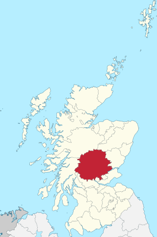
Perthshire, officially the County of Perth, is a historic county and registration county in central Scotland. Geographically it extends from Strathmore in the east, to the Pass of Drumochter in the north, Rannoch Moor and Ben Lui in the west, and Aberfoyle in the south; it borders the counties of Inverness-shire and Aberdeenshire to the north, Angus to the east, Fife, Kinross-shire, Clackmannanshire, Stirlingshire and Dunbartonshire to the south and Argyllshire to the west. It was a local government county from 1890 to 1930.

A glen is a valley, typically one that is long and bounded by gently sloped concave sides, unlike a ravine, which is deep and bounded by steep slopes. The word is Goidelic in origin: gleann in Irish and Scottish Gaelic, glion in Manx. The designation "glen" also occurs often in place names. Glens are appreciated by tourists for their tranquility and scenery.

Buachaille Etive Mòr, Scottish Gaelic: Buachaille Èite Mòr, 'great herdsman of Etive'), also known simply in English as 'The Buachaille', is a mountain at the head of Glen Etive in the Highlands of Scotland. Its pyramidal shape, as seen from the northeast, makes it one of the most recognisable mountains in Scotland, and one of the most depicted on postcards and calendars.

The Grampian Mountains is one of the three major mountain ranges in Scotland, that together occupy about half of Scotland. The other two ranges are the Northwest Highlands and the Southern Uplands. The Grampian range extends southwest to northeast between the Highland Boundary Fault and the Great Glen. The range includes many of the highest mountains in the British Isles, including Ben Nevis and Ben Macdui.
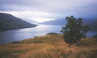
Loch Lomond and The Trossachs National Park is a national park in Scotland centred on Loch Lomond and the hills and glens of the Trossachs, along with several other ranges of hills. It was the first of the two national parks established by the Scottish Parliament in 2002, the second being the Cairngorms National Park. The park extends to cover much of the western part of the southern highlands, lying to the north of the Glasgow conurbation, and contains many mountains and lochs. It is the fourth-largest national park in the British Isles, with a total area of 1,865 km2 (720 sq mi) and a boundary of some 350 km (220 mi) in length. It features 21 Munros and 20 Corbetts.
Glen Coe is a glen of volcanic origins, in the Highlands of Scotland. It lies in the north of the county of Argyll, close to the border with the historic province of Lochaber, within the modern council area of Highland. Glen Coe is regarded as the home of Scottish mountaineering and is popular with hillwalkers and climbers.

Crianlarich is a village in Stirling council area and in the registration county of Perthshire, Scotland, around 6 miles (10 km) north-east of the head of Loch Lomond. The village bills itself as "the gateway to the Highlands".
Saint Fillan, Filan, Phillan, Fáelán or Faolán is the name of an eighth century monk from Munster, who having studied at Taghmon Abbey, traveled to Scotland and settled at Strath Fillan.
Clan Lyon is a Scottish clan.

A strath is a large valley, typically a river valley that is wide and shallow.

Myreton Hill is a peak near the village of Menstrie in the Ochil Hills of Scotland.
Strathallan is the strath of the Allan Water in Scotland. The strath stretches south west and south from Auchterarder in Perth & Kinross through Blackford, Dunblane, Bridge of Allan and on to Stirling.

Strathmore is a broad valley or strath in east-central Scotland, lying between the Grampian mountains and the Sidlaws. It is approximately 50 mi (80 km) long and 10 mi (16 km) wide. Strathmore is underlain by Old Red Sandstone but this is largely obscured by glacial till, sands and gravels deposited during the ice age. Its northeast to southwest alignment is influenced by the underlying geological structure of the area which reflects the dominant Caledonian trend of both the central lowlands and the Highlands of Scotland; its northern margin reflects the presence of the Highland Boundary Fault. Strathmore is fertile and has some of Scotland's best arable farmland, producing soft fruits and cereals.

Strathmore is a strath or wide valley in Sutherland in northern Scotland. The strath is in the parish of Durness to the south-east of Loch Eriboll. It runs north–south and has a minor road running alongside the Strathmore River which flows along the valley floor northwards into Loch Hope. Ben Hope is to the east.
The Prior of Strath Fillan was the head of the Augustinian monastic community of Strathfillan Priory, Strath Fillan in Argyll. The priors are badly documented and few are known.

Strath Fillan Priory was a small Augustinian Priory based at Strath Fillan in Argyll. It seems to have been founded in 1318 by Robert I, King of Scots, and given to the canons of Inchaffray Abbey in order to properly celebrate St Fillan, a saint popular with the 14th century kings of Scotland. It had royal patronage after the Dissolution of the Monasteries: by 1607 it was a Campbell possession, when it was incorporated into the secular lordship of Archibald (Gilleasbaig) Campbell of Glencarradale.
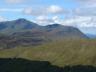
Beinn Chùirn is a hill five kilometres west-south-west of Tyndrum, Scotland, standing on the border of Stirlingshire and Perthshire at the northern extremity of the Loch Lomond and The Trossachs National Park.

Beinn Challuim is a mountain in the Breadalbane region of the Scottish Highlands. It is east of the village of Tyndrum, in the Forest of Mamlorn, an ancient deer forest at the northern edge of Loch Lomond and the Trossachs National Park. It is a Munro with a height of 1,025 metres (3,363 ft).
Strathdevon is the strath of the River Devon in Clackmannanshire, Scotland. Strathdevon is associated with the parish of Muckhart and was up until 1971 the southernmost tip of Perthshire.
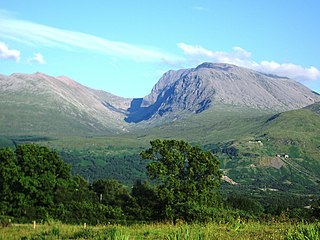
Ben Nevis and Glen Coe is a national scenic area (NSA) covering part of the Highlands of Scotland surrounding Ben Nevis and Glen Coe, in which certain forms of development are restricted. It is one of 40 such areas in Scotland, which are defined so as to identify areas of exceptional scenery and to ensure its protection from inappropriate development. The Ben Nevis and Glen Coe NSA covers 903 km2 (349 sq mi) of land, lying within the Highland, Argyll and Bute and Perth and Kinross council areas. A further 19 km2 (7.3 sq mi) of the NSA are marine, covering the sea loch of Loch Leven.


