Luxemburg, Wisconsin

Last updated
Luxemburg, Wisconsin
Kewaunee County Wisconsin Incorporated and Unincorporated areas Luxemburg Highlighted.svg
Location of Luxemburg in Kewaunee County, Wisconsin.
Coordinates: 44°32′45″N87°41′39″W / 44.54583°N 87.69417°W / 44.54583; -87.69417 Coordinates: 44°32′45″N87°41′39″W / 44.54583°N 87.69417°W / 44.54583; -87.69417
Country Flag of the United States.svg  United States
State Flag of Wisconsin.svg  Wisconsin
County Kewaunee
Area
[1]
  Total2.30 sq mi (5.95 km2)
  Land2.30 sq mi (5.95 km2)
  Water0.00 sq mi (0.00 km2)
Elevation
[2]
791 ft (241 m)
Population
 (2010) [3]
  Total2,515
  Estimate 
(2019) [4]
2,571
  Density1,119.77/sq mi (432.41/km2)
Time zone UTC-6 (Central (CST))
  Summer (DST) UTC-5 (CDT)
Area code(s) 920
FIPS code 55-46425 [5]
GNIS feature ID1568827 [2]
Website www.luxemburgusa.com

Luxemburg is a village in Kewaunee County, Wisconsin, United States. The population was 2,515 at the 2010 census. It is part of the Green Bay Metropolitan Statistical Area. The village is located within the town of Luxemburg.

Contents

Geography

Luxemburg is located at 44°32′18″N87°42′17″W / 44.53833°N 87.70472°W / 44.53833; -87.70472 (44.538378, -87.704962). [6]

According to the United States Census Bureau, the village has a total area of 2.27 square miles (5.88 km2), all of it land. [7]

Luxemburg, Wisconsin.png

Due to a clerical error, Luxemburg experienced a name swap with Belgium, Wisconsin. Both communities retained their accidental name. [8]

Climate

Luxemburg
Climate chart (explanation)
J
F
M
A
M
J
J
A
S
O
N
D
 
 
62
 
 
−6
−12
 
 
62
 
 
−6
−11
 
 
66
 
 
2
−8
 
 
141
 
 
14
−1
 
 
105
 
 
18
5
 
 
106
 
 
22
12
 
 
108
 
 
25
14
 
 
88
 
 
24
16
 
 
72
 
 
21
11
 
 
121
 
 
12
5
 
 
68
 
 
4
−2
 
 
61
 
 
−6
−10
Average max. and min. temperatures in °C
Precipitation totals in mm
Source: [9]

Demographics

Historical population
CensusPop.
1910 402
1920 45713.7%
1930 4753.9%
1940 468−1.5%
1950 51910.9%
1960 73040.7%
1970 85316.8%
1980 1,04021.9%
1990 1,15110.7%
2000 1,93568.1%
2010 2,51530.0%
2019 (est.)2,571 [4] 2.2%
U.S. Decennial Census [10]
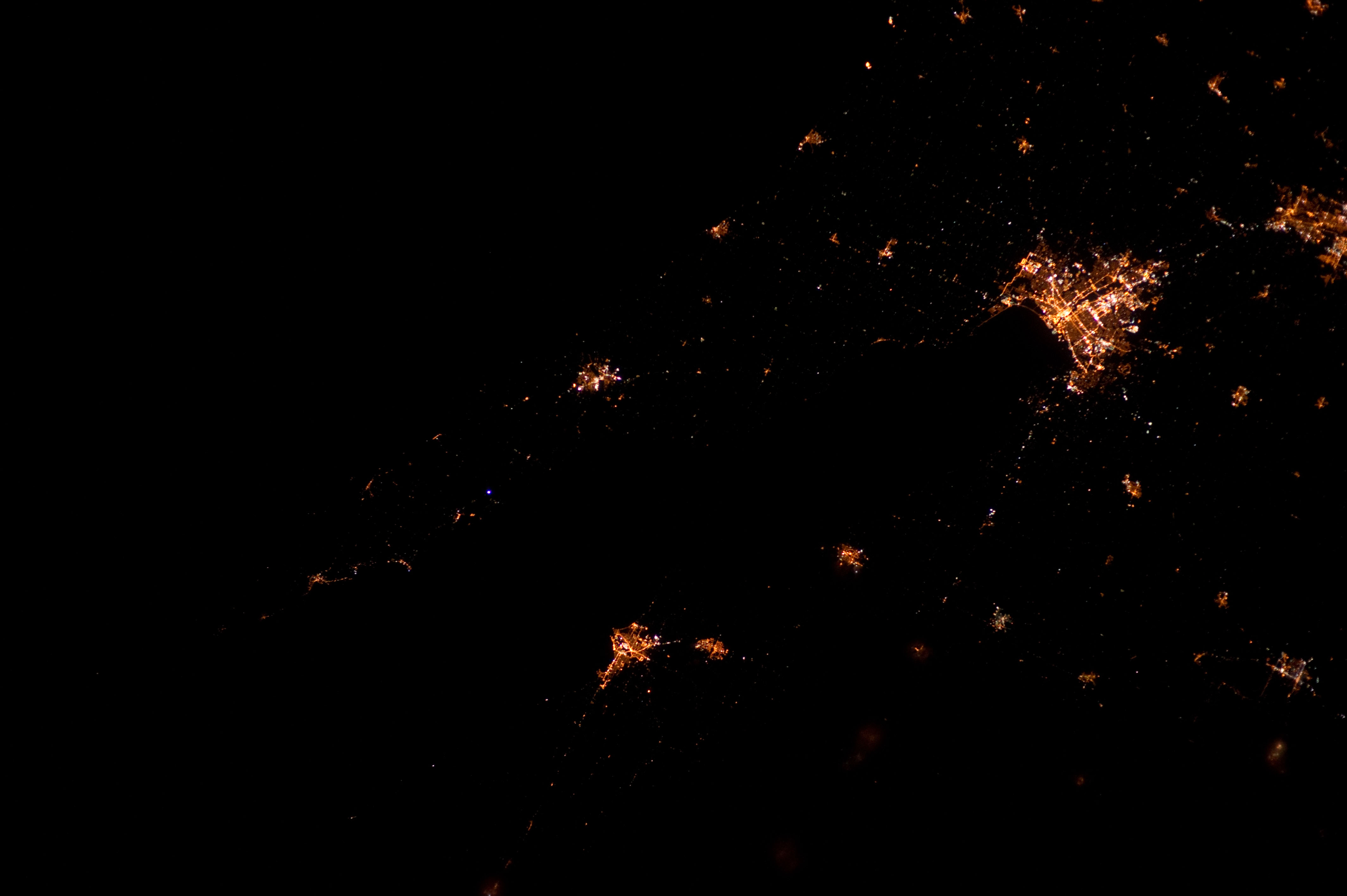
ISS030-E-183973.jpg
Luxemburg, 1:10 AM CDT

2010 census

As of the census [3] of 2010, there were 2,515 people, 973 households, and 672 families living in the village. The population density was 1,107.9 inhabitants per square mile (427.8/km2). There were 1,008 housing units at an average density of 444.1 per square mile (171.5/km2). The racial makeup of the village was 97.2% White, 0.2% African American, 0.7% Native American, 0.1% Asian, 0.9% from other races, and 0.9% from two or more races. Hispanic or Latino of any race were 2.5% of the population.

There were 973 households, of which 41.1% had children under the age of 18 living with them, 54.1% were married couples living together, 10.6% had a female householder with no husband present, 4.4% had a male householder with no wife present, and 30.9% were non-families. 26.2% of all households were made up of individuals, and 12.9% had someone living alone who was 65 years of age or older. The average household size was 2.57 and the average family size was 3.13.

The median age in the village was 34.7 years. 29.9% of residents were under the age of 18; 6.9% were between the ages of 18 and 24; 29.1% were from 25 to 44; 21% were from 45 to 64; and 13.1% were 65 years of age or older. The gender makeup of the village was 49.0% male and 51.0% female.

2000 census

As of the census [5] of 2000, there were 1,935 people, 719 households, and 524 families living in the village. The population density was 935.7 people per square mile (360.9/km2). There were 754 housing units at an average density of 364.6 per square mile (140.6/km2). The racial makeup of the village was 98.86% White, 0.10% Black or African American, 0.10% Native American, 0.26% Asian, 0.26% from other races, and 0.41% from two or more races. 0.47% of the population were Hispanic or Latino of any race.

There were 719 households, out of which 39.5% had children under the age of 18 living with them, 59.5% were married couples living together, 9.9% had a female householder with no husband present, and 27.1% were non-families. 22.7% of all households were made up of individuals, and 10.4% had someone living alone who was 65 years of age or older. The average household size was 2.63 and the average family size was 3.11.

In the village, the population was spread out, with 28.2% under the age of 18, 8.7% from 18 to 24, 32.8% from 25 to 44, 16.4% from 45 to 64, and 13.9% who were 65 years of age or older. The median age was 32 years. For every 100 females, there were 98.7 males. For every 100 females age 18 and over, there were 89.4 males.

The median income for a household in the village was $45,000, and the median income for a family was $50,795. Males had a median income of $32,813 versus $23,897 for females. The per capita income for the village was $17,856. About 2.6% of families and 5.6% of the population were below the poverty line, including 4.8% of those under age 18 and 17.2% of those age 65 or over.

Notable people

Related Research Articles

Ponderay, Idaho City in Idaho, United States

Ponderay is a city in Bonner County, Idaho. The population was 1,137 at the 2010 census, up from 638 in 2000. Ponderay's city motto is "Little City with the Big Future". Its name is an english phonetic spelling of the french words “Pend Oreille”, the name of the lake the city sits upon.

Wood Lake, Minnesota City in Minnesota, United States

Wood Lake is a city in Yellow Medicine County, Minnesota, United States. The population was 439 at the 2010 census.

Catron, Missouri City in Missouri, United States

Catron is a city in New Madrid County, Missouri, United States. The population was 67 at the 2010 census.

Palmyra, Nebraska Village in Nebraska, United States

Palmyra is a village in Otoe County, Nebraska, United States. The population was 545 at the 2010 census.

Marshallton, Pennsylvania CDP in Pennsylvania, United States

Marshallton is a census-designated place (CDP), located in Coal Township, in Northumberland County, Pennsylvania, United States. The population was 1,441 at the 2010 census.

Tennyson, Wisconsin Village in Wisconsin, United States

Tennyson is a village in Grant County, Wisconsin, United States, originally called Dutch Hollow. The population was 355 at the 2010 census.

Birch, Wisconsin Town in Wisconsin, United States

Birch is a town in Lincoln County, Wisconsin, United States. As of the 2010 census, the town had a population of 594, down from 801 at the 2000 census. The unincorporated community of Irma is located in the town.

Frederic, Wisconsin Village in Wisconsin, United States

Frederic is a village in Polk County, Wisconsin, United States. The population was 1,137 at the 2010 census.

Bonduel, Wisconsin Village in Wisconsin, United States

Bonduel is a village in Shawano County, Wisconsin, United States. The population was 1,478 at the 2010 census.

Big Falls, Waupaca County, Wisconsin Village in Wisconsin, United States

Big Falls is a village in Waupaca County, Wisconsin, United States. The population was 61 at the 2010 census.

Hewitt, Wood County, Wisconsin Village in Wisconsin, United States

Hewitt is a village in Wood County, Wisconsin, United States. The population was 828 at the 2010 census.

Unity, Wisconsin Village in Wisconsin, United States

Unity is a village in Clark and Marathon counties in the U.S. state of Wisconsin. It is part of the Wausau, Wisconsin Metropolitan Statistical Area. The population was 343 at the 2010 census. Of this, 204 were in Marathon County, and 139 were in Clark County. The village is located in northeastern town of Unity in Clark County and northwestern town of Brighton in Marathon County.

Arlington, Wisconsin Village in Wisconsin, United States

Arlington is a village in Columbia County, Wisconsin, United States. The population was 819 at the 2010 census. The village is located within the Town of Arlington. It is part of the Madison Metropolitan Statistical Area.

Necedah, Wisconsin Village in Wisconsin, United States

Necedah is a village in Juneau County, Wisconsin, United States. The population was 916 at the 2010 census. The village is located within the Town of Necedah.

Casco, Wisconsin Village in Wisconsin, United States

Casco is a village in Kewaunee County, Wisconsin, United States. The population was 583 at the 2010 census. It is part of the Green Bay Metropolitan Statistical Area. The village is located within the Town of Casco.

Luxemburg (town), Wisconsin

Luxemburg is a town in Kewaunee County, Wisconsin, United States. The population was 1,469 at the 2010 census. The village of Luxemburg, a separate municipality, is surrounded by the town. The unincorporated communities of Walhain and Casco Junction are in the town, and Neuern, Frog Station, and Tonet are partially in the town.

Pepin, Wisconsin Village in Wisconsin, United States

Pepin is a village in Pepin County, Wisconsin, United States. The population was 837 at the 2010 census. The village is located within the Town of Pepin.

Ettrick (village), Wisconsin Village in Wisconsin, United States

Ettrick is a village in Trempealeau County, Wisconsin, United States. The population was 524 at the 2010 census. The village is surrounded by the Town of Ettrick.

Plainfield, Wisconsin Village in Wisconsin, United States

Plainfield is a village in Waushara County, Wisconsin, United States. The village is located almost entirely within the Town of Plainfield. A tiny portion extends into adjacent Town of Oasis. The population was 897 at the 2010 census.

Norway (CDP), Maine CDP in Maine, United States

Norway is a census-designated place (CDP) in the town of Norway in Oxford County, Maine, United States. The population was 2,623 at the 2000 census.

References

  1. "2019 U.S. Gazetteer Files". United States Census Bureau. Retrieved August 7, 2020.
  2. 1 2 "US Board on Geographic Names". United States Geological Survey. 2007-10-25. Retrieved 2008-01-31.
  3. 1 2 "U.S. Census website". United States Census Bureau . Retrieved 2012-11-18.
  4. 1 2 "Population and Housing Unit Estimates". United States Census Bureau. May 24, 2020. Retrieved May 27, 2020.
  5. 1 2 "U.S. Census website". United States Census Bureau . Retrieved 2008-01-31.
  6. "US Gazetteer files: 2010, 2000, and 1990". United States Census Bureau. 2011-02-12. Retrieved 2011-04-23.
  7. "US Gazetteer files 2010". United States Census Bureau. Archived from the original on 2012-07-02. Retrieved 2012-11-18.
  8. Romance of Wisconsin Place Names by Robert E. Gard and L. G. Sorden, New York: October House, Inc. 1968, page 9
  9. "NASA Earth Observations Data Set Index". NASA. Retrieved 30 January 2016.
  10. "Census of Population and Housing". Census.gov. Retrieved June 4, 2015.