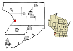
Lynxville, Wisconsin | |
---|---|
Coordinates: 43°14′51″N91°3′14″W / 43.24750°N 91.05389°W | |
Country | United States |
State | Wisconsin |
County | Crawford |
Area | |
• Total | 1.37 sq mi (3.54 km2) |
• Land | 1.35 sq mi (3.51 km2) |
• Water | 0.01 sq mi (0.04 km2) |
Elevation | 636 ft (194 m) |
Population | |
• Total | 132 |
• Estimate (2019) [4] | 127 |
• Density | 93.87/sq mi (36.23/km2) |
Time zone | UTC-6 (Central (CST)) |
• Summer (DST) | UTC-5 (CDT) |
Area code | 608 |
FIPS code | 55-46675 [5] |
GNIS feature ID | 1568849 [2] |
Lynxville is a village in Crawford County, Wisconsin, United States. The population was 132 at the 2010 census.
The village was named for the ship Lynx which brought the first surveyors to the area. [6] Mitchel Caya was the first resident of Lynxville in 1848. [7]
Lynxville is located at 43°14′51″N91°3′14″W / 43.24750°N 91.05389°W (43.247540, -91.053911). [8]
According to the United States Census Bureau, the village has a total area of 1.36 square miles (3.52 km2), of which 1.35 square miles (3.50 km2) of it is land and 0.01 square miles (0.03 km2) is water. [9]
Climate data for Lynxville, Wisconsin (Lock and Dam No. 9) (1991–2020 normals, extremes 1939–present) | |||||||||||||
---|---|---|---|---|---|---|---|---|---|---|---|---|---|
Month | Jan | Feb | Mar | Apr | May | Jun | Jul | Aug | Sep | Oct | Nov | Dec | Year |
Record high °F (°C) | 57 (14) | 70 (21) | 82 (28) | 93 (34) | 94 (34) | 100 (38) | 101 (38) | 101 (38) | 100 (38) | 92 (33) | 75 (24) | 66 (19) | 101 (38) |
Mean daily maximum °F (°C) | 26.6 (−3.0) | 31.4 (−0.3) | 44.0 (6.7) | 58.3 (14.6) | 70.1 (21.2) | 79.1 (26.2) | 82.5 (28.1) | 80.1 (26.7) | 73.3 (22.9) | 59.9 (15.5) | 44.4 (6.9) | 31.6 (−0.2) | 56.8 (13.8) |
Daily mean °F (°C) | 18.1 (−7.7) | 22.2 (−5.4) | 34.6 (1.4) | 47.8 (8.8) | 59.4 (15.2) | 68.9 (20.5) | 72.8 (22.7) | 70.7 (21.5) | 63.3 (17.4) | 50.5 (10.3) | 36.5 (2.5) | 24.3 (−4.3) | 47.4 (8.6) |
Mean daily minimum °F (°C) | 9.6 (−12.4) | 13.1 (−10.5) | 25.3 (−3.7) | 37.3 (2.9) | 48.7 (9.3) | 58.7 (14.8) | 63.1 (17.3) | 61.3 (16.3) | 53.3 (11.8) | 41.1 (5.1) | 28.6 (−1.9) | 17.0 (−8.3) | 38.1 (3.4) |
Record low °F (°C) | −43 (−42) | −34 (−37) | −34 (−37) | 11 (−12) | 27 (−3) | 36 (2) | 46 (8) | 44 (7) | 29 (−2) | 18 (−8) | −8 (−22) | −29 (−34) | −43 (−42) |
Average precipitation inches (mm) | 1.29 (33) | 1.18 (30) | 2.03 (52) | 3.75 (95) | 4.68 (119) | 5.50 (140) | 4.47 (114) | 3.82 (97) | 3.79 (96) | 2.53 (64) | 2.02 (51) | 1.45 (37) | 36.51 (927) |
Average snowfall inches (cm) | 9.9 (25) | 10.0 (25) | 4.6 (12) | 0.6 (1.5) | 0.0 (0.0) | 0.0 (0.0) | 0.0 (0.0) | 0.0 (0.0) | 0.0 (0.0) | 0.1 (0.25) | 1.7 (4.3) | 8.6 (22) | 35.5 (90) |
Average precipitation days (≥ 0.01 in) | 8.9 | 7.8 | 9.1 | 11.3 | 12.6 | 12.0 | 9.8 | 8.9 | 9.3 | 9.3 | 7.7 | 9.0 | 115.7 |
Average snowy days (≥ 0.1 in) | 6.1 | 5.1 | 2.2 | 0.3 | 0.0 | 0.0 | 0.0 | 0.0 | 0.0 | 0.1 | 1.3 | 5.3 | 20.4 |
Source: NOAA [10] [11] |
Census | Pop. | Note | %± |
---|---|---|---|
1880 | 155 | — | |
1890 | 243 | 56.8% | |
1900 | 322 | 32.5% | |
1910 | 274 | −14.9% | |
1920 | 253 | −7.7% | |
1930 | 230 | −9.1% | |
1940 | 233 | 1.3% | |
1950 | 217 | −6.9% | |
1960 | 183 | −15.7% | |
1970 | 149 | −18.6% | |
1980 | 174 | 16.8% | |
1990 | 153 | −12.1% | |
2000 | 176 | 15.0% | |
2010 | 132 | −25.0% | |
2019 (est.) | 127 | [4] | −3.8% |
U.S. Decennial Census [12] |
As of the census [3] of 2010, there were 132 people, 63 households, and 45 families living in the village. The population density was 97.8 inhabitants per square mile (37.8/km2). There were 101 housing units at an average density of 74.8 per square mile (28.9/km2). The racial makeup of the village was 98.5% White and 1.5% African American. Hispanic or Latino of any race were 3.8% of the population.
There were 63 households, of which 25.4% had children under the age of 18 living with them, 54.0% were married couples living together, 11.1% had a female householder with no husband present, 6.3% had a male householder with no wife present, and 28.6% were non-families. 27.0% of all households were made up of individuals, and 6.4% had someone living alone who was 65 years of age or older. The average household size was 2.10 and the average family size was 2.40.
The median age in the village was 52.7 years. 18.2% of residents were under the age of 18; 4.5% were between the ages of 18 and 24; 18.2% were from 25 to 44; 37.8% were from 45 to 64; and 21.2% were 65 years of age or older. The gender makeup of the village was 51.5% male and 48.5% female.
As of the census [5] of 2000, there were 176 people, 76 households, and 56 families living in the village. The population density was 127.0 people per square mile (48.9/km2). There were 111 housing units at an average density of 80.1 per square mile (30.8/km2). The racial makeup of the village was 98.86% White, 0.57% Asian, and 0.57% from two or more races. Hispanic or Latino of any race were 1.70% of the population.
There were 76 households, out of which 22.4% had children under the age of 18 living with them, 57.9% were married couples living together, 13.2% had a female householder with no husband present, and 26.3% were non-families. 22.4% of all households were made up of individuals, and 7.9% had someone living alone who was 65 years of age or older. The average household size was 2.32 and the average family size was 2.63.
In the village, the population was spread out, with 17.6% under the age of 18, 6.3% from 18 to 24, 26.1% from 25 to 44, 35.8% from 45 to 64, and 14.2% who were 65 years of age or older. The median age was 45 years. For every 100 females, there were 107.1 males. For every 100 females age 18 and over, there were 98.6 males.
The median income for a household in the village was $30,833, and the median income for a family was $35,000. Males had a median income of $17,083 versus $18,333 for females. The per capita income for the village was $14,979. None of the families and 6.7% of the population were living below the poverty line, including no under eighteens and 9.5% of those over 64.
Bus service towards La Crosse and Prairie du Chien is provided three times daily per direction by Scenic Mississippi Regional Transit. [13]
Gramercy is a town in the U.S. state of Louisiana, in St. James Parish. It is part of the New Orleans Metropolitan Area. The population was 3,613 at the time of the 2010 U.S. census and 3,188 according to the 2020 population estimates program.
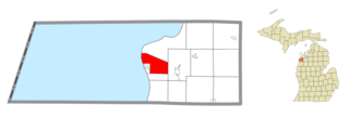
Crystal Lake Township is a civil township of Benzie County in the U.S. state of Michigan. The population was 1,065 at the 2020 census.
River Bend is a village in Jackson County, Missouri, United States. The population was 3 at the 2020 census. It is the only part of Jackson County that lies north of the Missouri River. In 1951, the Missouri River was relocated to a new channel, creating River Bend,. The county line still follows the original riverbed. It is part of the Kansas City metropolitan area. The mayor is Alex Dockler.
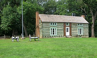
Grantwood Village is a town in St. Louis County, Missouri, United States. The population was 863 at the 2010 census.
Champ is a village in St. Louis County, Missouri, United States. The population was 10 at the 2020 census.
Walton Hills is a village in Cuyahoga County, Ohio, United States. The population was 2,033 at the 2020 census. A suburb of Cleveland, it is a part of the Cleveland metropolitan area.
Tarlton is a village in Fairfield and Pickaway counties in the U.S. state of Ohio. The population was 254 at the 2020 census.
Harpster is a village in Wyandot County, Ohio, United States. The population was 160 at the 2020 census.
Turley is a census-designated place (CDP) in Tulsa County, Oklahoma, United States. The population was 2,607 at the time of the 2020 census.
Pine Glen is an unincorporated community and census-designated place (CDP) in Centre County, Pennsylvania, United States. It is part of the State College, Pennsylvania Metropolitan Statistical Area. It is part of Burnside Township. The population was 190 at the 2010 census.
Windsor Heights is a village in Brooke County, West Virginia, United States. It is part of the Wheeling, West Virginia Metropolitan Statistical Area. The population was 423 at the 2010 census. Grace Davis was the mayor as of June 2017.
Bellevue is a village in Brown County, Wisconsin. It was a town until incorporating as a village on February 14, 2003. The population was 15,935 at the time of the 2020 census. Bellevue is part of the Green Bay metropolitan area. Bellevue sits around 4.34 miles (6.99 km) east from central Green Bay.
Kekoskee is a village in Dodge County, Wisconsin, United States. The population was 161 at the 2010 census.
Avoca is a village in Iowa County, Wisconsin, United States. The population was 637 at the 2010 census. It is part of the Madison Metropolitan Statistical Area. It is named after Avoca in Ireland.
Bay City is a village on the Mississippi River in Pierce County, Wisconsin, United States. The population was 500 at the 2010 census.
Wilson is a village in Belmont and Monroe counties in the U.S. state of Ohio. The population was 129 at the 2020 census. It is part of the Wheeling metropolitan area.
Verona is a village in Montgomery and Preble counties in the U.S. state of Ohio. The population was 403 at the 2020 census. It is part of the Dayton Metropolitan Statistical Area.
Dallas is a village in Barron County in the U.S. state of Wisconsin. The population was 409 at the 2010 census. The village is located within the Town of Dallas.
Mount Hope is a village in Grant County, Wisconsin, United States. The population was 225 at the 2010 census. The village is located within the Town of Mount Hope.
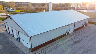
Wonewoc is a town in Juneau County, Wisconsin, United States. The population was 783 at the 2000 census. The Village of Wonewoc and the village of Union Center are located within the town.