Manchester, Pennsylvania

Last updated

Manchester, Pennsylvania
Borough
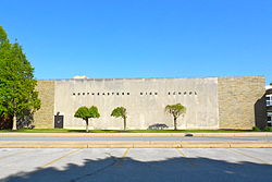
NE High School Manchester PA.JPG
Northeastern High School
York County Pennsylvania incorporated and unincorporated areas Manchester highlighted.svg
Location in York County and the U.S. state of Pennsylvania.
USA Pennsylvania location map.svg
Red pog.svg
Manchester
Location of Manchester in Pennsylvania
Usa edcp location map.svg
Red pog.svg
Manchester
Manchester (the United States)
Coordinates: 40°03′39″N76°43′11″W / 40.06083°N 76.71972°W / 40.06083; -76.71972
Country United States
State Pennsylvania
County York
Settled1814
Incorporated1869
Government
  TypeBorough Council
  MayorPatricia Witt
Area
[1]
  Total0.77 sq mi (2.00 km2)
  Land0.77 sq mi (2.00 km2)
  Water0.00 sq mi (0.00 km2)
Elevation
453 ft (138 m)
Population
 (2020) [2]
  Total2,800
  Density3,622.25/sq mi (1,397.90/km2)
Time zone UTC-5 (Eastern (EST))
  Summer (DST) UTC-4 (EDT)
Zip code
17345
Area code 717
FIPS code 42-46864
Website manchesterborough.com

Manchester is a borough in York County, Pennsylvania, United States. The population was 2,798 at the 2020 census. [3]

Contents

History

Settled in 1814, the village of Liverpool (now Manchester) was incorporated in 1869 in the eastern section of Manchester Township. During the Gettysburg Campaign of the American Civil War, Liverpool's merchants were raided by the 17th Virginia Cavalry.

Geography

Manchester is located at 40°03′39″N76°43′11″W / 40.060943°N 76.719626°W / 40.060943; -76.719626 . [4]

According to the United States Census Bureau, the borough has a total area of 0.8 square miles (2.1 km2), all land.

Demographics

Historical population
CensusPop.Note
1870 406
1880 4305.9%
1890 51319.3%
1900 507−1.2%
1910 5477.9%
1920 71630.9%
1930 94031.3%
1940 1,0046.8%
1950 1,26425.9%
1960 1,45415.0%
1970 2,39164.4%
1980 2,027−15.2%
1990 1,830−9.7%
2000 2,35028.4%
2010 2,76317.6%
2020 2,7981.3%
2021 (est.)2,788 [3] −0.4%
Sources: [5] [6] [7] [2]

As of the census [6] of 2000, there were 2,350 people, 1,009 households, and 664 families living in the borough. The population density was 2,986.4 inhabitants per square mile (1,153.1/km2). There were 1,058 housing units at an average density of 1,344.5 per square mile (519.1/km2). The racial makeup of the borough was 97.28% White, 0.47% African American, 0.26% Native American, 0.26% Asian, 0.89% from other races, and 0.85% from two or more races. Hispanic or Latino of any race were 1.49% of the population.

There were 1,009 households, out of which 28.6% had children under the age of 18 living with them, 49.9% were married couples living together, 11.8% had a female householder with no husband present, and 34.1% were non-families. 27.0% of all households were made up of individuals, and 9.2% had someone living alone who was 65 years of age or older. The average household size was 2.33 and the average family size was 2.81.

In the borough the population was spread out, with 21.5% under the age of 18, 10.3% from 18 to 24, 34.2% from 25 to 44, 21.4% from 45 to 64, and 12.6% who were 65 years of age or older. The median age was 35 years. For every 100 females there were 95.7 males. For every 100 females age 18 and over, there were 92.7 males.

The median income for a household in the borough was $41,450, and the median income for a family was $47,845. Males had a median income of $32,219 versus $22,000 for females. The per capita income for the borough was $18,700. About 2.4% of families and 3.7% of the population were below the poverty line, including 3.0% of those under age 18 and 4.8% of those age 65 or over.

Education

Manchester is served by the Northeastern York School District.

Notable people

Related Research Articles

<span class="mw-page-title-main">Applewold, Pennsylvania</span> Borough in Pennsylvania, United States

Applewold is a borough in Armstrong County, Pennsylvania, United States. The population was 334 at the 2020 census.

<span class="mw-page-title-main">Strausstown, Pennsylvania</span> Unincorporated community & CDP in Pennsylvania, United States

Strausstown is a census-designated place and former borough located in Upper Tulpehocken Township in Berks County, Pennsylvania. The population was 342 at the 2010 census.

<span class="mw-page-title-main">Sylvania, Pennsylvania</span> Borough in Pennsylvania, United States

Sylvania is a borough in Bradford County, Pennsylvania, United States. It is part of Northeastern Pennsylvania. The population was 216 at the 2020 census. Children residing in the borough are assigned to attend the Troy Area School District.

<span class="mw-page-title-main">Summerhill Township, Cambria County, Pennsylvania</span> Township in Pennsylvania, United States

Summerhill Township is a township in Cambria County, Pennsylvania, United States. The population was 2,467 at the 2010 census. It is part of the Johnstown, Pennsylvania Metropolitan Statistical Area.

<span class="mw-page-title-main">Wallace Township, Pennsylvania</span> Township in Pennsylvania, United States

Wallace Township is a township in Chester County, Pennsylvania, United States. The population was 3,458 at the 2010 census.

<span class="mw-page-title-main">Briar Creek, Pennsylvania</span> Borough in Pennsylvania, United States

Briar Creek is a borough in Columbia County, Pennsylvania, United States. It is part of Northeastern Pennsylvania. The population was 597 at the 2020 census. It is part of the Bloomsburg-Berwick micropolitan area.

<span class="mw-page-title-main">Ephrata Township, Pennsylvania</span> Township in Pennsylvania, United States

Ephrata Township is a township in northeastern Lancaster County, Pennsylvania, United States. The population was 10,391 at the 2020 census.

<span class="mw-page-title-main">Pennsburg, Pennsylvania</span> Borough in Pennsylvania, United States

Pennsburg is a borough in Montgomery County, Pennsylvania. Its population was 3,889 at the 2020 census. It is part of the Upper Perkiomen School District. It is also part of the strip of small towns that run together along Route 29: Red Hill, Pennsburg, and East Greenville. The towns are collectively referred to as Upper Perk.

<span class="mw-page-title-main">Riverside, Pennsylvania</span> Borough in Pennsylvania, United States

Riverside is a borough in Northumberland County, Pennsylvania, United States. The population was 1,932 at the 2010 census. The current mayor is John LaMotte.

<span class="mw-page-title-main">Auburn, Pennsylvania</span> Borough in Pennsylvania, United States

Auburn is a borough in Schuylkill County, Pennsylvania, United States. The population was 663 at the 2020 census.

<span class="mw-page-title-main">Orwigsburg, Pennsylvania</span> Borough in Pennsylvania, United States

Orwigsburg is a borough in Schuylkill County, Pennsylvania. The borough was named for its founder, Peter Orwig, and created from West Brunswick Township in 1823.

<span class="mw-page-title-main">Friendsville, Pennsylvania</span> Borough in Pennsylvania, United States

Friendsville is a borough in Susquehanna County, Pennsylvania, United States. The population was 100 at the 2020 census.

<span class="mw-page-title-main">Cross Roads, Pennsylvania</span> Borough in Pennsylvania, United States

Cross Roads is a borough in York County, Pennsylvania, United States. The population was 524 at the 2020 census. The crossroads in the borough is where Church Road intersects Cross Roads Avenue and are joined by Century Farms Road. East of the intersection, Century Farms Road is numbered SR 2050 and Church Road is unnumbered.

<span class="mw-page-title-main">East Manchester Township, Pennsylvania</span> Township in Pennsylvania, United States

East Manchester Township is a township in York County, Pennsylvania, United States. As of the 2020 census, the township population was 8,327.

<span class="mw-page-title-main">Felton, Pennsylvania</span> Borough in Pennsylvania, United States

Felton is a borough in York County, Pennsylvania, United States. The population was 501 at the 2020 census. The borough is located within the Red Lion Area School District. Local services include the Felton Fire Company and the Felton US Post Office. The current Mayor of Felton borough is Bryan T. McManus, Jr.

<span class="mw-page-title-main">Manchester Township, York County, Pennsylvania</span> Township in Pennsylvania, United States

Manchester Township is a township in York County, Pennsylvania, United States. The population was 19,511 at the 2020 census.

<span class="mw-page-title-main">North York, Pennsylvania</span> Borough in Pennsylvania, United States

North York is a borough, adjacent to the city of York, in York County, Pennsylvania, United States. As of the 2020 census, the borough had a total population of 2,196.

<span class="mw-page-title-main">Springfield Township, York County, Pennsylvania</span> Township in Pennsylvania, United States

Springfield Township is a township in York County, Pennsylvania, United States. The population was 6,023 at the 2020 census.

<span class="mw-page-title-main">West Manchester Township, Pennsylvania</span> Township in Pennsylvania, United States

West Manchester Township is a township in York County, Pennsylvania, United States. The population was 19,217 at the 2020 census.

<span class="mw-page-title-main">York Haven, Pennsylvania</span> Borough in Pennsylvania, United States

York Haven is a borough in York County, Pennsylvania, United States. The population was 691 at the 2020 census. The borough is the home of the Brunner Island coal-fired electrical generation plant, located on the Susquehanna River on Wago Road and operated by PPL Corporation.

References

  1. "ArcGIS REST Services Directory". United States Census Bureau. Retrieved October 12, 2022.
  2. 1 2 "Census Population API". United States Census Bureau. Retrieved October 12, 2022.
  3. 1 2 Bureau, US Census. "City and Town Population Totals: 2020-2021". Census.gov. US Census Bureau. Retrieved July 9, 2022.
  4. "US Gazetteer files: 2010, 2000, and 1990". United States Census Bureau. February 12, 2011. Retrieved April 23, 2011.
  5. "Census of Population and Housing". U.S. Census Bureau. Retrieved December 11, 2013.
  6. 1 2 "U.S. Census website". United States Census Bureau . Retrieved January 31, 2008.
  7. "Incorporated Places and Minor Civil Divisions Datasets: Subcounty Resident Population Estimates: April 1, 2010 to July 1, 2012". Population Estimates. U.S. Census Bureau. Archived from the original on June 11, 2013. Retrieved December 11, 2013.